Welcome back! This is Part 2 of a series of my first Ozark Waterfall hikes. This is the second stop on a day trip spent hiking in the Big Piney Forest near Pelsor. If you missed it, Part 1 was the first leg of our day trip at Haw Creek Falls. So be sure to check that out for more info, maps, and pics. Our next stop that day was a hike to Kings Bluff Falls.
Directions
From Haw Creek, this was a backtrack to Hwy 7. (North on Hwy 7 past Dover to the Sand Gap/Pelsor area). At the intersection at Pelsor Post Office you take a right on Hwy 16 towards Ben Hur. See Google map below for directions to this and Falling Water Falls (Part 3). You will see a sign on the right for Pedestal Rocks / Kings Bluff Falls. Once you park, you’ll find the two trail heads are pretty close together. You could even combine the two hikes in one big loop if you wanted. You can read about Pedestal Rocks here. On this day, we wanted to hike to Kings Bluff Falls.
What to Expect
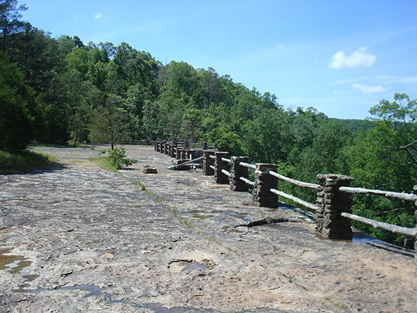
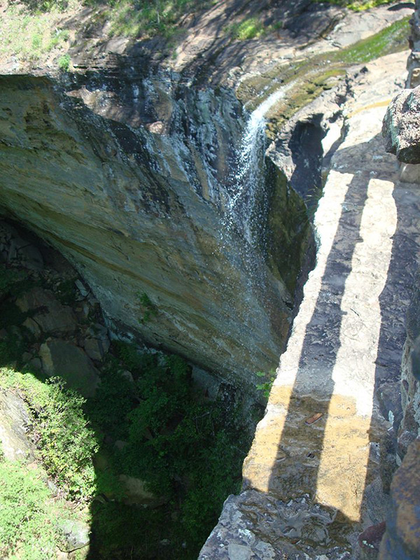
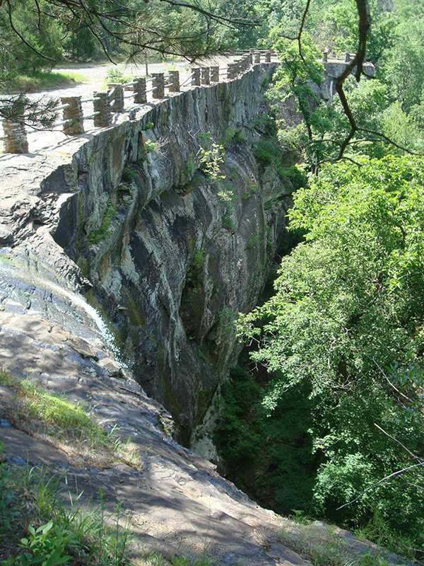
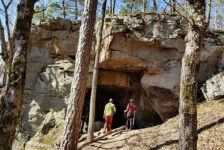
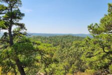
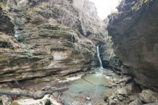
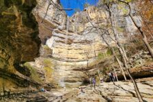
The trail is a two mile loop and was pretty easy going down to the falls and moderate coming back up. I recommend taking some bug spray in the summer months as the trail was a little overgrown in some parts. The official trail stops at the top of the falls before the loop goes back towards the trail head. Once there, it opens up into a huge rock shelf atop a high bluff that overlooks a forested gorge. There is some old wooden picket railing that goes along the edge of the bluffs. It really gives a kind of deserted ghost-town look to the area. As you make your way to the right, you’ll eventually run into a small creek that runs off the edge of the bluffs creating the falls. You can look right over the edge to see the water fall about 115 feet down, making Kings Bluff Falls one of the highest waterfalls in Arkansas.
Unfortunately for us, there was not much water flowing that day at Kings Bluff. That was strange considering the amount of water at Haw Creek that same day. But they are two different creeks, so I guess it makes sense. We did notice some trails at the bottom of the falls, but with the lack of water we decided it was not worth it that day to make the descent down there for the view. The trails were unmarked and not part of the official trail loop, but there did appear to be a way down for anyone motivated to climb back up. It’s a pretty nice view from the top of the falls and we could see some nice rock formations around the sides of the bluffs and further out in the gorge. So there is probably more to see out there from those trails at the bottom.
Plan your Visit
As I mentioned, there is no cell phone service in this area. So be sure to print out trail maps and directions, or save them to your phone. If you are spending the day, bring food and water. There is only one store in the area (the Pelsor post office and general store) and they may or may not be open when you’re there. Same goes for gas stations so make sure you have plenty of gas. Bathrooms are primitive, so if that’s an issue, better handle your business before you get there.
Like I said in Part 1, the bad news is that when we did this hike, I had no idea that I would one day have an outdoors blog so unfortunately I did not get a lot of pictures. But I did get a few. Sorry they kinda suck, but if you do this hike, here’s a little bit of what you’ll see. Be sure to check out Part 3 where we made our way to Falling Water Falls.