In my very first blog post about Haw Creek Falls , I promised to do a follow-up story on a hike to Pack Rat Falls. Well, here it is. After some friends saw my pics of Falling Water Falls, we decided to organize a group hike. So I researched a few spots for us to hike and see some waterfalls. I knew I wanted to return to Haw Creek and find Pack Rat Falls. And I had read great things about Pam’s Grotto, which is very close to Haw Creek. I also knew I had to return to Falling Water Falls – this time prepared to swim. So this was a perfect spot for a day hiking trip with a large group. And just like my very first post, this is another three-part series where I’ll feature each stop of the day.
Our first stop of the day was a quick hike to Pack Rat Falls.
Quick Glance
Distance: Approximately 1.5 miles out and back
Difficulty: Easy to Moderate
Parking Coordinates: 35.67708, -93.25461
Trailhead: 35.67661, -93.25454
Lower Pack Rat Falls: 35.67267, -93.25335
Upper Pack Rat Falls: 35.67199, -93.25326
Hagarville Grocery: 35.516263, -93.330430
Hankins Country Store (Pelsor): 35.721263, -93.095938
Gez Rogers’ GPS Track: Click Here
(Copy/Paste Coordinates into GPS or Google Maps search bar)
Directions
Pack Rat Falls is located at the Haw Creek Falls Recreation Area in the Big Piney Forest near Pelsor. From I-40 at Russellville, go north on Hwy 7 past Dover (south from Harrison) to the Sand Gap/Pelsor area. Go west on Hwy 123 at the Pelsor Post Office until you get to Haw Creek campground on the left. See Google map below.
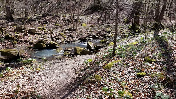
There are no signs for Pack Rat Falls or for the trailhead. But at the back of the loop in the campground, you’ll find a trail that goes along Haw Creek. That is the Ozark Highlands Trail, and not the trail you want for Pack Rat Falls. Instead, go to the right of that until you find a creek bed. You might even see some rough trails blazed through the vegetation around some of the camp sites. Those should lead you to the creek bed, which essentially IS the trail to Pack Rat Falls. See pics below for visual references.
What to expect
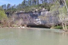
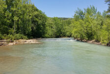
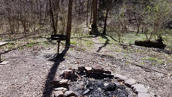
As you enter the Haw Creek Falls Recreation Area, you will come to a spillway crossing the road. You might have to get out and walk into the campground depending on how high the water is. If so, it’s a short walk, so figure out how to cross the creek (it’s doable) and go for it. Once inside, you’ll find a primitive campground (no running water or showers), restroom, parking area, and trails. After getting parked and geared up, we took a minute to check out Haw Creek Falls. The water was really low, so I was concerned that Pack Rat Falls may not be flowing either. But we went for it anyway and made our way to the trail for Pack Rat Falls.


Lower Pack Rat Falls
Upon finding the creek bed at the back of the campground, there was not a lot of water in it that day. So we were easily able to hike the creek bed all the way to the falls. It’s a pretty short out and back hike – about 0.7 miles each way on an . The further up the creek you get, the more dense the forest and vegetation gets. It’s a pretty hike with lots of color from the trees, moss and ferns. You will need to traverse some rocks and boulders along the way, so sturdy footwear is recommended here.
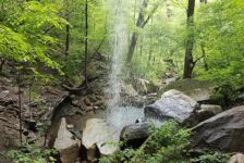
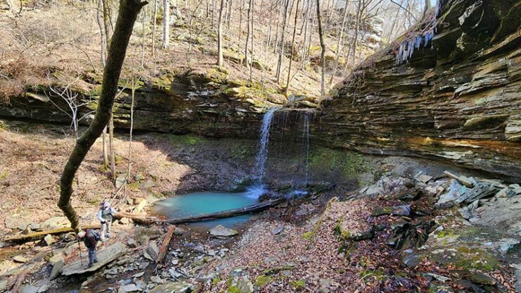
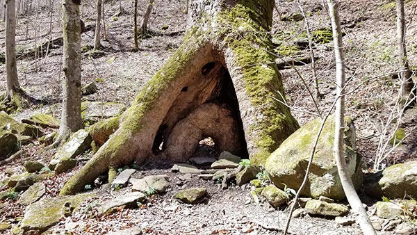
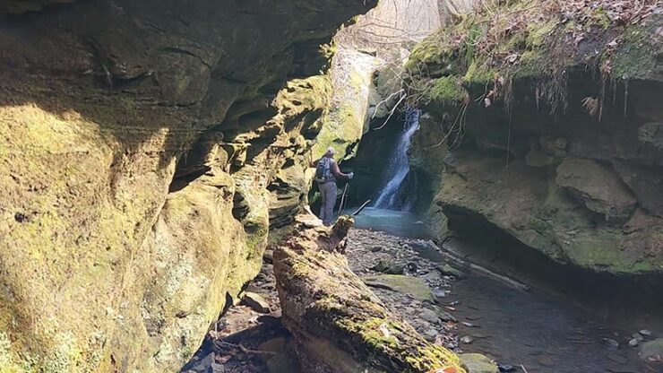
The creek is flanked on both sides with steep hills as you go further into the canyon. In some spots, there is no room for a trail along the banks. So rock hopping up the creek is required. Eventually the canyon widens as the creek bed/trail ends at a nice sized grotto. This is what most know as Pack Rat Falls. But technically, it is Lower Pack Rat Falls, as there are more falls upstream. There was not a lot of water in the falls that day. But there was enough water trickling through to make it worth it. The falls are about 24 feet high, and are accessible from all sides of the grotto. You can even climb up to the top of the grotto and view the area from there.
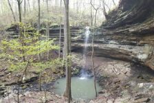
Upper Pack Rat Falls
On this first hike to Pack Rat Falls, I was unaware that there were more falls upstream from Lower Pack Rat Falls. Later I would learn that there was much more to see, and would make a return trip to see it. A bushwhack scramble up the hill on the left side of Lower Pack Rat will get you to the top. From there, you’re treated to a nice cascade along the creek. Keep following the creek up a short distance as it leads into a short box canyon. Upper Pack Rat Falls is in this box canyon. Another scramble up the hill on the left side of this box canyon gets you to the top of this one. From here, the brush gets pretty thick, and that’s where we stopped. But if you’re willing to get through it, you’ll find a beautiful slot creek and other sights. My friend Gez Rogers with Waterfalls in AR and Other Cool Places has a great video showing more of the upper creek. You can see that here .
Plan your visit
As I mentioned, there is no cell phone service in this area. So be sure to print out trail maps and directions, or save them to your phone. If you are spending the day, bring food and water. There are two stores in the area. To the southwest is Hagarville Grocery. And to the east is Hankins Country Store in Sand Gap. Both stores have great food, as well as drinks, supplies and restrooms. Gas stations are hard to come by in this area so make sure you have plenty of gas. There are public bathrooms in the campground but they are primitive…you’ve been warned.
Haw Creek Campground and Pack Rat Falls is a pet-friendly area, but please be prepared to pick up after your dog along the trails. And also don’t forget to pack out any trash you may have and leave no trace. All in all, the hike to Pack Rat Falls is a great little day hike. What it lacked in water volume that day, it more than made up for in visual appeal. It’s also a short hike, so you might consider planning other hikes in the area to fill out your day. Hobo Falls is just a few miles down Hwy 123 and is an outstanding day hike. And definitely be sure to check out Part 2 of the Waterfall Group hike – Pam’s Grotto, just down Hwy 123 to the east.