This hike to Pam’s Grotto is part 2 of a waterfall group hike series. In case you missed part one, I wrote in that post about how some friends saw my first pics of Falling Water Falls and wanted to do a group hike. So I researched a few spots for us to hike and see some waterfalls.
We started the day off with a short hike to Pack Rat Falls at Haw Creek Recreation Area. I had read about Pam’s Grotto and finally figured out where the trail is. It’s actually very close to Haw Creek. So this was a perfect spot to take a large group and not have to drive much between stops.
Once we finished up at Pack Rat, we headed back down Hwy 123 to find the trail for Pam’s Grotto.
Quick Glance
Distance: Approximately 1 mile round-trip
Difficulty: Easy to Moderate
Parking Coordinates: 35.680066, -93.252097
Trailhead: 35.68031, -93.25189
Pam’s Grotto waterfall: 35.68328, -93.25540
Hagarville Grocery: 35.516263, -93.330430
Hankins Country Store (Pelsor): 35.721263, -93.095938
Directions
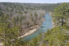
Pam’s Grotto is located just before Haw Creek Rec Area in the Big Piney Forest near Pelsor. From I-40 at Russellville, go north on Hwy 7 past Dover (south from Harrison) to the Sand Gap/Pelsor area. Go west on Hwy 123 at the Hankins Country Store until you get to the spot you see in the map below. If you get to Haw Creek Rec Area you’ve gone too far. Coming from the south, at the intersection of Hwy 164 and Hwy 123 in Hagarville, head north on Hwy 123. At 14.6 miles, look for a pull off into a clearing on the right. Or just park along the highway.
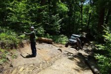
There are no signs for Pam’s Grotto or for the trailhead. You just have to know where it is. Just a little bit past the cemetery on the left, you’ll see Haw Creek running alongside the road. There will be a small clearing on the left between the road and creek. It can fit about five cars or so. That’s the spot to park. Cross the road from there and veer right. You’ll see an unmarked trail headed up the hill. That goes to Pam’s Grotto.


What to expect
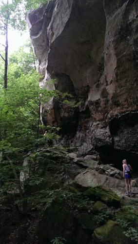
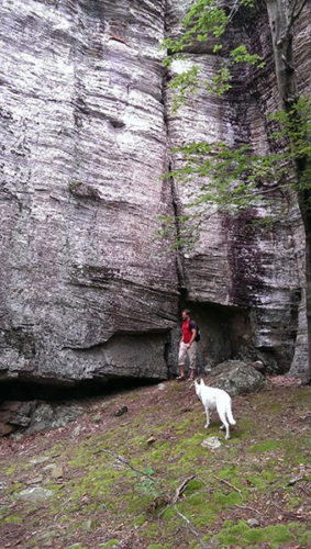
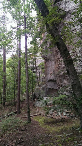
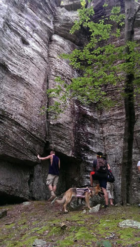
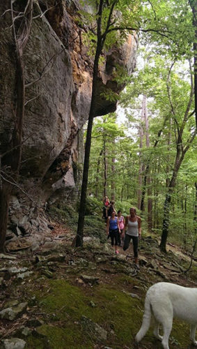
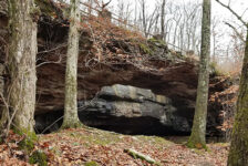
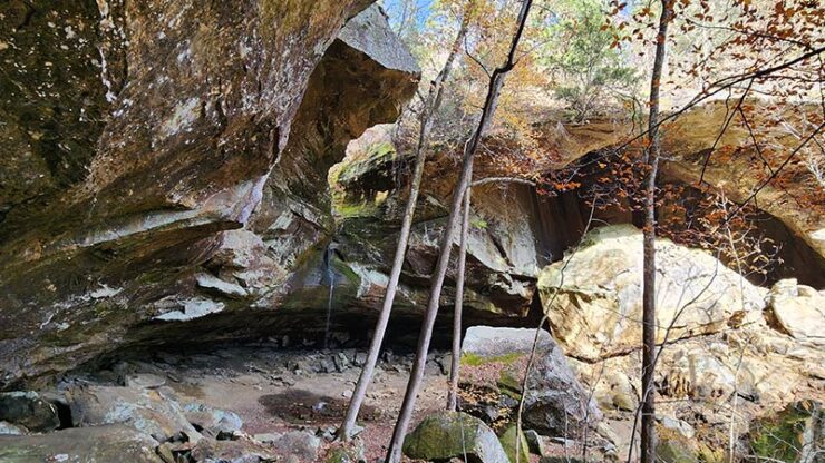
Once we found the unmarked trail in the tall grass, we made our way into the woods. From there the trail quickly starts to wind its way up the hill. It is an out-and-back trail that is just under a mile round-trip. A short hike, but rated moderate due to the uphill climb in the beginning and boulders to traverse at the end. It’s a clean, well-used trail that is not too technical or difficult. But the first half of the trail is all uphill and will get the heart pumping. Once it levels out near the top, you will want to go to the left. The trail makes it’s way around a huge cliff face. This thing is high and goes straight up. It would be a great place for rock climbing.
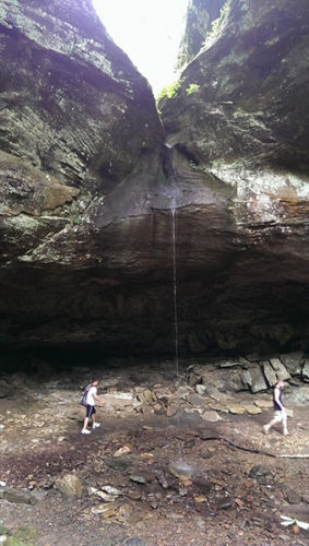
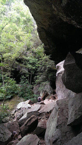
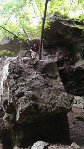
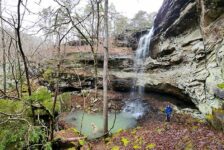
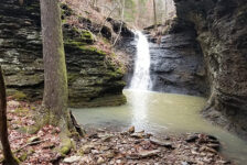
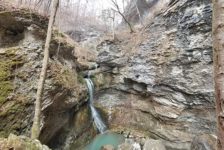
We continued on the trail, making our way around the cliff. We saw some really cool rock formations in the rock face along with some small caves. This is where the trail starts to get a little bit technical. It makes its way up, down and around trees and boulders on it’s way down to the bottom of the cliff to the grotto. There are a few spots where the footing is a little sketchy and we had to grab a tree here and there. Sturdy footwear is highly recommended for this hike. Once at the bottom we were faced with an ENORMOUS grotto. This thing is huge!!!
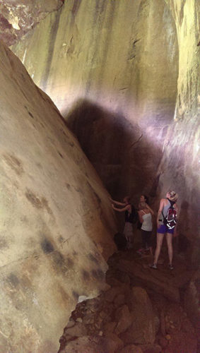
There is a gigantic boulder under the grotto, probably 30 feet tall. You can go to the left, or to the right, staying under the grotto. I recommend staying to the right. It’s really cool when you get past the boulders and into the part of the grotto where the waterfall is. The trail does continue to pass through the grotto and continue on for a little while on the other side. But then it just kind of stops. There are other large boulders near the waterfall to climb around on and get pics. We did that as we hung out a while and cooled off in the trickle of waterfall we had that day.
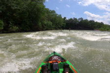
We could have stayed much longer, but we had to get on down the road to our next stop. This group really wanted to end this hot day at Falling Water Falls. And I was ready for a return trip there too – this time prepared to swim!
Plan your visit
There is no cell phone service in this area until you get closer to Hwy 7. So be sure to save maps or directions to your phone before you get there. If you are spending the day, bring food and water. There are two stores in the area. To the southwest is Hagarville Grocery. And to the east is Hankins Country Store in Sand Gap. Both stores have great food, as well as drinks, supplies and restrooms. Gas stations are hard to come by in this area so make sure you have plenty of gas. There are public bathrooms in the nearby Haw Creek Rec Area, but they are primitive…you’ve been warned.
A good hiking stick would be handy on a hike to Pam’s Grotto. And, as mentioned, wear sturdy footwear. Pam’s Grotto is a pet-friendly area, but please be prepared to pick up after your dog along the trails. And also don’t forget to pack out any trash you may have and leave no trace. I have done this hike a couple more times since this first one because it’s such a cool hike. It’s one you’ll want to take other people to see. It’s also a short hike, so you might consider planning other hikes in the area to fill out your day. Obviously, Pack Rat Falls is just down the road at Haw Creek Rec Area. And Hobo Falls is just a few more miles down Hwy 123 and is another outstanding day hike. Be sure to check out Part 3 of our group waterfall hike where we end the day with a dip at Falling Water Falls.