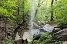
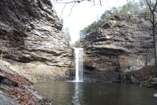
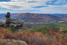
Welcome to Part Three of the Petit Jean State Park hiking series, the Canyon Trail. Petit Jean is Arkansas’ first state park. It’s also one of my go-to spots when I want a spur-of-the-moment, close to home day hike. It’s great because there are so many options there. Whether you want waterfalls, vista views, caves, or cool rock formations, Petit Jean has it all. If you missed Part One, I covered the most popular hike in the park. That would the Cedar Falls Trail, with it’s massive grotto and 90-ft Waterfall.
The Canyon Trail starts around the halfway point of the Cedar Falls trail. The first half of it is the exact same trail as the Cedar Falls hike. It is not a trail that I would drive to Petit Jean to do on its own. I mean, if you’re going to make the climb out of the canyon at the end, you might as well hike to Cedar Falls. But if you do that and want to add a little to it, then this trail is definitely worth the time
On its own the Canyon Trail is a pretty nice hike. But compared to the other trails at Petit Jean this one is probably my least favorite. That’s nothing against the Canyon Trail. If it were a lone trail located somewhere else I would probably think it’s a great hike. It’s just that I like the other trails in the park so much more.
Directions
Petit Jean State Park is a few miles southwest of Morrilton right off Hwy 154. Or approx 6 miles north of Adona off Hwy 10 to Hwy 324/155 if you’re coming from the south. Google knows all about this one, so not much direction is needed here. Type the park in your phone map and it will get you there. Once there, stop by the visitor center and pick up a park and trail map. Driving south from the visitor center, make your way to Mather Lodge. Behind the lodge is the trail head for Cedar Falls Trail. Start there.
What to Expect
As I mentioned, the first half is actually the Cedar Falls Trail. It is a fairly steep descent down into the canyon. Coming back out can be a pretty strenuous uphill walk for some. I highly recommend sturdy comfortable shoes for this hike. You can read more about this part of the trail in Part One of this series. Once you cross the narrow bridge over Cedar Creek, turn left to hit the Canyon Trail. From there it is a clean trail that is very easy to walk.
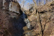
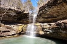
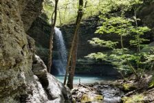
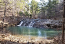
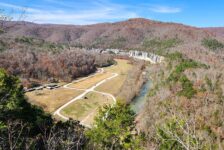
The trail follows right along Cedar Creek as it makes it’s way west out of the park towards the Arkansas River Valley. There’s plenty of views of the creek and lots of large boulders. The creek eventually widens to form a pool (aka “Blue Hole”). At that point, you’ve pretty much reached the end of the trail. Or you can access the Boy Scout Trail from here. The park lists the Canyon Trail at one mile. But it’s actually 1 mile to the Blue Hole. So out and back is two miles. And if you include the section of the Cedar Falls Trail, the overall hike is a little longer than that.
Plan Your Trip
Due to all the large rocks and steep ascent in and out of the canyon, I recommend good hiking or trail shoes. At a minimum, tennis shoes, or hiking sandals. If hiking this trail on the way back from Cedar Falls, give yourself another 30 minutes or so for this trail. On it’s own, this trail can be done in an hour or less.
Cell phone service is spotty throughout the park, but you’re never too far away from a cell signal. As I mentioned in the last post, there is snack food and drinks at the visitor center. There is also a full-service restaurant at Mather Lodge. There are enough things to do in the park to fill a weekend, and plenty of options for spending the night. Definitely call ahead to check availability on the lodge or cabins. Camp sites are almost always available. But during busy times it’s probably a good idea to call ahead to check on those as well.
Here are some pics from the Canyon Trail. I hope you like these. If you get a chance to visit, please remember this park gets a lot of visitors. Help take care of it by taking nothing but pictures, and leaving nothing but footprints. Thanks!