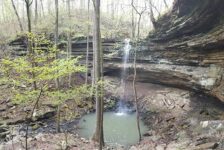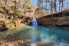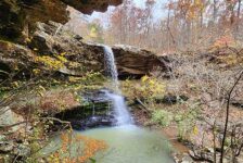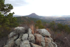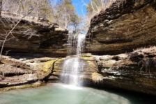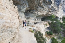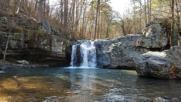
I have seen several people on social media ask where to see waterfalls close to Central Arkansas. Some have specifically asked about “the waterfalls close to Malvern/Hot Springs/Lake Catherine”. They would be referring to Falls Creek Falls at Lake Catherine State Park. For anyone that’s asked or has wondered the same thing, this post is for you.
I actually hiked to Falls Creek Falls at Lake Catherine years ago. But I recently made a return trip to refresh my memory and get new pics. The things I do for my readers. (Me, pretending to have readers, lol). Wow, I had forgotten what a great hiking spot this is! Why? Keep reading and I’ll tell you all about it. But first…
Directions
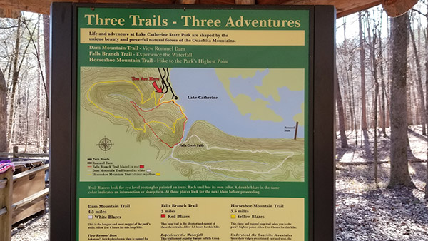
Where is it? It’s very easy to find. The trail system is located in Lake Catherine State Park, which is a fairly popular state park between Malvern and Hot Springs. You can easily find the park on any map search. Just search for Lake Catherine State Park and follow the directions there. Once you enter the park, keep right and follow the signs for the trail head. The road will eventually make a loop with a parking area and a small trail head pavilion. That’s the spot. See pics below.
What to Expect
So what makes this place so great? Aside from the really great waterfall, the trails are very clean and well-marked. And there’s a lot to see. From high ridgeline views of the lake to relaxing sights and sounds of the creeks in the valleys, and everything in between. But also, it’s the options. There are three intersecting trails of varying lengths. Each offers something different. But since they all intersect, you can use whatever combination you want to suit your interest and physical ability.
Falls Branch Trail
This is the red trail. If you have little ones or just want to see the falls, I recommend this one. It is the shortest of the three (2 mi) and not as physically challenging as the others. But it’s a nice hike and probably the prettiest because you get to see all the creeks in the valley on your way to the falls.
Horseshoe Mountain Trail
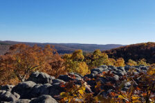
If you want to get your heart rate up and see some views of Lake Catherine, then take the yellow Trail. It is a bit longer (3 mi) and will take you up to the highest point in the park. It’s a gradual climb – not that steep or terribly difficult. But it could be a problem for anyone with heart, respiratory, or mobility issues.
Dam Mountain Trail
I have not hiked this trail yet. But according to the trail head sign, it is the longest (4.5 mi) and “most rugged”. The beginning of it follows the same path as the Falls Branch Trail. It takes you past the falls and onward toward Remmel Dam, making a loop back to the falls.
On my recent hike, I chose to start on the Horseshoe Mountain Trail and jump to the Falls Branch Trail at their intersection. If you take this trail, I recommend turning right at the sign where the trails split, and do the yellow Trail counter clockwise. Going this way will immediately take you up the hill to the top of the ridge.
About halfway up the hill, there is a large boulder area in the trail, and this is where it can get confusing. The trail splits to the left and heads downhill, unmarked. It might connect with the Falls Branch Trail (red), but I’m not sure. At that point, look up the hill for the yellow blazes, and follow those. There were several spots where I thought I had reached the highest point. But the trail continues its gradual climb, with several lake views along the way.
Eventually the trail does flatten out along the top of the ridge before it begins its descent down the hill. It’s an easy stroll along the ridge with more views of the lake and a far-off view of Remmel Dam. After winding it’s way down the hill, it intersects with the Falls Branch Trail. A right turn here will take you further downhill to the valley floor. This was my favorite part.
Falls Creek
The trail follows a small creek that flows into Falls Creek and offers plenty of photo ops. And Falls Creek itself is almost as photogenic as the waterfall it forms. The trail follows the creek for a short walk to the rock shelf that forms the top of the falls. It continues down to the bottom of the falls and is a nice spot to stop and hang out. From here, it is a short hike back to the trail head. For anyone that only wants to see the falls, take the trail in a clockwise direction from the trail head. It’s only about a half mile walk that way. But you’re missing out on a beautiful hike.
Plan Your Trip
I don’t recommend the Horseshoe Mountain trail in the summertime because the leaves on the trees will block the view of the lake. I would hike that trail from late Fall to early Spring, when visibility through the trees is better. As for the Falls Branch Trail and the waterfall, I have never hiked it in really hot weather. So I don’t know if the falls are flowing year-round. It’s probably best to do that one in Winter and Spring, or after a good rain. Pets are allowed on a leash if you want to take your four-legged hiking buddy.
Although it is a really great hike, visiting Falls Creek Falls at Lake Catherine is probably not a full-day event. The two shorter trails can be done in less than 2 hours each. But there are plenty of other things in the area you can do to fill out the day. Things like AdventureWorks zipline park, Garvan Woodland Gardens, and Hot Springs National Park. And Lake Catherine State Park is a great place to spend a weekend. It’s a really nice park on the lake with cabins, tent camping, and excellent RV campsites. The park also has picnic areas, clean restrooms and showers, and a visitor center with gifts, drinks, and snacks.
If you have never visited Lake Catherine State Park, I highly recommend planning a visit to the area and hike to the falls. In the park and on the trails, please remember to take nothing but pictures and leave nothing but footprints. Enjoy the pics below of this hike, and thanks for reading!

