
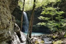
With the recent rain, the next few days will be a great time to see some waterfalls in Arkansas. I have written before about the many options along Falling Water Rd in the Richland Creek Wilderness. On my last venture to this area, I took a friend out that wanted to spend a day seeing some falls. On our last stop of the day, we made the beautiful hike to Terry Keefe Falls.
Before we started this hike, we had made stops at Falling Water Falls, Six Finger Falls and Fuzzy Butt Falls. We were prepared to see others after Keefe Falls, but those got rained out. I have seen other people comment in different forums that Terry Keefe Falls was not their favorite in the area. I would have to agree, but only because the other falls in the area are so great. This waterfall is still absolutely worth hiking to. Even though it might not be the favorite waterfall in the area, the hike to it is probably the prettiest, not counting Twin Falls. So don’t sleep on this one!
Directions
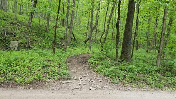
The trail to these falls starts on Falling Water Rd. This is about 35 minutes northeast of Sand Gap. Use the map below to navigate to the trail head. After crossing the narrow concrete bridge over Falling Water Creek, you’ll see a fork in the road. Stay to the left. Around a quarter mile past that, look to the left for some blue hashes on trees and a wide spot in the road. There you’ll find Six Finger Falls. (Note: the blue hashes indicate a trail leading to the creek. There are several of these along Falling Water Rd.) Approximately .35 miles past Six Fingers Falls is the trail head for Terry Keefe Falls on the right. You might see a trail on the right going up a hill with orange paint on the trees. That is not the right trail. I have a picture of the correct trail head below.
What to Expect
The hike to Terry Keefe Falls is a short one. It is an out-and-back trail that is just over a half mile each way (1.1 miles total). The trail is not very well marked, but it is pretty easy to follow on its own. It follows a creek bed fairly closely all the way to the falls. Stay on the left side of the creek until after you have passed the high bluff on the left. After that the trail descends downhill back to the creek. At that point, there were spots where it was not clear whether or not the trail crosses the creek or keeps going. We crossed the dry creek bed several times as we got closer to the falls. If the creek is wet, you can stay on the trail. If not, it’s a little easier to take the creek bed. Either way, it all goes to the same place.
Like I said, this is a very pretty trail. A large section of the trail winds across a hillside that is covered with ferns. It reminded me of hiking in the Pacific Northwest. The ferns, moss, and other plant life make for a very, VERY green hike. We did this hike in early May and the trail was clean. It might get overgrown in the summer, I don’t know. And for most of the way, there is a good view of the creek.
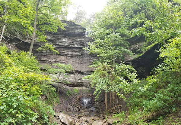
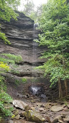
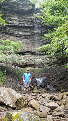
It is very quiet out there, so you’ll know when you are getting close to the falls. You’ll hear it before you see it. The creek bed will open up into a fairly tall grotto. This is one of the taller waterfalls in the Falling Water/Richland Creek area. As you can see in the video below, there was not a lot of water in the falls that day. But it was still a nice waterfall and probably really impressive after a hard rain.
Plan Your Hike to Terry Keefe Falls
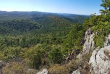
This area is one of the most highly concentrated areas for waterfalls in the state. If you come in from Sand Gap, you’ll pass by the trail head for King’s Bluff Falls and Pedastal Rocks. As you drive down Falling Water Rd, you’ll pass right by the popular Falling Water Falls. Just before reaching Terry Keefe Falls on Falling Water Rd, you’ll pass trails for Six Fingers Falls, Fuzzy Butt Falls, and Horsetail Falls. And even further down Falling Water Road, deep in the wilderness, you can find Richland Falls and Twin Falls. I recommend filling your day seeing as many of these as possible. Remember, this area is kind of in the middle of nowhere as far as cell service goes. You will lose cell service long before you reach Falling Water Rd. So if you plan to hike other trails, download or print a map before you go.
It might be important for some people to know that Falling Water Rd is a long gravel road. It is rough in some places and can washed out sometimes. Most vehicles should be able to handle it, but it’s not a place for sports cars. There are also no public restrooms near here. The Pedestal Rocks parking area nearby has a pit toilet, but that’s about it. So unless you’re cool with going in the woods, you’ll need to handle your business well before you arrive. There are also no gas stations or convenience stores within 45 minutes of here, so keep that in mind. If you plan to spend all day, you might want to bring food with you, but definitely bring water. In the summer, I would recommend going right after a good rain, and take some bug spray.
Waterfall hiking has become extremely popular and these areas get a lot of foot traffic, so please remember to leave no trace. Take only pictures, and leave only footprints. The falls should be flowing this week. Enjoy!


Jennifer
What is the falls called near Terry Keefe if you go straight and not turn left to Keefe?
Scott Hallmark
Hi Jennifer. If you go up the creek off to the right side instead of staying left to Terry Keefe, that will take you to Calypso Falls and Splashdown Falls. I have another article on that if you search the blog for “Splashdown”.