I have written a few articles about certain popular hikes or floats that have always eluded me for whatever reason. Hiking the Big Bluff Goat Trail is one of those that has been on my list for years, but just never happened. But this summer, I finally got to mark this hike off my list. And it was everything I expected it to be. In a time where waterfall hikes are all the rage, this a great hike to do when those falls are all dried up. What a great hike this one is. It’s not too long, not too short, slightly challenging, and definitely one of the most rewarding.
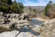
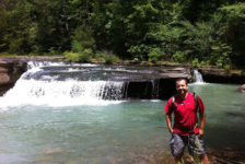
If you have not made this hike yet, I highly recommend adding it to your list. If you use the AllTrails app, this hike is called Centerpoint to Goat Trail. I think you can get all the way to Hemmed-In Hollow from this trail, but it would be a tough hike. I only hiked to Big Bluff, and that was enough on a hot summer day. Luckily there was still a little bit of water left at Steel Creek on the Buffalo for me to cool off afterwards.
Directions
The Centerpoint trailhead is right on Hwy 43, just a few miles north of Ponca. The parking lot is directly across the highway from Centerpoint Campground on Fire Tower Rd. See Google map below.
What to Expect
Hiking the Big Bluff Goat Trail from the Centerpoint Trailhead is about a 6 mile hike. It is an out and back trail, approximately 3 miles each way. Hiking out to the bluffs is pretty much downhill all the way, making the hike back completely uphill. But don’t let that scare you. It is not very steep. But it is a gradual incline the whole way. It is rated as difficult on the AllTrails app. While it’s definitely not easy, I didn’t think it was physically all that hard. Yes, I stopped a couple of times for water and a breather, and was totally drenched in sweat at the end. But it was also a hot day in August. Maybe they rate is as difficult due to the narrow ledges along the bluffs.
The trail is clean and well-marked. It is very clear which way to go, even without a map. The trail cuts through dense forest along the top of a ridge and is shaded pretty much the whole way. But because of the forest, there are not may views of the canyon along the way until you reach the bluffs. A lot of the trail is pretty rocky, as you can see in the pics and video below. Some parts of the trail get some water drain-off and are pretty muddy. But there is a side trail you can take that bypasses these areas and merges back with the main trail later. Around 2.5 miles into the hike, you’ll reach the beginning of the bluffs.
Big Bluff
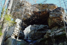
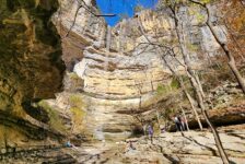
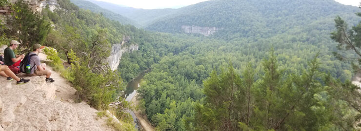
Once you reach the bluffs, the trees start to thin out and you can catch some views of the canyon below. There are some very cool rock formations as you start to approach Big Bluff. When you actually reach Big Bluff, the trail becomes a ledge that winds it’s way around the edge of the bluffs. I wasn’t sure what to expect with this ledge before I went. But it is wider than I thought it would be, and wider than it looks in most pictures and even in my video below. I never felt like I was in danger of falling off. The view from there is incredible! You can see the Buffalo River below, which is really cool if you’ve ever floated that section of the river and looked up to these bluffs. And in both directions, the canyon winds through the mountains all around. It’s one of those views where you keep taking the same pictures over and over because it’s so awesome. Definitely one of the best in the state.
Plan Your Trip
Before you take your four-legged hiking partner, be aware that pets are not allowed. It’s posted on the trailhead sign. I did see some people with a small dog, but I don’t recommend testing the rangers on this. If they see you, they will give you a ticket. But if you do, please keep them on a leash around the bluffs. I recommend starting this hike early to beat the heat. I would say before 9 or 10 am, even earlier if you don’t want to see a lot of people. Give yourself at least 3 hours for hiking the Big Bluff Goat Trail, maybe longer if you want to spend more time hanging out at Big Bluff. I think it would also be cool to do late in the afternoon to catch the sun going down over the hills. But be sure to get out of there before dark.
There are no bathrooms nearby, so that will need to be handled before you arrive. There is a little bit of cell signal in the parking lot, but that’s it. You really don’t need a map for this hike. The trail is well-marked and it’s obvious where to go. Take plenty of water, especially in the summer. Definitely wear some hiking boots or good, sturdy shoes for this hike. I didn’t have a problem with insects or with the trail being overgrown. But I could see it happening at certain times of the year. Insect repellent might be a good idea. But whatever you do, make sure you have a way to take pictures!
If you want to make a weekend of hiking all the trails in the area, there are lots of cabins, campgrounds, and places to stay nearby. You won’t cover them all in a weekend. No matter where you go around the Buffalo National River, be prepared to pack out any trash that you have and leave no trace. Help take care of this treasure by taking only pictures and leaving only footprints. Enjoy the hike!


