If you do a lot of hiking in Arkansas and haven’t made the hike to Whitaker Point, you have to add this one to your to-do list. It’s one of the more popular hikes in the Ozarks. Even if you don’t know what Whitaker Point is, you’ve probably seen a picture of it somewhere. Also known as Hawksbill Crag, it is one of the most photographed scenic spots in Arkansas. Lots of marriage proposals happen here and people actually pay photographers to capture the moment from far off.
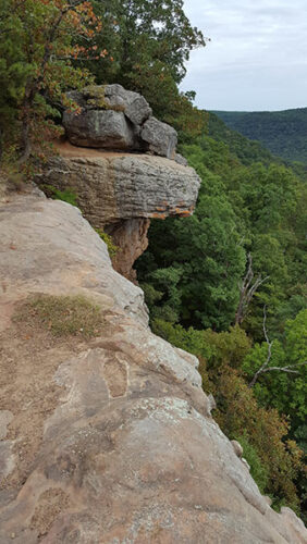
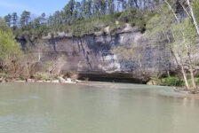
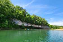
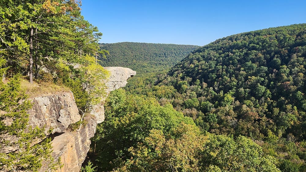
So what is it? Hawksbill Crag is a large rock outcropping sticking out from the top of a really high bluff. The bluff overlooks Whitaker creek in the valley below. On the AllTrails app, it is listed as “Whitaker Point Trail (Hawksbill Crag)”. On Google maps, you’ll find both “Hawksbill Crag/Whitaker Point” and “Whitaker Point Trailhead”. So both names are common, but they are essentially the same thing. Being a popular spot, it can get kind of crowded, especially on the weekends. I was lucky enough to go on a weekday with rain in the forecast. Hardly anyone was there and I had the place almost all to myself.
Quick Glance
Distance: 2.5-miles Out and back
Difficulty: Easy-to-Moderate
Parking/Trailhead Coordinates: 35.898231,-93.457992
Haley Falls: 35.89350, -93.44688
Mule Trail Falls: 35.89363, -93.44988
Thousand Kisses Falls: 35.89242, -93.45053
Whitaker Point/Hawksbill Crag: 35.89125, -93.44043
(Copy/Paste Coordinates into GPS or Google Maps search bar)
Directions
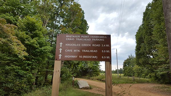
The Whitaker Point trailhead is about an hour north of Clarksville, and about 20-30 minutes south of Ponca. If you are coming from Ponca/Boxley Valley, take Gravel Road 5 off Hwy 21. It is a rough and steep uphill drive to reach the trailhead. If you are coming from anywhere other than Boxley Valley, I recommend coming in from the west by accessing Gravel Road 5 from Hwy 16. It is a much better road, not as steep or rough. See Google map below. From the parking area, the trailhead is easy to find, as you can see in the pictures further below.
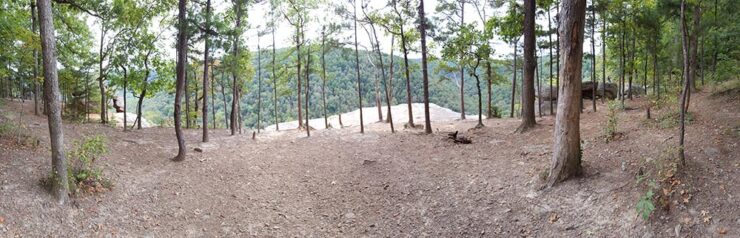
What to Expect
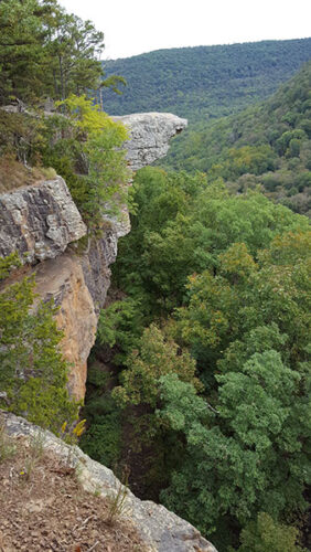
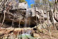
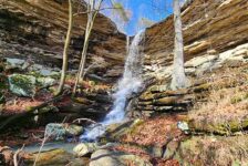
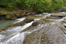
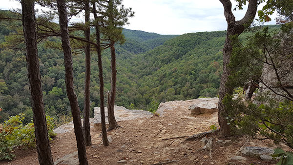
The hike to Whitaker Point is a moderate 1.5 mile out and back trail (3 miles round trip). It is a nice clean trail with plenty of shade and is well-marked. There is a slight uphill climb on the hike out, but overall the hike is not too physically difficult. The trail starts off winding it’s way downhill a bit and crosses a creek(no creek shoes necessary). As it makes it’s way toward the Crag, the trail comes to a smaller ledge that forms a small waterfall when there is water in the creek. At that ledge, the trail turns left and winds its way along the top of the bluff until it reaches Hawskbill Crag. You will start to see the Crag about 50-100(ish) yards before you reach it. From there you’ll find several great spots take pictures of the Crag.
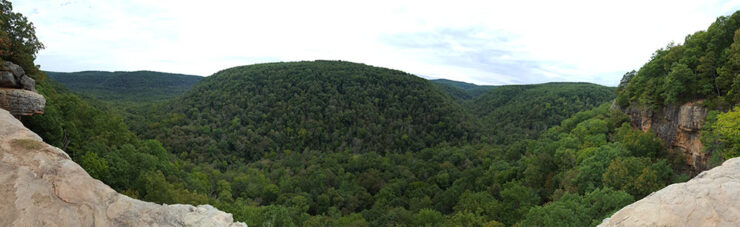
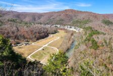
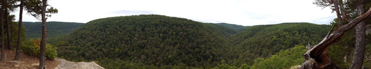
Once you reach the Crag, you’ll see why it’s such a popular hike – That view!!! You actually get to see the view before reaching Hawksbill Crag, but it’s even better once you’re standing on top of that rock. I’m not sure which picture is better – the view of the canyon and mountains all around, or the view of Hawksbill Crag itself from down the trail. Either way, just make sure you take a camera. And if you have time, it would be great place to string up a hammock and hang out a while.


BE SAFE – PLEASE read this!
While this is a beautiful area to be enjoyed, it can be a hazardous area that can turn a great day into a terrible one. But it doesn’t have to be. Just be safe and watch your step. There are several spots close to the ledges where people can loose their footing and fall. Guys, it’s a really long fall. Unfortunately, there have been accidents here over the years that have resulted in serious injuries and fatalities. So when you are trying to get that “perfect Instagram shot” or even the pro’s capturing the bluffs, just watch your step. Don’t let this scare you – As long as you don’t get too close to the edge, you’ll be fine. But no picture is worth taking that fall and ruining your day.
Plan Your Trip
When making the hike to Whitaker Point, give yourself at least a couple of hours to enjoy the area. It is not the easiest drive getting there, so you might as well take your time and enjoy it. Speaking of the drive, it is at least 5-6 miles of gravel road no matter which direction you come from. The road from Ponca/Boxley Valley is steep and a little rough. You don’t need a 4-wheel drive, but I would not try in a small car. As I mentioned, this area can get pretty crowded on the weekends. I highly recommend going on a week day if possible, especially if you want pictures without a lot of people in them. I also recommend starting early. In one day you can easily fit in this hike along with another nearby hike like Eden Falls at Lost Valley. Or if there’s nowhere to park for Whitaker Point, you can go maybe a mile west on the same gravel road to hike Compton’s Double Falls, which is an outstanding hike. Just make sure there has been recent rainfall for that one.
There are no bathrooms nearby, so that will need to be handled before you arrive. You really don’t need a map or GPS for this hike unless you want to hunt the waterfalls. The trail is well-marked and it’s obvious where to go. Take plenty of water, especially in the summer. Definitely wear some hiking boots or good, sturdy shoes for this hike. I would highly recommend taking lunch and maybe a hammock. But whatever you do, make sure you have a way to take pictures!
There are lots of cabins, campgrounds, and places to stay nearby if you want to make a weekend of hiking all the trails in the area. You won’t cover them all in a weekend. No matter where you end up, be prepared to pack out any trash that you have and leave no trace. Help take care of this treasure by taking only pictures and leaving only footprints. Enjoy the hike!