
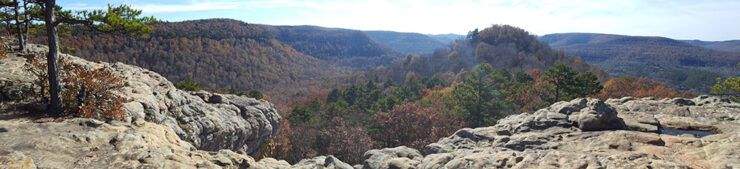
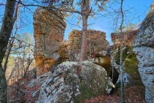
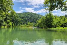
Summer is over, and before long the Ozarks will be covered up with the colors of Fall. And one of my favorite spots to see all the Fall colors is Sam’s Throne. This is a hike along the top of a bluff line to a point overlooking a valley, and the views here are gorgeous! Hiking at Sam’s Throne can be a very short hike, or a longer hike depending on what you want to see. Either way, it’s a great place to hang out for a while and enjoy the views.
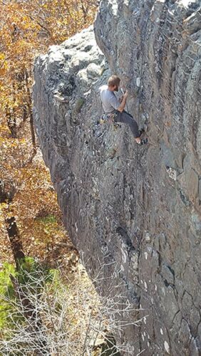
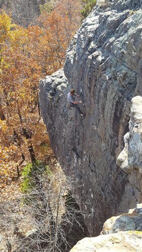
Sam’s Throne is also a popular rock climbing destination. I’m not a climber myself, so I won’t write any about that and risk putting bad info out there. But it’s worth mentioning to anyone interested in climbing…and I do like watching the climbers scale the walls. Between that, the views, and the drive there, it’s a good way to spend a day and definitely worth a visit. Once those leaves turn colors, you’re going to want to go here!
Directions
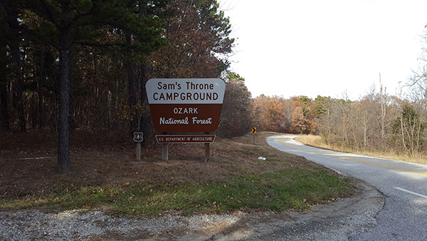
Coming from the south (Russelleville/Dover) up Hwy 7, turn right on Hwy 123. This is an awesome drive! The highway winds along the top of the bluffs and gives you lots of views of the valleys and mountains all around. Stay on this road until you see the Sam’s Throne sign on your left. Coming from the north, from Jasper/ Harrison (Hwy 74) or St. Joe area (Hwy 123), you will pass through the community of Mt. Judea. After a steep, winding climb up the mountain, the Sam’s Throne sign will be on the right. See Google map below:
What to Expect
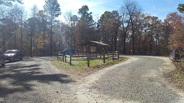
Upon arriving at Sam’s Throne campground, you’ll drive through a primitive campground as far as you can go till your reach a circle drive. Park there, and you’ll see signs with maps for the area. The trail kind of makes a loop from that spot. I recommend starting at the trailhead on the west side of the parking loop that’s closest to the bluffs, and just make it an out-and-back hike. This is much more scenic. The other direction cuts through the woods and can get a bit overgrown.
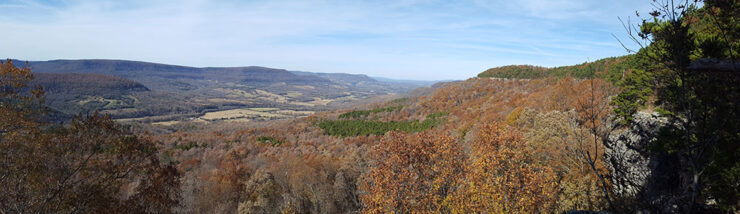
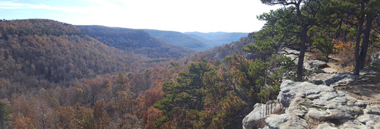
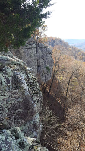
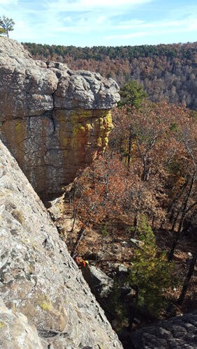
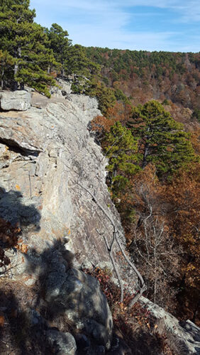
It is a short hike along this bluff line to the main bluff vista where you can see Sam’s Throne. (Sam’s Throne is actually a lone peak in the middle of the valley). Along the way there are lots of spectacular views of the valley. From the main vista, the trail continues to wind along the bluff line where you can see the wall that most climbers like to play on. If you’re lucky, maybe you’ll get to see some climbers scaling it. But this is where things get tricky. The trail is not well-marked. I explored it, trying to find a way down to the valley floor to look up at the bluffs and possibly hike out to Sam’s Throne. I went as far as I could until I ran into what looked like private property. That’s where I stopped and turned around.
Getting to Sam’s Throne
This is the part where the hike gets longer if you want to see more. It is a two-mile round-trip, out-and-back hike. But you will need to download some maps and do some homework. One resource you an use is to download the Hiking Project app and find Sam’s Throne on the map. From there you’ll see a blue trail called “Dog Trot Trail”. Click that and read the Trail Description & Highlights. This is the same route that Rick Henry describes in his blog. So if you don’t want to download the Hiking Project app, you can go here and download Rick’s waypoints and tracks into your GPS.
I personally recommend the latter option of downloading Rick Henry’s track and waypoints into a GPS app like GAIA, If you just want the coordinates for the trail, its (35.87741, -93.04654). While the hike to vista is easy, the hike to the top of the throne is not. Be prepared for a pretty tough hike up to the top of Sam’s Throne.


Plan Your Trip
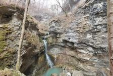
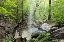
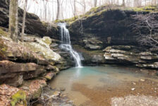
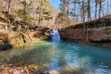
Whether you hike all the way to Sam’s Throne or cut it short at the vista bluffs, Hiking at Sam’s Throne is well worth the trip. If you plan to venture out past the bluffs then you definitely want to download the two apps I’ve mentioned and download some trail maps. Otherwise, no maps are needed. The area is pretty remote, so don’t plan on having cell service there. Since this can be a really short hike, you might consider planning another hike in the area to fill up your day. Maybe something fairly close like Glory Hole Falls or Pam’s Grotto would be good.
There are lots of cabins, campgrounds, and places to stay nearby if you want to make a weekend of hiking all the trails in the area. You won’t cover them all in a weekend. The Sam’s Throne campground is a primitive campground with a basic bathroom (pit toilets), no electric or running water. The closest town is Mt. Judea, so bring food and water if you plan to make a day of it. You will definitely want pictures so don’t forget a camera! Be prepared to pack out any trash that you have and leave no trace. Take only pictures and leave only footprints. Enjoy the view!


Joshua Allen
I love what your doing here! This is a great place to find some great weekend ideas. I am all about exploring AR. There is a lot of untapped adventure in AR. Thanks for your help!
Scott Hallmark
Wow, thanks for the feedback! That’s why I do it. I’m glad you like the site. And I agree, we are very fortunate here in AR to have so much to explore
Tammy
You are spot on in your description. I hiked it yesterday with seven other ladies and saw some beautiful views along with a proposal. Yes, the trail going to Sam’s Throne is not well marked. It can be as easy as you want or as challenging.
Scott Hallmark
Thanks for the comment, Tammy! I hope the article was helpful for you. It’s a beautiful area for sure. Just my opinion, but I think the views are as good or almost as good as Whitaker Point…but without the crowd.