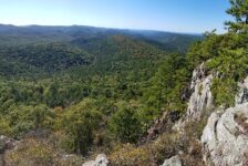
I love finding new areas to hike that I’m completely unfamiliar with. They offer brand new sights, new mountains, streams, waterfalls, and trails. For me it’s the same excitement as taking a vacation to a new but popular place. You don’t know exactly what to expect, but you know you’re going to enjoy it. Even though I’ve explored quite a bit of Arkansas, this still continues to happen (which is a good thing!). The latest example is an area of the Big Piney Forest I’ve been exploring lately, just east of Hector. And my first visit to this area included a quick hike to Schoolhouse Falls.
Yes, I realize a lot of people know about this area and hike it regularly. But for some reason, I’ve skipped right over it for years on my way to areas northwest of it. And that’s typically how it goes with me and new places. They usually have been right under my nose the whole time. Maybe I’ve passed them on the way to somewhere else and didn’t realize what was there. Or maybe I just never thought to check them out at all. I had heard of several of the waterfalls in this area. But once I started to research those, I quickly realized this area is treasure trove of waterfalls and hiking trails. If you like to hit multiple waterfall hikes in one day, this is an area you need to dig into. I think the short but popular hike to Schoolhouse Falls is a great starting point.
Directions
From Hector, head north on Hwy 27 to Dare Creek. Immediately after crossing Dare Creek, turn right on White Oak Mountain Rd (Nfm 1301/Co Rd 1). Continue for about 12 miles and turn right onto Wilderness Trail (Co Rd 2). At about the 3 mile mark, you’ll see a pull-off into a clearing on the right side of the road. It is across the road from the Austin Trailhead. Pull in there. There are other routes to reach this area. If coming from the south or east, use the map below to find the best route.
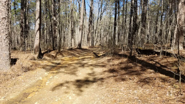
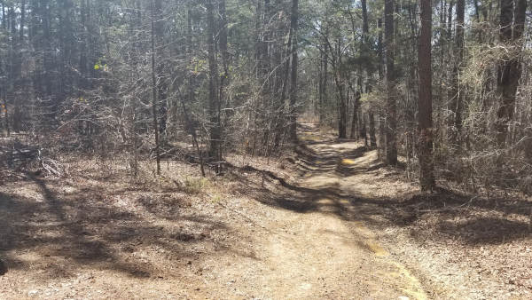
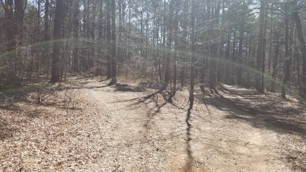
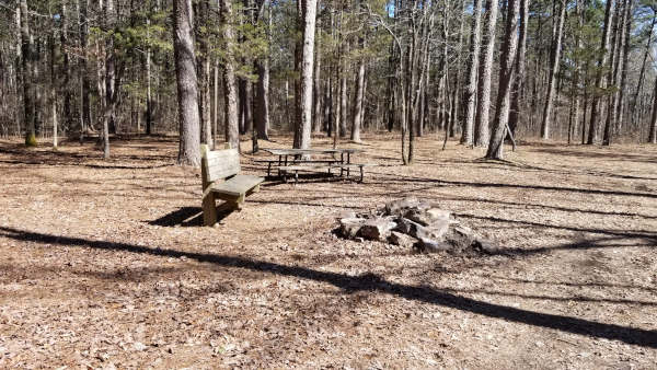
Once you reach the parking area, follow the ATV trail. I drove my truck without 4WD most of the way down that trail. But it is rough and full of large mud holes. I had to stop and park about 2/3 of the way up the trail. Use your own discretion here. It is not far from the road to the actual hiking trail – maybe a half-mile. So it’s not too far to walk, and definitely better than getting stuck if you don’t have 4WD. The ATV trail will eventually fork. Veer left at the fork, through a clearing with a picnic table and fire ring. The trail starts there.
What to Expect
The Hike
The hike to Schoolhouse Falls is really short. I didn’t measure it or track my steps, but it’s easily less than a half-mile each way. I would rate the hike as easy-to-moderate. The trail itself is super easy. It’s a very clean and easy to follow trail with nothing technical about it. The reason I might consider it a little moderate is because it is all uphill on the way out. It will get your heart pumping a bit, but at least it’s a short hill and not terribly steep. By normal hiking standards, this is an easy hike.
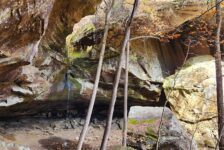
Starting from the point I described above with the picnic table, the trail winds down a gradual hill. Within less than a half-mile, you’ll reach the creek that forms the falls. You will need to cross the creek to continue along the trail to Schoolhouse Falls. I could see the need for creek shoes or bare feet if crossing this right after a heavy rain. But it was shallow enough for me to cross in my boots and not get wet. There might even be a better crossing upstream, but I didn’t even need to go look. Cross the creek, and you’re immediately met with Upper Schoolhouse Falls. The trail continues from there to take you to the bottom of the main waterfall and grotto.


Waterfalls
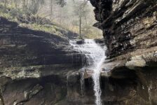
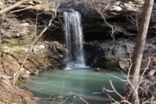
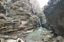
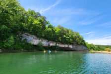
The creek above Schoolhouse Falls is a pretty cascade that comes to a straight drop-off roughly four feet high. This is Upper Schoolhouse Falls and is the first true waterfall you’ll see. Less than 50 ft further down the trail you’ll reach the top of the grotto for Schoolhouse falls. The trail goes along the top of that with a view of the falls. There is a break in the bluff that you can climb down to get to the bottom. If it is wet and slick, I recommend staying on the trail for another 40 yards. The trail wraps around the bluff and down to the creek level, and comes back up to the falls.
Schoolhouse Falls is really beautiful waterfall. At a light flow, it splashes into a bright green rock formation before finally landing in the emerald green pool below. It sits in the middle of a really cool-looking grotto and there is room to walk behind the waterfall. It is kind of hard to photograph from a distance because of all the trees in front of it. But between the trees and the falls, a good panoramic setting can capture some decent shots of the grotto and falls. It’s a great place to string up a hammock and hang out, or stop for lunch.
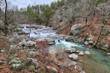
Before leaving the area, I absolutely recommend following the creek downstream from the falls. There are some really cool slot falls and rock formations to see there. I probably could have spent a lot more time exploring that creek, but I had other hikes I wanted to fit in that day. Be sure watch my video below for a visual on all these steps.
Plan Your Trip
No matter where you come from, the dirt road drive to get here is much longer than the hike itself. So to justify the drive, I recommend planning one or two more hikes in the area to go with this one. Either that, or bring lunch and a hammock and make a day of hanging out and playing in the creek here. As I mentioned, this area has a TON of waterfalls to explore. The closest ones are Lizard Log Falls. A longer hike just down the road would take you to Laddderbucket Falls and John Mountain Falls, and Brushy Grotto Falls. For another short easy hike, check out Fiddlehead Falls. I have not hiked or written about these yet. So for now, I’m linking those to Rick Henry’s posts, which is where I got my info for this hike. Check back later for new links to my own articles with my own take on those. To see all the waterfalls in the area, check out the Waterfalls in Arkansas map.
No matter which hikes you do, be sure to download maps and coordinates for falls and parking locations. I recommend using a GPS with some pre-loaded tracks and waypoints for some of those other hikes. Cell service is hit and miss out there – mostly miss – so do all that before you go. Many of these trails are a little less trafficked than some of the hikes around Hwy 7, Fallsville, and Ponca. So bug spray is recommended in the Spring and Summer. Personally, I wouldn’t hike these in the Summer unless it was right after a rain. These areas are pretty far from anything. So take food and water with you. Just be sure to pack out what you pack in and leave no trace. Take only pictures and leave only your footprints. Enjoy the hike!