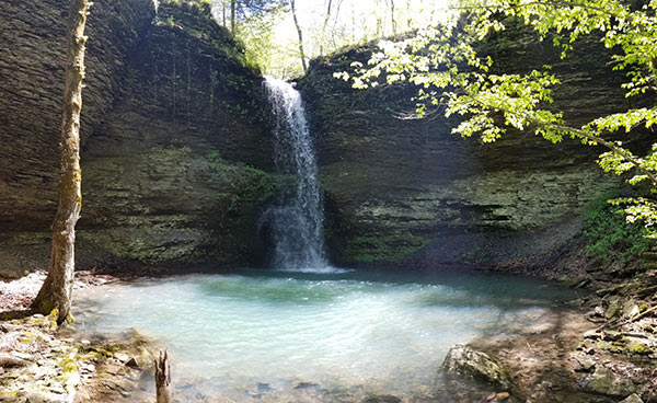
I have written several articles now about waterfalls that I have missed while hiking to others close by. My research is getting better, so hopefully I won’t keep missing them. But I recently visited two more waterfalls you can easily combine with other waterfall hikes in the Falling Water Creek area. Splashdown Falls and Intersection Falls are two that are located off Falling Water Rd near several popular waterfalls. If you ever hike to Terry Keefe Falls, you should definitely add Splashdown Falls to the same hike. There are a lot waterfalls in this area such as Six Finger Falls and Fuzzy Butt Falls, Horsetail Falls, Terry Keefe Falls, and others. If you ever stop to see ANY of the waterfalls along Falling Water Rd, Intersection Falls is another quick and easy stop you can add.
I had a guest hiker join me on this hike who has recently gotten into hiking and wanted to see some waterfalls. Well, what’s a great place to see a lot of waterfalls in a short amount of time? Falling Water Rd in the Richland Creek Wilderness, of course! So off we went. Along the way, we saw Falling Water Falls and Six Finger Falls. And I pointed out how to find King’s Bluff Falls, Horsetail Falls and Fuzzy Butt Falls. And I decided we would hike to see Splashdown Falls, Calypso Falls and Intersection falls that day to finish out my Falling Water Rd list. That is unless I decide to go back and find Hidden Falls or Landslide Falls, haha.
Directions
To reach Splashdown Falls, start on the Terry Keefe Falls trail. The trail to these falls starts on Falling Water Rd. This is about 35 minutes northeast of Sand Gap. Use the map below to navigate to the trail head. After crossing the narrow concrete bridge over Falling Water Creek, you’ll see a fork in the road. Stay to the left. Around a quarter mile past that, look to the left for some blue hashes on trees and a wide spot in the road. There you’ll find Six Finger Falls. (Note: the blue hashes indicate a trail leading to the creek. There are several of these along Falling Water Rd.) Approximately .35 miles past Six Fingers Falls is the trail head for Terry Keefe Falls on the right. You might see a trail on the right going up a hill with orange paint on the trees. That is not the right trail. I have a picture of the correct trail head in the slideshow down below. And here are the coordinates for the trail head: 35.765463, -92.933339.
Before you reach Six Fingers and Terry Keefe Falls, you’ll drive right over Intersection Falls and not even know it. Here are the coordinates for parking to see that waterfall, which is also marked on the map above: 35.758880,-92.936450.
What to Expect
Intersection Falls
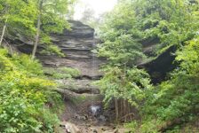
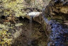
As I mentioned, you drive right over this waterfall as the creek feeding it runs under Falling Water Rd. It’s completely unnoticeable as you’re driving along. I’ve driven over it at least a dozen times and never even knew it. The walk to the waterfall is so short I don’t even consider it a hike. And that’s why it doesn’t get it’s own article. There’s just not much to it. But it does have a place somewhere in my blog. It is a nice waterfall and totally worth the short walk down the creek to see. Once parked, look for a narrow trail on the creek side of the road. See pic below. Follow that down to Falling Water Creek. Then turn left and follow the trail up the creek less than 50 yards. The trail ends with a nice view of the falls and Falling Water Creek.
Terry Keefe Hollow
I wish I had known about Calypso and Splashdown Falls the first time I hiked to Keefe Falls. They are so close together it only makes sense to see them all in the same hike. Start off on the Terry Keefe Falls trail.(read all about that hike here The hike to Keefe falls along the creek is a fairly easy one. It is a clear, well-trafficked trail with a lot of greenery following along a scenic creek. There is a little elevation change as you head up into the hollow, but nothing too difficult. You will approach some bluffs close to the top of the hollow and then descend back down towards the creek. At this point, start looking or listening for another creek feeding into this one. That creek is the south prong that leads to Calypso and Splashdown Falls.
This is where things get complicated. There are two ways to get to Calypso and Splashdown Falls. One way is a bushwack up the south prong creek bed. Our hike was on a day after we had some good rain. The creeks were full and flowing, so this didn’t seem like a good option. There is another option though. As the main trail comes back down to the creek and you can see the south prong, there is a place to cross the creek. You can either cross here or stay on the trail going up to Keefe Falls. If you cross the creek, you’ll find a faint trail heading up a hill away from the creek. This trail will lead to Splashdown Falls.
Splashdown Falls and Calypso Falls
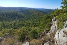
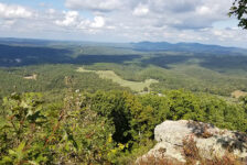
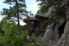
We headed up the trail across the creek in hopes that it would lead to Calypso and Splashdown. We were right…sort of. This trail is considerably more difficult than the Keefe Falls trail. It goes uphill and follows the bluff line of the south prong hollow. It is not well-marked or heavily trafficked, so parts of it are hard to follow. But there are some really cool bluffs and rock formations up there. The trail gets really high above the creek and seems like maybe it’s not the right way. But eventually it will come back down and lead right into Splashdown Falls.
But remember when I said we were sort of right? Well, I was following Rick Henry’s GPS tracks and waypoints on my GPS. And I could tell we were standing high above Calypso Falls. But we never found a way down to the waterfall. The hillside is really steep and the vegetation is extremely thick between the trail and the creek. The closest we ever got to Calypso was at the top of the falls, which was barely visible. We even tried another trail coming back from Splashdown, but it was a dead-end into a really steep drop. So maybe we just missed the way to go, but we didn’t get to see Calypso Falls. But here are the coordinates for it: 35.762730,-92.925740. I recommend going up the creek bed to reach this one.
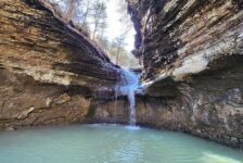
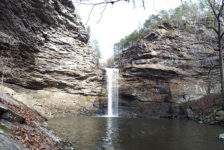
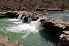
As for Splashdown Falls, the trail we took goes all the way to the falls. It is not terribly far – maybe a half mile hike up the south prong. But it is kind of difficult. The footing is not good – slick in some areas, and loose rocks in others. It is 100% worth it though. As you approach the falls, the creek flows out of an almost completely enclosed grotto. It’s like peeking through a door into a room with an awesome waterfall in it. We caught it at just the right time of day with sunlight beaming into the grotto at just the right angle. When this 35-ft waterfall has good flow, it is an impressive sight. Be sure to check out the video below, and then go see it for yourself.
Plan Your Trip
This area is one of the most highly concentrated areas for waterfalls in the state. If you come in from Sand Gap, you’ll pass by the trail head for King’s Bluff Falls and Pedastal Rocks. As you drive down Falling Water Rd, you’ll pass right by the popular Falling Water Falls. Just before reaching Terry Keefe Falls on Falling Water Rd, you’ll pass trails for Six Finger Falls and Fuzzy Butt Falls, and Horsetail Falls. And even further down Falling Water Road, deep in the wilderness, you can find Richland Falls and Twin Falls. I recommend filling your day seeing as many of these as possible. Now you can add Splashdown Falls and Intersection Falls to that list. Remember, this area is kind of in the middle of nowhere as far as cell service goes. You will lose cell service long before you reach Falling Water Rd. So if you plan to hike other trails, download or print a map before you go. For this hike, I highly recommend downloading Rick Henry’s track file to your GPS. Get that here. Save these waypoint coordinates in your GPS as well. Splashdown Falls : 35.76245 -92.92499. Calypso Falls: 35.76273 -92.92574.
It might be important for some people to know that Falling Water Rd is a long gravel road. It is rough in some places and can washed out sometimes. Most vehicles should be able to handle it, but it’s not a place for sports cars. There are also no public restrooms near here. The only toilets around are pit toilets at Pedestal Rocks parking area and Richland campground. Neither are super close. So unless you’re cool with going in the woods, you’ll need to handle your business well before you arrive. There are also no gas stations or convenience stores within 45 minutes of here, so keep that in mind. If you plan to spend all day, you might want to bring food with you, but definitely bring water. In the summer, I would recommend going right after a good rain, and take some bug spray. Waterfall hiking has become extremely popular and these areas get a lot of foot traffic, so please remember to leave no trace. Take only pictures, and leave only footprints. Have fun and enjoy the hike.



Delana Ryan
Thank you for this post and video! I wish I had watched it a week ago. Last week I went with a couple of friends to Horsetail, Upper Horsetail, Fuzzy butt, Six Finger, Intersection, and Keefe. We were following directions in Tim Ernst book and stopped at the wrong spot for Keefe. My friend followed the OHT for a ways, other friend waited behind and I bushwhacked half a mile up that little creek before giving up. I jokingly said it’s probably a few yards up the road. Then, there it was! Kind of glad I didn’t know about splashdown because I was a little worn out by that time. We planned to have lunch at sand gap and didn’t get to until 5:00! Anyway, appreciate your post
Scott Hallmark
Hi Delana. Thanks for your comment! I hope the video helps. I have recorded a new video for Keefe Falls that will be more helpful, and eventually I’ll add that to the old blog article. Just got a backlog of hikes and float to write up and get published first. But I’ll get to it!