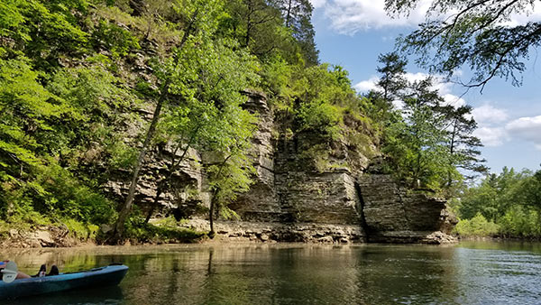
The 2021 float season has been a good one so far. Planning has been a challenge at times but I’ve managed to paddle a lot of new water this year. This Spring, I made my first floats down Kyle’s Landing to Ozark on the Buffalo, and Norman to Caddo Gap on the Caddo River. And in May I finally got to float the Cove Creek run on Cadron Creek. (This is Hwy 65 to Hwy 285). This one had been on my list for a while since floating the section upriver from it many years ago. I’ve always heard this is a nice float, but the scenery and the river completely exceeded my expectations that day.
Floating the Cove Creek run on Cadron Creek is really convenient for folks in Central Arkansas and the Ozark foothills. It’s only a half hour north of Conway and easy to self-shuttle. I’ve kind of ignored it for a long time because I’ve had so many rivers I want to float. But I’m definitely coming back to this one and adding it to my “Easy Sunday” list.
Quick Glance
Distance: 10 miles
Difficulty: Easy
Put-in Coordinates: 35.284965, -92.472015
Take-out Coordinates: 35.299438, -92.402959
Directions
First the take-out. Park a car here first. From Hwy 65, 4 miles north of Greenbrier or 5.5 miles south of Damascus, head west on W. Republican Rd for 4.7 miles. Turn right on AR 285 North. In almost a half-mile you’ll reach the Hwy 285 bridge that crosses Cadron Creek. Parking and the boat ramp are on the left. To reach the put-in at Hwy 65, go back to Hwy 65 and turn left (north). Drive 1.6 miles and turn right on Ozark Dr. Follow it all the way down to the river and parking area.
What to Expect
Surprisingly Scenic
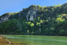
First of all, I was not expecting this float to be as pretty as it is. The beauty of this river and the bluffs around it was a total surprise to me. I guess I should not have been all that surprised. After all, it is in the foothills of the Ozarks, which is some beautiful country. But even as we were driving to the take-out and put-in, I would not have guessed this river would look the way it does. There’s not really any large mountains immediately close to the river. Yet, there are lots of large bluffs overlooking this river all along the banks. No, they’re not the size of the bluffs along the Buffalo, but they’re bigger than those of the Mulberry River. Check out the pics and video below and you’ll see what I mean.
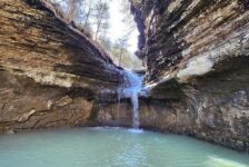
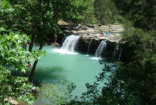
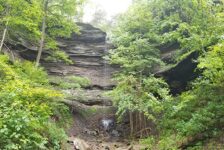
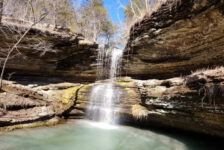
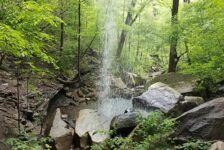
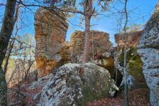
Other things you’ll see floating the Cove Creek run on Cadron Creek is some cool rock formations and even a couple of small waterfalls. There are plenty of gravel bars to stop and hang out on or swim. I saw several spots that I would’ve liked to camp on, but I’m not sure if camping is allowed. I doubt it since a lot places on the river looked like private property. One cool feature I recommend stopping for is Peavine Creek. It’s closer to the end of the float, river left. If you paddle 100 or so yards up this creek, you’ll be treated to some cool rock formations and a beautiful cascading creek. I’ve featured this in my video below too.
The River
The Cove Creek run on Cadron Creek is a 10 mile float. We floated it at 2.5 feet on the gauge, which is about the minimum for a decent float. I think the prime float level is probably around 4-6 feet. At 2.5 feet there weren’t any rapids more than what I would consider Class I. That may change with higher water. But at 2.5, there is a lot of fast-moving water and a good steady current for most of the trip. Our float took just a little over six hours. But we did stop a lot and took a detour up Peavine Creek. The float can be done faster, especially when the water is higher.
There were a couple of spots on the Cadron that looked a bit murky. But for the most part the water was a pretty emerald green, and crystal clear in the shallow spots. We didn’t fish that day, but it looked like a great river for smallmouth bass and bream. Close to the midpoint of the float is a fun feature called “Rock of Gibraltar”. As you might guess, it’s a giant rock right in the middle of the river, in a slight curve. You’ll want to stay to the right of it. I’ve featured this in my video as well. There were several strainers (downed trees) in the river that day. I’m guessing this river doesn’t get the kind of maintenance as the more touristy rivers. So keep an eye out for those.
Plan Your Trip
The first thing to know when planning this float is that it’s often not floatable without recent rain. Be sure to check the water level on American Whitewater. I don’t recommend doing this float if it’s less than 2.5 feet. It could be done, but you’ll drag a lot. This is a very easy float to self-shuttle if you have your own gear and a paddling buddy. But if you need to rent or get a shuttle, you’d better call ahead. I only know about one outfitter in the area and they didn’t answer my call. So I won’t list them here and I can’t vouch for them good or bad. But if you need an outfitter, you can Google “Cadron Creek Outfitters” and try your own luck.
The closest town is Greenbrier, where you can get food, drinks, ice, etc. There are no bathrooms anywhere close. So if you need one, better handle that ahead of time. For those that need to stay connected, I did get a phone signal (AT&T) pretty often on this float. Be prepared to pack out your trash and leave no trace. I hope you enjoy this float as much as I did. Be safe out there and happy paddling.



John Svendsen
Some corrections and clarification:
1) Shuttles are shorter and faster using Solomon Grove Road vs. Republican Road albeit the approach to take-out via Republican Road is shorter when coming south off of Hwy. 65.
2) There are NO smallmouth in the Cadron — we do have some tail-walking largemouths and Kentucky’s but no smallmouth bass.
3) The Cove Creek run has adequate water for paddling MOST of the year — only in the throes of a summer’s drought (July-September) are the lower reaches unsuitable for paddling without dragging or portage. The Cadron actually has one of the longest seasons of any free-flowing stream in Arkansas for paddling. The stream is hisotically “good to go” from 1st of November to mid-June of each year and is only “rain dependent” for a few weeks every year. In fact the lower Cadron is good for paddling 24/7/365.
4) You can find food, gas and even “adult beverages” in nearby Damascus Arkansas which is often closer than driving back to Greenbrier. You will find gas stations, grocery store, Dollar General, a beer and liquor store and one of the best Mexican restaurants in the area.
5) Camping and lodging are available on the Cadron and can be found through several available web sites: AirBnb, HipCamp, Dyrt, Campspot, etc. And yes these are “private properties” but they are readily accessible to the public nevertheless. But if important to limit stays to public properties such can be found at nearby Woolly Hollow State Park and Choctaw Recreational Area. “Wilderness camping” can also be found in the Arkansas Game and Fish Wildlife Management Area to the north — either the Scott Henderson Gulf Mountain WMA or Cherokee WMA.
6) The Cove Creek reach is the most popular only because it is the most accessible — but frankly the Cadron has even better delights and scenery along its length. One of the best “family-friendly” short runs (2-4 hours) suitable for beginners can be found at the new AGFC access at the Highway 124 bridge to Mill Bridge. Highly recommended.
7) The USGS gauge for the Cadron can be found here: https://waterdata.usgs.gov/monitoring-location/07261000/#parameterCode=00065&period=P7D. Our general recommendations: If the creek is “good to go” it is good to go from Highway 124 to the mouth of the Arkansas River — and “good to go” is any level above 3 foot. At 4.5-5 feet the river gets pushing with the middle section of the river (Batesville Mountain to Cove Creek) displaying some nice surf waves and wave trains, Above 5 feet we advised most people to consider paddling a nearby stream (such as Cove Creek) unless an experienced boater possessing good boat control. Around 2-2.2 feet we begin to have expectations of dragging albeit a low draft boat can find a line down to 1.5 feet.
7) And lastly, Cadron Creek Outfitters has been assisting paddlers for over a decade in enjoying the marvelous works and wonders to be found on the Cadron. Not only do they provide kayak and canoe rentals and shuttle service they have four separate campgrounds on the Cadron — Batesville Mountain Campground, Pinnacle Springs Recreational Park, River Camp and Cove Creek Camp allowing one to easily pursue multi-day adventures on the Cadron — they provide service to over 60 miles of river!! Albeit they are open year around for camping, climbing, hiking and other outdoor adventures all year long they are open for paddling adventures only on the weekend (Friday, Saturday and Sunday) from the 1st of March to mid-June — call any other time and indeed they won’t answer your call — but they will return a message. BUT if you want a really quick reply then send them an e-mail ([email protected]) or a text (501-993-1650) and they’ll get right back to you. Reservations for camping at Cadron Creek Outfitters can be reserved through all the major portals: HipCamp, Dyrt, Campspot, etc.
Be safe out there!!