There are many hikes in Arkansas that are better at certain times than others. And when you can’t do those, you need a backup plan. I have a list of hikes that I have been saving for times when rivers and waterfalls are dry. These are my “Plan B” hikes. Not because they are not good hikes, but because they can be done at any time. Hikes like Centerpoint/Goat Trail to Big Bluff or the Mt. Nebo Rim Trail for example. The latest Plan B hike I’ve checked off my list was a visit to Round Top Mountain hiking trails.
I have passed by Round Top Mountain dozens of times on my way to Jasper or the Upper Buffalo River area. This Fall I finally had a good chance to stop in and hike it. I had been out waterfall hunting up Hwy 7 right after a rain. And after striking out on several waterfalls, decided it was past time to check out Round Top. I always thought this would be a good hike to do at any time of year. But that is not exactly the case for this one, as I would find out.
Quick Glance
Distance: Approximately 3 miles total
Difficulty: Easy-Moderate
Parking Coordinates: 35.983910, -93.178495
Directions
Coming up Hwy 7 from the south, go 1.15 miles past the Arkansas Grand Canyon Scenic Point Gift Shop. Look for a small brown hiking trail sign and turn left there. Coming from Jasper head south down Hwy7. Starting at the bottom of the hill headed out of town, it is 1.9 miles to the parking area. From both directions, the sign for the parking area is really small. So if you are unsure, plug in the parking coordinates listed above into your Google map directions.
What to Expect
Round Top Mountain has about 3 miles of hiking trails. The main trail is a 1.6 mile loop around the mountain. And there is another 1.3 miles of trail on top of the mountain. From the parking lot, the trail starts with a switchback section heading uphill to the main loop. This section is the “moderate” part of my difficulty rating. Other than that, the rest of the hike is easy. The Loop is a pretty clean trail for the most part. Outside of a few signs, it is not marked all that well.
I was surprised by the thick vegetation in some sections of the Loop trail. It looked like a rain forest jungle in one place. I didn’t expect to see that on top of a mountain. The trail was overgrown in a couple of spots but most of it was fine. Overall, I thought this was a decent hike. Not bad, but not amazing. It’s definitely worth doing once. But there are too many amazing hikes in the Ozarks for me to revisit this one.

Scenic Views and Features
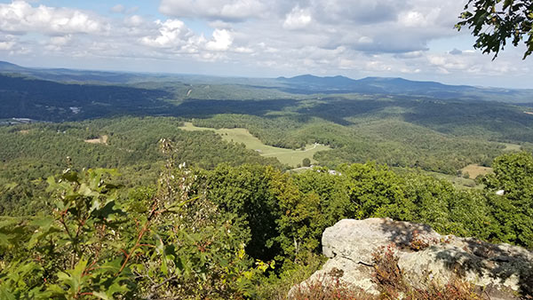
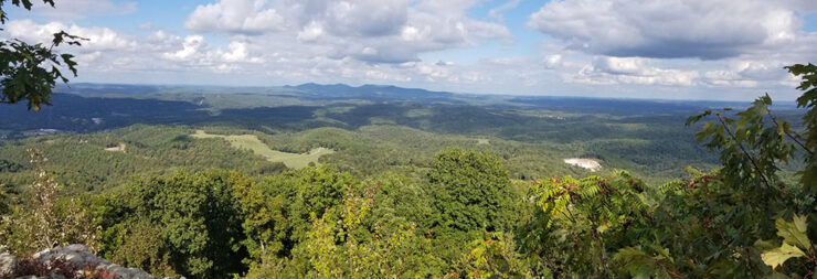
I thought this was going to be a vista hike with lots of views of the surrounding valleys. But that wasn’t the case, at least not in Summer or early Fall. The only good view I saw was from the North Bluff. According to the map, there is another scenic point on the south end. But I didn’t do the South Gap trail. From the Loop trail, there are no views because it is below the treetops. With all the leaves and vegetation, it is impossible to see out into the valleys. That was disappointing because that was the biggest reason I did the hike. Maybe it’s better in Winter after the leaves fall. Having said that, the view from the North Bluff is pretty spectacular.
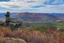
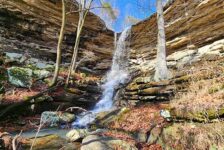
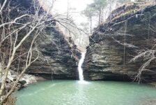
One thing that was not disappointing was the rock features along the trails. There are some pretty large boulders and some very interesting rock formations. You can see some of these in the pics and video below. A side trail breaks off from the main Loop towards the north end and creeps up a cliff face. That trail winds around beneath the cliff and through a couple of caves before it finally just stops. The coolest rock formations are on the south end of the Loop trail.
Plane Crash Site
An old military airplane crash into the mountain back in 1948. You won’t have to look for it. The Loop trail takes you right by the crash site where it is marked with a sign and a commemorative plaque. Don’t go there expecting to see anything that resembles a wrecked airplane or damaged landscape. There is a small pile of wreckage parts there, although I’m not so sure it’s actually from the plane wreck. But that happened in 1948 so I guess you can’t expect much to still be there. If you want to see that, then take the Loop trail counterclockwise.Plan Your Trip
The Round Top Mountain hiking trails can be done in one or two hours depending on how much you want to see. For better views, I recommend visiting in Winter or early Spring when there are no leaves on the trees. If you want the quickest route to the great view of the North Bluff, then take the Loop trail clockwise. At the top of the initial switchback section, turn left on the Loop trail. You’ll reach the turn-off to the top trails and lookout point much faster that way.
There are public restrooms here, but they were locked up and closed when I visited. Take any snacks or drinks you may need. Be sure to pack out your trash and as always, leave no trace. Round Top Mountain is not a full day visit, so maybe plan another hike in the area or a short float. And if you have never visited nearby Jasper, you must drop in for a burger at the Ozark Cafe. Add this hike to your to-do list for a a weekend trip to Jasper. Or add it to your “Plan B” hiking list. If you have such a list, drop a note in the comments letting us know some of your favorites!


