Sometimes you just need a do-over. The third article I ever wrote for my blog was for a hike to Kings Bluff Falls. I did that hike years before I ever knew I would have an outdoors blog. I didn’t research the hike or even really know what to expect. We just showed up and hiked to the falls and back, not even knowing what else was out there. That was the case for several of my early articles, but this one only had a few pictures and no video! There’s so much more to hiking the Kings Bluff Loop than I covered the first time. So I think this hike deserves a do-over.
After that first visit, I made a return trip there and hiked the Pedestal Rocks Loop. Both hikes are really one big loop, but you can hike them separately. The rock formations at Pedestal Rocks are amazing. It wasn’t until a couple years later that I would find out the Kings Bluff loop has the same rock formations. And caves! How did I not know this???!!! Don’t worry, I’ve learned my lesson about researching these hikes before I go. And maybe I’ll re-do a few more. But for now, let’s give the Kings Bluff Loop a better look.
Quick Glance
Distance: 1.9 mile loop
Difficulty: Trail route is Easy. Bushwhack route is Moderate.
Parking Coordinates: 35.723945, -93.015912
Kings Bluff Falls: 35.724928, -93.025113
Bluffline Break #1: 35.72303, -93.02527
Bluffline Break #2: 35.72144, -93.02072
(Copy/Paste Coordinates into GPS or Google Maps search bar)
Directions
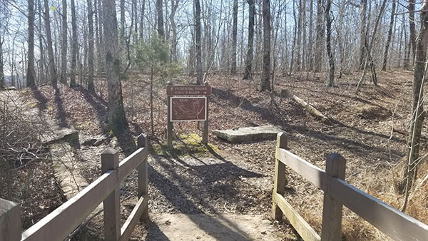
From Russellville, go north on Hwy 7 past Dover (Or south on Hwy 7 from Jasper) to the Sand Gap/Pelsor area. At the intersection at Pelsor Post Office, head east on Hwy 16 towards Ben Hur for 5.9 miles. You will see a sign on the right for Pedestal Rocks / Kings Bluff Trailhead. You can also come in from the East through Witts Springs on Hwy 16. See Google map below for directions.Once you park, take the trail across the bridge and turn right at the fork.
What to Expect
The Hike
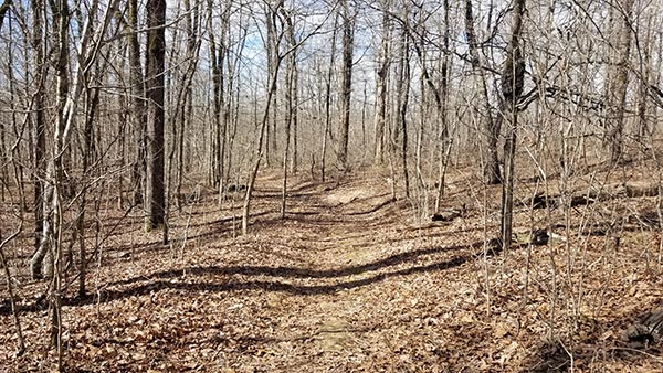
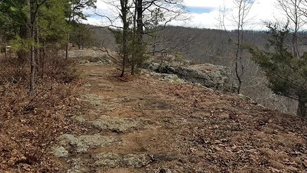
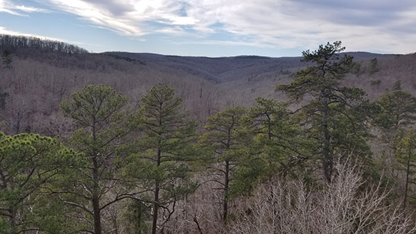
There are several ways to go about hiking the Kings Bluff Loop area. One way is to take the trail out and back to Kings Bluff Falls. This is a short and easy hike. A second way is to stay on the trail past the falls and hike the entire loop trail along the top of the bluffs. This hike is also easy and just under two miles. AllTrails rates it as moderate, but I disagree. Aside from a short uphill section at the end, it’s an easy hike. Both of these hikes will take you down a clean, well-marked trail. As long as you stay on this trail, no map or GPS is needed.
Finally, another way to hike this area is to bushwhack from the falls along the base of bluffs. This is the way you have to go if you want to explore the caves at the bottom of the bluffs. There are only two bluffline breaks (that I know of) to get from the main trail down to the bottom of the bluffs. Those breaks are on each end of the bluffs. You can take them and explore the caves on each end and then come back up. But if you want to see everything in the middle of the bluffs, you have to bushwhack the whole thing. Because there is NO trail down there.
Kings Bluff Falls
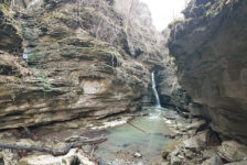
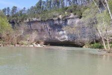
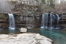
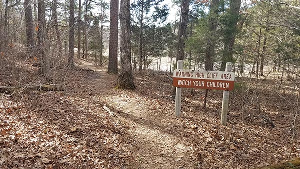
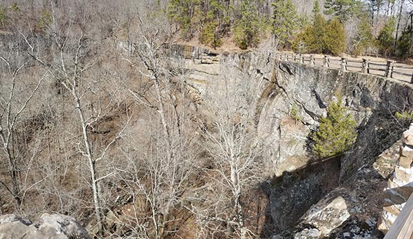
Just under a mile into the trail you’ll come to the top of Kings Bluff Falls. This is a 114 ft waterfall that sits atop a massive rock bluff. It’s gigantic. It’s so high that an old wooden guardrail runs all the way along the top of it. A fall from here would be 100 feet straight down. You can get a good look at the falls here, but good pictures are kind of hard to get. The bluffs are too high and wide to get it all, and often the falls are just a trickle. The best view is from the bottom, which is accessed by following the loop trail.
If you cross the small creek at the top of the falls, there’s another trail that goes along the ridge on the right side. About 200 ft down this trail you can see another waterfall if you go right after a hard rain. Back to Kings Bluff Falls. If you go left and continue along the loop trail, you’ll see a side trail going down the hill. Take this go down to the creek. Then follow the creek up to the bottom of Kings Bluff Falls. Along the way you’ll see a cave and possibly a couple of small waterfalls depending on rainfall. You can see all these things in my video below.

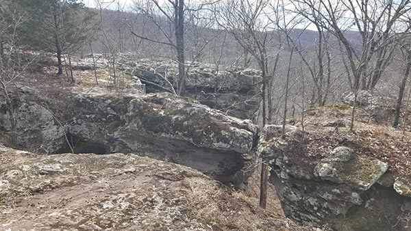


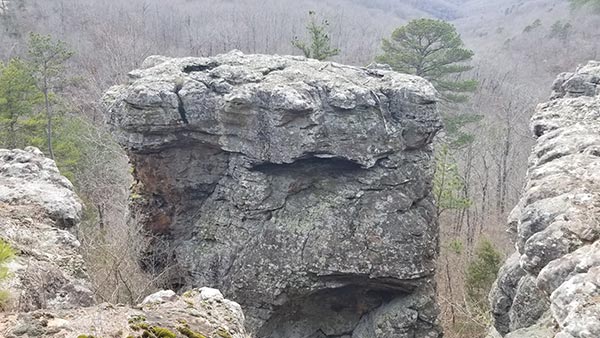
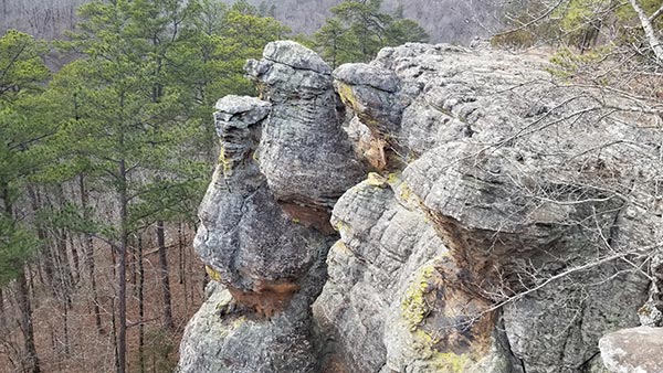
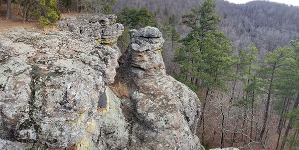


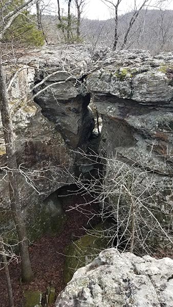
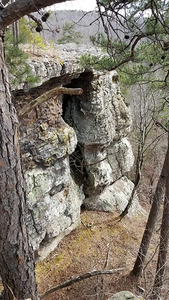
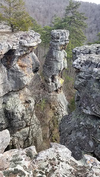
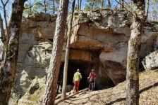
Rocks and Caves
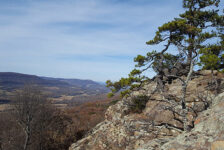
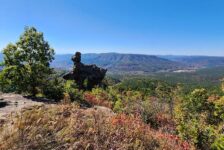
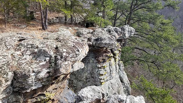
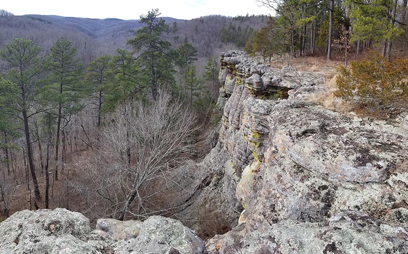
What I missed on my first trip here was all the caves and crazy rock formations – my favorite part! Staying on the loop trail will take you along the top of bluffs. From there you get a great view of the huge monoliths, pedestal rocks, bluffs, and down into some of the caves. There’s also great views of the valleys in the distance. If you want to explore the caves and tunnels down below, you have to access the base of the bluffs. As I mentioned, there are only two breaks to get down there. So you either have to stay high or stay low. There’s no going back and forth.
I started off at the base of the bluffs and saw the first group of caves. From there I went up the first bluffline break to the top. I thought I would be able to get some views up there and then drop back down further along the trail. That was not the case. The next break came well after the end of bluffs and would have been a backtrack to see more caves. But that’s OK. I wouldn’t want to do this article without photos and video from the top. The view of the huge bluffs and pedestals are incredible from there. I do plan to go back and see all the caves one day. There are also some other caves and waterfalls down the hill I want to see, so I’ll be back.
Plan Your Trip
Hiking the Kings Bluff Loop can be done any time of year. However, I would only recommend the bushwhack route in the Winter. And if you’re into bushwhack hikes, you can also follow the creek at the bottom to see Kings Bluff Twin Falls. Give yourself a couple of hours to do the trail hike, and more than that to explore all the caves. If you want to make a full day of it, combine it with the Pedestal Rocks Loop. Or head to nearby Richland Creek for some waterfall hikes or swimming at Falling Water Falls. You can check out some of those spots HERE.
There is no cell phone service in this area. So be sure to download any maps you want beforehand. Bathrooms are primitive, so if that’s an issue, better handle your business before you get there. If you are spending the day, bring food and water. But be prepared to pack out any trash you have and leave no trace. There are plenty of places to fall out here. Please stay away from the edges so you can come back for your own do-over. Be safe out there and enjoy the hike.