Hello again everyone! Travis here, back with another tale from the trails. While I rarely have the opportunity to hike during weekdays, I’d taken this past Wednesday off to celebrate my younger brother’s birthday. We share a deep fondness for the outdoors, so it’s only natural we’d celebrate with a hike. He selected a Bushwhack to Ladderbucket Falls from Tim Ernst’s “Arkansas Waterfalls” as our destination, a moderate 4.5-mile out-and-back trail nestled on the southeastern portion of Lost Corner. Lost Corner is the home of many excellent waterfalls, including Brushy Grotto Falls and Green Grotto Falls, both of which were featured by Scott recently. The torrential rains of Monday and Tuesday had left the region well saturated; we were confident it would be a great trip!
The drive to Ladderbucket is none too challenging. I’d recommend driving from Cleveland north along Highway-287 into Highway-95 and Wilderness Trail Road. The road, although dirt, was in solid condition and was easily handled by my 2WD vehicle. We parked along the edge of the road and quickly set out north along the muddy ATV trail, eyeing the incoming clouds with some anticipation. The forecast showed rains weren’t due for another 2 hours, more than enough time to get in and out, or at least we hoped. Although muddy, trail conditions were still reasonable. The wide dirt road made it easy to avoid the puddles inhabiting the tire ruts.
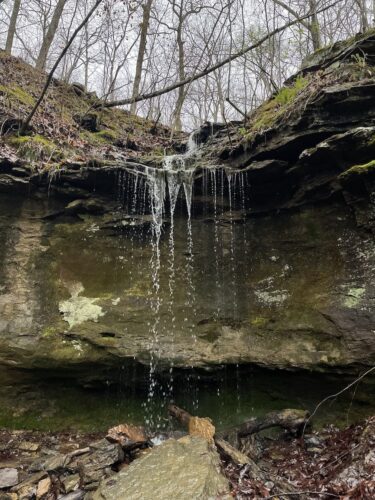
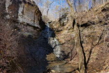
The ATV trail briefly skirted private property, clearly marked by several signs, before meeting up with a small fork that housed two waterfalls, each around 10 ft in height. They were easily audible well before we could see them, and a small trodden trail off the main path led us between the two, one on the right of the fork and the other on the left. From their flow rates, I’d guess that both would only flow with recent rainfall, which would explain their absence from any maps of the area I found. Falls like this are one of the many reasons I enjoy hiking in the rain; there is something special about seeing this fleeting moment of beauty brought on by the storms.
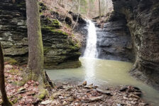
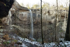
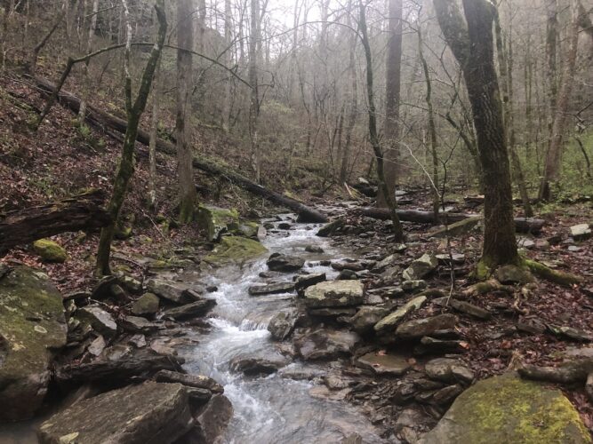
We pushed onward across the ridgeline, traveling 1.7 miles along the ATV route before cutting south to join a creek. The creek quickly met up with a volunteer trail that skirted the rim just above John Mountain Falls. This portion of our journey was the most difficult. John Mountain Falls is 84 feet high, which gives a good impression of the grandeur this fork provides. The volunteer trail leads to a break in the bluff where descent is possible, albeit a bit tricky. In drier conditions, our entry wouldn’t have been too much trouble, but the moistened moss-covered rocks and steep incline slowed our pace considerably.
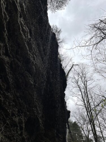
We first cut back up the cliffside for a view of John Mountain. It’s one of the tallest waterfalls I’d seen in Arkansas, so tall that I had a hard time capturing the entire thing in one shot! After a brief rest to enjoy the view, we trekked away from John Mountain, quickly meeting up with the downstream products of Ladderbucket falls. Although the volunteer trail here was sparse, the path towards Ladderbucket was clear: straight upstream.
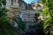
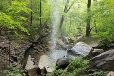
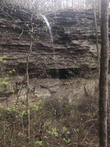
Deeper into the fork, the canyon walls rose around us while rain began to fall. Lightly at first, but soon a consistent shower that wet our clothes and bags alike. The cliffs on the southern side of the fork provided our only respite from the weather. We soon found ourselves trekking along the shattered rocks beneath the cliff face as we worked ourselves farther upstream. The entire rim of the canyon soon formed a waterfall of its own, the water trickling down like a damp curtain a hundred feet long. For this moment alone, the hike had been worth it. The view was unlike anything else I’ve encountered in Arkansas. I remarked to myself, ‘We hadn’t even made it to the main waterfall yet!’
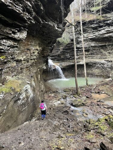
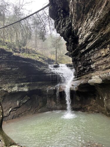
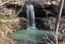
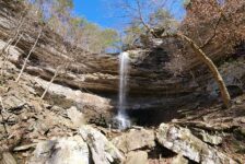
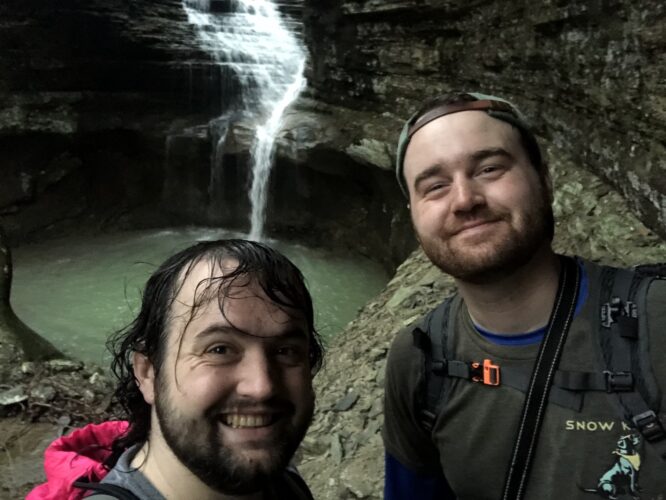
It’s only a quarter-mile from John Mountain to Ladderbucket, but the two falls feel miles apart in appearance. We approached Ladderbucket from the cliffside, which hid over half of the falls from view until the last moment. The falls have a charming duality: the top 20 ft are a stepped-cascade, wide, frothy, airy, before funneling into a single stream that drops the final 15 ft into a large, sea-green pool. The slight bend at the end of the fork made it feel like an auditorium, with Ladderbucket the lead actor on stage, commanding your attention with a riveting performance. Two trees stand at the foot of the pool, just far enough apart to beg for someone to string a hammock between them. It was instantly a favorite for both of us as we paused on the rim overlooking the falls.
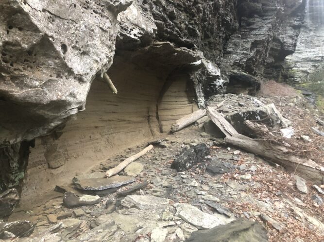
The crack of thunder nearby broke our interlude at the falls, and the downpour soon quickened. We hastened back along the cliffside, briefly admiring smooth rock formations that revealed the location of a previously underwater river. Our return trip was identical to the journey in, save for the ever-increasing rain and cracks of thunder. We broke into a soggy jog, our shoes slopping through puddles several inches deep as we rushed the two miles back to the car. Finally back at our vehicle, a nearby utility worker approached us, wondering what would bring two idiots out to backwoods Arkansas in a downpour like this. Grinning, we replied:
“Waterfalls!”
Ladderbucket Falls Bushwhack at a Glance
Distance: About 4.5 miles in and out. 3.5 miles are on an easy ATV trail, 1 mile bushwhack
Difficulty: The bushwhack to Ladderbucket Falls is moderate. The traces of the Volunteer trail really help here. I’d consider this trail a good intro to those unfamiliar with navigation for Bushwhacks. There are only two notable turns that need to be made off trail: one to reach the creek, and the other to turn upstream to Ladderbucket Falls.
Route and Waypoints: The trailhead starts at 35.53791, -92.79682. John Mountain Falls is at 35.55087, -92.7933. Ladderbucket Falls is at 35.54865, -92.79497. A specific route can be found in the AllTrails recording here.
Driving Directions: See Google Map below.
There were far more traces of trash along the trail than anyone would like to see. If you do happen to partake in the Bushwhack to Ladderbucket Falls, remember to #leavenotrace and #packoutmore to help keep places like this clean for generations to come.
Travis Howk is an amateur writer and hiker from North Little Rock, Arkansas. When he’s not out on the trail or spending way too long looking at maps for new trails, you can find him at home with his newborn, playing board and video games, or spending far too much time on Wikipedia.