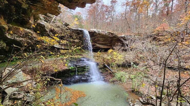
The beginning of waterfall season can be a little hit-and-miss sometimes. I guess the dry ground in the Fall soaks up all the rainfall before it can drain off. There have been several Autumn hikes I’ve done right after a rain, only to reach a waterfall that’s dry or barely running. (Like the first time I hiked to Magnolia Falls). Because of this, I tend to save the longer or more difficult hikes for late Winter/early Spring, when I know the falls will be running strong. Early in the season, I’ll “test the waters” with some shorter hikes. So if I strike out, oh well – at least it was a short hike! This year, I started waterfall season off with a hike to Fern Falls in the Ozarks.
Fern Falls is a pretty well-known waterfall that gets a decent amount of visitors. So why am I just now writing about it? Well, it’s another one of those places I’ve passed by a million times and just never stopped. Always on the way to a float trip, or another hike. “I’ll hit Fern Falls on the way home”, I’d say. Then I’d run out of daylight, or go home a different way. It’s always something. So this fall, I put the short hike to Fern Falls at the top of my list. Along with a few other waterfalls in this area, I had a bit of a waterfall roundup this Fall to check these off my list.
Quick Glance
Distance: Approximately 1.4 miles out and back
Difficulty: Easy-Moderate
Trail Head Coordinates: 35.89287, -93.19024
Fern Falls Coordinates: 35.89760, -93.19249
GPS Track: Click Here
(Copy/Paste Coordinates into GPS or Google Maps search bar)
Directions
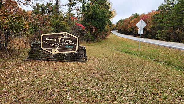
This is one of the easiest waterfall trailheads you’ll ever find. It is right on Hwy 7, just 11.3 miles south of Jasper. It is 17 miles north of Sand Gap/Pelsor. Whichever one of those directions you are coming from, simply look for the Ozark National Forest Scenic 7 Byway sign. It will be on the west side of the road on Hwy 7. See the picture below, you can’t miss it. Or use the coordinates listed above to map yourself there. Some say you can park in the grass right there by the sign. But I did see a no parking sign there, so park at your own risk. There are a couple of gravel roads within a few hundred yards that you can park on if you don’t want to park directly on Hwy 7. When you reach the Scenic 7 Byway sign, you’ll find the trailhead right behind it along a fence row. Just look for the opening with a ribbon in the tree. You’ll see a trail heading west towards the woods. That’s it.
What to Expect
The hike to Fern Falls is 1.4 miles round-trip on an out-and-back trail. The trail isn’t particularly well marked with blazes or signs. But it is a clean and clear trail that get’s plenty of traffic, so it’s easy to follow. There is a ribbon in a tree just above the waterfall marking the spot to cross the creek to access the trail down to the bottom. If you watch the video below, you really don’t even need a map or GPS. All the turns are featured in the video. The hike down into the hollow to Fern Falls is very easy. There’s nothing technical or physically demanding about it. And the trip back up the hill to the trailhead is only slightly more difficult because it’s mostly uphill. But it’s not steep and only 0.7 miles back. So still relatively easy.
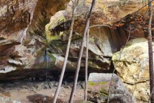
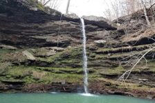
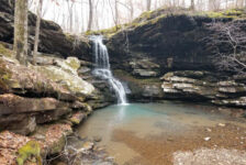
As soon as you enter the woods at the beginning of the trail, you’ll see why it’s called Fern Falls. There are ferns along the trail, foreshadowing what’s to come when you reach the falls. Just above the falls, the trail will fork. The trail to the right will go around the top of the grotto for a great view of the falls from the top. The trail to the left (with the red ribbon) leads to a shallow creek crossing. You can rock-hop this one and stay dry, and the trail picks up on the other side. Turn right after the creek and follow the trail down to the bottom of the grotto. From there, the trail continues under the grotto and behind the falls…where the ferns live. You can follow it all the way around the grotto and to the pool below. You’ll find lots of great vantage points to get shots of this very photogenic waterfall.
Plan Your Trip
As I mentioned, the trailhead is located right on Hwy 7, so anyone in any vehicle can easily drive to it. The hike to Fern Falls can be done in an hour, not counting time spent hanging out at the falls. It is a dog-friendly trail, but keep them leashed around the top of the falls. And keep an eye on kiddos on top of the falls as well. It’s a pretty high drop to the bottom. The path to the bottom of the grotto is rocky and slick, so a hiking stick might be helpful. There are no restrooms close by – but who needs one of those in the woods? There are also no trash cans, so be prepared to pack out any trash might have and leave no trace.
Since the hike to Fern Falls is a short one, you might want to pair it with one or two other hikes to fill out your day. There are plenty of hikes nearby to choose from. The road to Big Creek Cave Falls is just two miles south of here, off Hwy 7. It’s a little longer hike (4 miles), but both could be done in a day if you start early. Go another 4.5 miles south on Hwy 7 and you’ll find the road to Hudson Shelter Falls on the left. And just a little further on the right is the road to Lonesome Hollow Falls. I’ll have an article on Lonesome Hollow in the upcoming weeks, so stay tuned. There are many other hikes in the area, but these are the closest. Next time you’re on this section of Hwy 7 and have an hour, give Fern Falls a look. Enjoy the hike!


