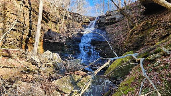
I have written several articles recently about some of the hiking gems that can be found along AR Hwy 7. Waterfall hikes like Fern Falls, Hudson Shelter Falls, and Lonesome Hollow are just the tip of the iceberg. There are many more of those yet to go. Some of them are longer hikes, some are more difficult bushwhacks, and some are further off Hwy 7. I’ll try to eventually include as many as I can here. As for the more popular hikes closer to Hwy 7, the next on our list is the Native American Falls hike near Sand Gap.
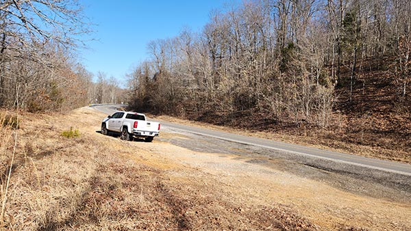
Much like Fern Falls, the parking location for Native American Falls is right on Hwy 7. There are no gravel roads to travel or complicated directions. It’s simply a dirt parking area off the highway, just south of the Hwy 16 intersection at Sand Gap. But proximity to Hwy 7 is about the only similarity this one has to Fern Falls. Native American Falls is a completely different kind of waterfall, and a slightly more difficult hike. It definitely deserves it’s spot in our Hwy 7 collection.
Quick Glance
Distance: Approximately 1.3 miles out and back
Difficulty: Moderate
Parking Coordinates: 35.71632, -93.09870
Native American Falls : 35.71340, -93.10510
Bluffline Break to Bottom of Falls : 35.71340, -93.10565
GPS Track: Click Here
(Copy/Paste Coordinates into GPS or Google Maps search bar)
Directions
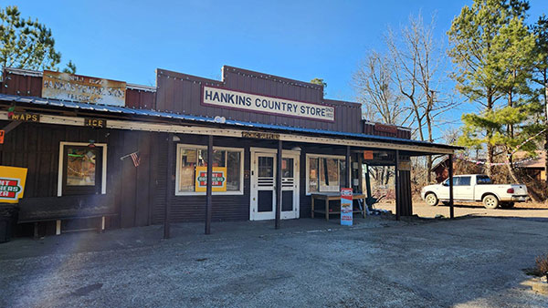
The parking area for Native American Falls is a dirt/gravel parking area right off Hwy 7. It is 0.4 miles south of where Hwy 16/123 intersect with Hwy 7. This is the same intersection you can find the landmark Hankins Country store. (see image below). If you’re at this intersection, drive south on Hwy 7 for 0.4 miles and look for the dirt clearing on the right. There is no sign. Again, see the image below, or use the marked location on the Google map to navigate yourself there. From the parking area, walk along the treeline until you see a faint trail leading into the woods. That is the beginning of the hike.
What to Expect
The Hike
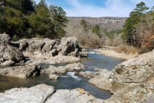
The Native American Falls hike is approximately 1.3 miles round trip on an out-and-back trail. It’s an unofficial volunteer trail, but it is a noticeable one. And there are occasional tree ribbons marking the way in case the trail is hard to see. I did this hike in January, so the leaves were trampled down, and trail was clear of vegetation. But I could see this trail potentially being overgrown in the Summer. Follow this trail all the way down the hill until you reach the creek. Cross the creek and you’ll find that the trail picks up again on the other side, turns left, and heads downstream. The trail will follow along the right side of the creek. It will rise a bit uphill and away from the creek in parts, but the creek is always in view. Follow this until you reach the top of Native American Falls.
To this point of the hike, I would rate it as moderate. The hill has some steep sections to it. Easy hiking down, but hiking back up it is a pretty good workout. The rest is fairly easy hiking. That is, unless you want to go to the bottom of the falls. Then it’s a little more on the difficult side.
Native American Falls
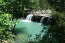
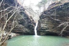
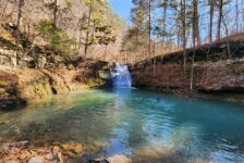
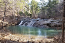
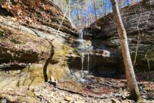
Native American Falls is a 41-foot cascading waterfall. The creek pours over the top of a cliff that steeply slopes to the bottom of a canyon. Similar to a waterslide type of fall, the water maintains contact with the rocky cliff as it makes it’s way to a pool at the bottom. The creek then runs out through the canyon. One side of this canyon is sheer cliffs with no way down. The other side (left side) is a steep, rocky hillside that is also difficult to hike down. But there is a way to the bottom.
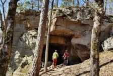
To reach the bottom, cross the creek at the top of the falls. Work your way up to the top of the large crag on the left side that overlooks the falls. Continue along this ridgeline (it’s almost a bushwhack at this point). Eventually you’ll see a yellow climbing rope strung in the trees leading down towards the creek. This is the bluffline break that takes you to the bottom of the falls. The coordinates for this spot are listed above. Many thanks to whoever put this rope up. It was extremely helpful in getting down and back up this hillside. Be sure to watch the video below for all the turn-by-turn details getting to the top and the bottom of the falls.
Plan Your Trip
When I did the Native American Falls hike, I made an old mistake that I haven’t made in a long time. I didn’t do all my homework. I failed to read the last paragraph that Tim Ernst wrote about it, as well as the end of Rick Henry’s write-up. In doing so, I missed out on the slot canyon and other waterfalls that are further down the creek. These are smaller, lesser-known waterfalls. But they apparently are very close. So you might consider checking those out.
The Native American Falls hike can be done in about one hour. I took a little longer because I had lunch by the falls. This means you have time for other nearby hikes if you’re up for it. There are plenty of waterfall hikes along Hwy 7 that I’ve written about. Hikes such as Fern Falls, Hudson Shelter Falls, and Lonesome Hollow would work well with this one. And others I have not written about yet, can be found on the Waterfalls in Arkansas Map. There are plenty more great hikes just around the corner along Hwy 123. Short hikes like Pam’s Grotto and Pack Rat Falls , or non-waterfall hikes like Buzzards Roost would be good. Bear Creek is nearby too, but it’s tougher and might be too much for some after hiking Native American Falls.
Cell service is spotty in this area. You might have a signal sometimes, but don’t count on it for downloading maps or information. Dogs are allowed here, but might need to be on a leash around the top of the falls. This hike might be OK for some people’s kids, but I don’t think I would take young kids on this one. Food and drinks can be found at Hankins Country Store just up the road at Sand Gap. If you’be never been there, you should stop in for a step back in time in an old country store. Grab lunch and visit with the nice folks there. But if you’re hiking on Sunday, pack some food and drinks, because Hankins is closed that day. Be prepared to pack out any trash you might have on your hike and leave no trace. Be safe out there and enjoy the hike.


