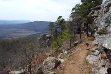
Because we have so many fantastic State Parks in Arkansas, I think some of them don’t quite get the attention they deserve. We are truly fortunate here to have such amazing State Parks like Petit Jean , Devil’s Den, Mt Magazine, Mt. Nebo, Hobbs, and others. While those parks tend to draw the most visitors, others, like Cossatot State Park, sometimes get lost in the shuffle. And if you’ve never been hiking Cossatot Falls at Cossatot River State Park, you’re missing out on one of the most impressive natural sights in the state.
When most people think of the word “Cossatot”, they think of the Cossatot River and it’s Class IV whitewater sections. Most people – including me – are not equipped or skilled enough to paddle these sections, so they dismiss the Cossatot altogether. I was one of those people for most of my life. But a couple of years ago, I discovered that there is more to Cossatot River State Park than just the whitewater paddling. One day when all the other rivers were too high to float solo, I decided to go hiking Cossatot Falls at Cossatot River State Park. My goal was to watch the extreme whitewater folks paddle the “Skull Crusher”. But instead, I ended up finding a great hiking spot.
Quick Glance
Distance: Approximately 1 mile out and back
Difficulty: Easy (approach 1) to Moderate (approach 2)
Cossatot Falls Parking Coordinates: 34.321050, -94.227099
Visitor Center: 34.294007, -94.177177
(Copy/Paste Coordinates into GPS or Google Maps search bar)
Directions
Cossatot River State Park is tucked away deep in the Ouachita Mountains, south of Mena. Traveling on Hwy 278 between Umpire and Wickes, look for the Cossatot River State Park sign on the east side of the park. Across the road from that sign is Weyco Rd 52200. Take that road and follow it for 4.5 miles. Where it intersects with Weyco Rd 52600, turn left and continue for 0.9 miles. Turn left at the sign for Cossatot Falls Campground. See Google Map below.
What to Expect
When I first arrived at Cossatot River State Park, all I knew was that it is home to some of the most extreme whitewater in Arkansas. I wasn’t even exactly sure where to find Cossatot Falls. So I made a quick stop at the visitor center for info. I found park maps, an interactive 3-D display of the park, and an informative Ranger. Turns out there is a lot of hiking here to do! There are four main trails in the park. One of which would be great for overnight hiking. Another, the Harris Creek Trail, looked like a great option for a short day hike. It quickly became clear that I was going to have to make a return trip. You can see that return trip here, where I hiked the Harris Creek Trail. But on this day, my top priority was to see Cossatot Falls, and hopefully someone paddling it.
There are two ways to go about hiking Cossatot Falls as Cossatot River State Park. One way is to take the blue trail, which starts at the picnic area near Cossatot Falls. That route was recommended by the Ranger at the Visitor Center. The other way is a more direct route that involves rock-hopping down the river bank. The best route for you depends on your physical ability to hop rocks versus your willingness to hike the trail.
The Blue Trail
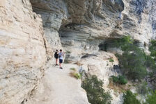
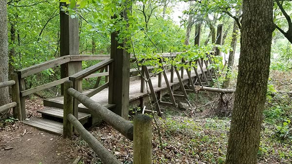
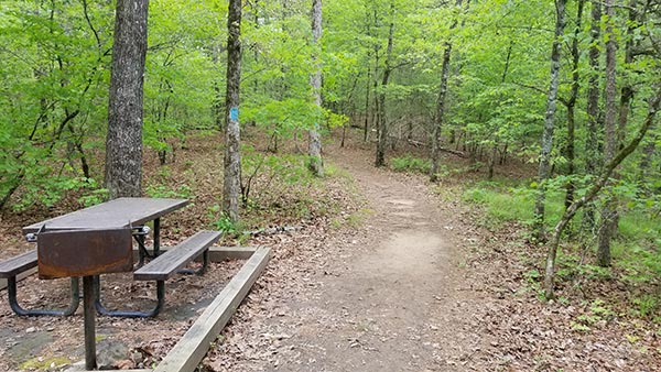
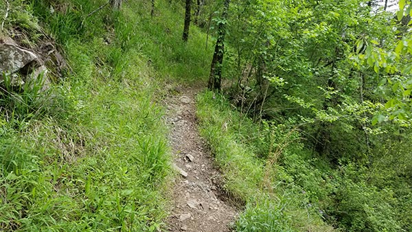
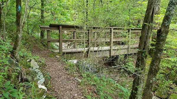
From the Cossatot Falls parking area, cross the wooden bridge and follow the trail through the picnic areas. After the second bridge, look for a trail to the left with blue blazes painted on the trees. I believe this is the River Corridor Trail. It meanders through the woods a bit, and then heads up along the top of a ridge. From the ridge, there are views of Cossatot Falls below. But I was not able to find a trail leading down to the river bank.
I continued on the blue trail thinking maybe I had just not gone far enough. Maybe it eventually comes back down the ridge and to the river bank. I must have hiked close to a mile. And the longer I went, the further away the trail got from the river. I finally decided that I was either on the wrong trail, or I had gone too far and missed the turn. So I turned around and went back. Along the way, I looked for ways to cut over to the river but never found one.
Cossatot – 1…. Scott – 0.
River Bank Approach
Back to the spot after the second bridge where we turned left on the blue trail. Instead of turning onto the blue trail, continue straight on down to the river bank. You’ll immediately arrive at the beginning of Cossatot Falls. This approach appears to be a no-brainer as the way to go. You can see a large portion of Cossatot Falls quickly and easily. But in order to see all of it, you have to make your way along the bank to the end. If the river is high, this can be difficult to do without getting your feet wet. It also requires going around and over some very large boulders.
In spite of one slightly sketchy spot to climb down, I think this is the best route for hiking Cossatot Falls. Most of it is very easy. And to me, the rock-hopping is fun. There are several places along the way to rock-hop way out into the river among the rapids. That’s the part I liked the most. Once I made it to the very end of Cossatot Falls, I saw a family coming up the bank from the opposite direction. They said they had come down the other trail to the falls. I assumed they meant the blue trail, and that they found the way. So maybe I just didn’t go far enough. The river bank approach is featured in the video below.
Cossatot Falls
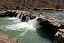
Hiking Cossatot Falls at Cossatot River State Park, you’ll find it is not the same type of waterfall that I typically feature here. Instead, it is a series of boulder-laden cascades spanning a few hundred feet of the Cossatot River. These cascades are what form the Class IV and V rapids that the Cossatot is famous for. I managed to get many great views of all the different rapids forming the falls. But unfortunately, no paddlers came through while I was there. While it would have been cool to see some paddlers run the falls, I didn’t mind much. Cossatot Falls is such an impressive sight, I was pretty content with taking in all the sights and sounds. Paddlers or not, this is a place you can easily sit and enjoy for hours. The sound of rushing water all around is pretty relaxing. And it’s easy to imagine kayaking down these rapids yourself, as you can see in the video below.
Plan Your Trip
The best time for hiking Cossatot Falls at Cossatot River State Park is in the Spring when there is plenty of rain. The Cossatot River tends to get pretty low without sufficient rainfall. Without a lot of water, the falls aren’t as impressive. All of Cossatot Falls can be seen in less than an hour. But I recommend spending at least a couple of hours there. It’s a long drive down a gravel road, so you might as well enjoy the destination! The road to Cossatot Falls from the highway is all gravel. Parts of it are a little rough, but four-wheel drive is not necessary. Most vehicles should be fine. The State Park is in a fairly remote and isolated area. So cell service is sparse. Plan to download any maps or directions before arriving.
I recommend getting an early start if you want to explore the park and hike more than one trail. Or if you’re coming from far away, consider spending a weekend at the State Park. Camping is available at Cossatot River State Park and other nearby campgrounds. Click here to see all the camping options and other local accommodations. There aren’t many towns close by. The closest is the small town of Wickes to the west, and there is Dierks to the southeast. So it’s a good idea to arrive with all the food and supplies you need. Limited food and drinks are available at the Visitor Center. Restrooms are also at the Visitor Center and in the park campgrounds. Be prepared to pack out any trash you might have and leave no trace. If you’re looking for scenic adventures in the Ouachitas, give Cossatot River State Park a try.


