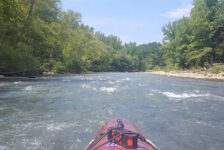
The Kings River is well-known as a fun and scenic destination for floating and fishing. But it also has plenty to offer in the way of hiking. From its headwaters near the community of Boston, it carves its way north through the Ozark Mountains. Far before this meandering stream reaches the major paddling sections, it tumbles over a massive rock shelf, to create the picturesque Kings River Falls. But this isn’t just any run-of-the-mill waterfall in a stream. The rocky shores around the waterfall help form a deep pool, perfect for a cool refreshing dip on a hot day. The hike to Kings River Falls is indeed more than a standard waterfall hike – it’s a trip to an Ozark swimming hole and natural oasis.
Quick Glance
Distance: Approximately 1.5 miles out and back
Difficulty: Very Easy
Parking Coordinates: 35.894494, -93.584945
Kings River Falls Coordinates: 35.901897, -93.574540
(Copy/Paste Coordinates into GPS or Google Maps search bar)
Directions
The Kings River Falls parking area is located along Madison 3175/3145, 4.5 miles north of the community of Boston. Or 10 miles west of Hawksbill Crag via Co Rd 5/Madison 3500. Or if you’re coming from Northwest AR, take AR-127 at Aurora for 5.4 miles to Madison 3345 for another 5.1 miles to Madison 3500. From there, it’s 1.5 miles to the parking area. See map below. Note: No matter which way you come in from, it’s a long, rough dirt road to get there.
What to Expect
Kings River Falls Natural Area is one of many Natural Areas managed by Arkansas Natural Heritage Commission and its partners. These Natural Areas are lands specifically managed to preserve or restore rare plant or animal species. So when visiting, be sure not to disturb any of the plant or wildlife in the area. Click here to read more about Arkansas Natural Areas. Or click here to find one of the 79 Natural Areas in Arkansas.


The Hike
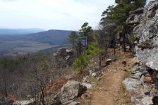
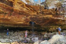
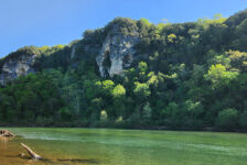
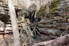
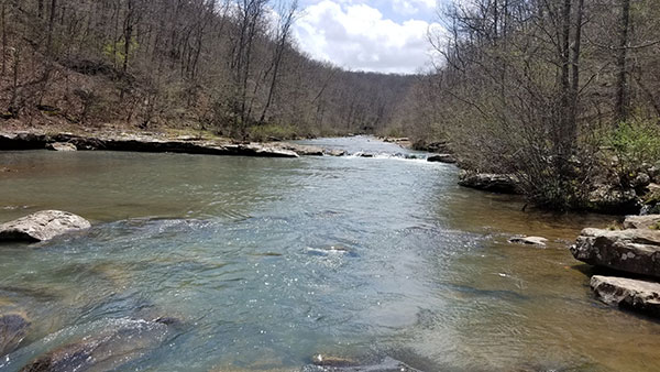
The hike to Kings River Falls is short one – only 0.7 miles each way on an out-and-back trail. It is a well-marked trail that’s easy to follow as it runs parallel with the Kings River all the way to the falls. No map or GPS are needed. This is a flat and easy hike with no technical or physical challenges. There are some detours you can take along the way. On the hike in, you’ll see some caves and grottos on the left that are worth a stop. You can see these from the main trail, but of course, they are better up close! And on the right side of the trail, you’ll find several nice spots along the river to take in some picturesque river views.
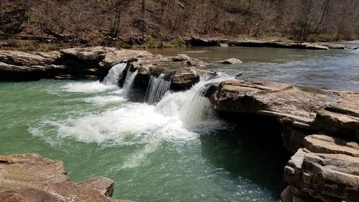
Kings River Falls
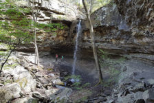
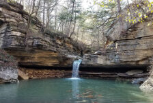
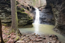
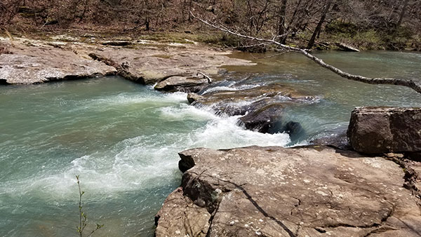
As you near the end of the trail, the sound of rushing water intensifies. As you pass a creek cascading down the hill on your left, Kings River Falls comes into view on the right. This 10-foot waterfall spills over a rocky ledge, creating an inviting pool, perfect for wading or swimming on a hot summer day. The smooth rocks surrounding the pool offer a place to relax and soak in the beauty of the Ozark scenery.
The area around Kings River Falls transforms into a natural playground during the warmer months. It has a “stay and hang out” vibe, that is very reminiscent of Falling Water Falls, another great Ozark swimming hole. It’s the kind of place you’ll want to bring a lunch to, or hang a hammock. Maybe take a swim and lounge on the smooth rocks around the pool. Or explore the creeks and smaller trails that meander through the nearby woods. When observing some of the diverse plants and flowers there, just remember it is a Natural Area. Some of these species should not be trampled or removed. Rock stacking should not happen either, as it can disrupt the ecosystem here.
Plan Your Trip
The hike to Kings River Falls can easily be done in an hour or less. But I recommend allowing at least a couple of hours to hang out and enjoy it. Make it worth the long drive down a rough dirt road. Four-wheel drive is not needed, but a sports car would not be ideal. There is no cell service in this area and you won’t find a restroom here, so plan ahead for those things. It is a dog-friendly trail, but they must stay on a leash. Late Spring is probably the best time to go. I don’t imagine there is a lot of water in the creek as we get deeper into Summer.
Since it does take a while to get there from most places, I recommend making a day of it. Hang out at the swim hole all day, or plan more hikes in the area. To see all the waterfalls in the area, check out the Waterfalls in Arkansas map. Click on each one to find links with information. Most hikes in this area are pretty far from anything. So take food and water with you. Just be sure to pack out what you pack in and leave no trace. Whether you seek a refreshing dip in the cool waters, or a scenic hike through the woods, this natural wonder in the Ozarks has something to offer everyone.