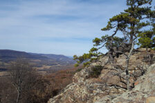
The Ozarks, a vast and scenic mountain range stretching across Missouri, Arkansas, and Oklahoma, is a paddler’s paradise. With an abundance of options ranging from gentle floats to adrenaline-pumping whitewater, the Ozarks cater to all paddling skill levels. In the Arkansas Ozarks, iconic rivers such as the Buffalo, Kings, and Mulberry garner most of the attention, and rightfully so. But beyond these popular rivers lie some lesser known gems like War Eagle Creek. Floating War Eagle Creek is a must-do for anyone seeking a scenic and relaxing experience in nature, away from the crowds.
My first glimpses of War Eagle Creek came while I was driving to Marble for a float trip down the nearby Kings River. I knew right then I had to come back to float this one too. This gentle waterway is often dubbed the “Little Buffalo” for its resemblance to its more famous cousin. Here, amidst towering bluffs and vibrant forests awaits a relaxing float trip perfect for anyone seeking a dose of Ozark charm. Plenty of float options are available on War Eagle Creek. We chose the section from Hwy 23 to Hwy 45, winding 13 miles through some stunning Ozark scenery.
Quick Glance
Distance:13.5 Miles
Difficulty: Very Easy
Outfitter Coordinates: 36.148527, -93.739941
Put-in Coordinates: 36.149553, -93.741064
Waterfall #1 (short hike): 36.17202, -93.77367
Waterfall #2 (paddle behind) : 36.17693, -93.78784
Strainer at Walnut Hollow: 36.20644, -93.84025
Take-out Coordinates: 36.20285, -93.86367
(Copy/Paste Coordinates into GPS or Google Maps search bar)
Directions
There is more than one outfitter servicing War Eagle Creek. We chose to shuttle with OAR War Eagle Kayak and Campground. They – along with the put-in – are located on Hwy 23, just 1.9 miles north of the Hwy 23/Hwy 412 intersection. The takeout is on Madison 8340, just off Hwy 45, 3.5 miles north of Hwy 412 near Hindsville. The take-out is on private property. Contact OAR War Eagle Kayak and Campground for questions about accessing the take-out. I recommend just setting up a shuttle with them. It’s well worth the cost.
What to Expect
The Float
Floating War Eagle Creek from Hwy 23 to Hwy 45 is a 13.5-mile float, and the longest one offered by OAR War Eagle. We started at 10:30 am and ended around 6:00 pm. That included quite a few stops, two rope swings, and even a detour for a short waterfall hike. Fair warning: This section is a long day float. But riverbank camping is allowed for most of it, making this a good option for overnight floating. Before doing that, check with a local outfitter for advice on camping restrictions along the river.
Classified as a Class 1 stream, its calm waters with minimal rapids are ideal for families, beginners, and those seeking a leisurely float. Some sections are long deep pools of flat water that require a lot of paddling. Other sections are clear, fast-running water with nice current. Although there were plenty of fast-moving shoals, there were only two spots that resembled rapids. Did we go out of our way to hit those? Yes we did. We would have liked to have seen more, but the main attraction on this float is the scenic bluffs.
The Scenery
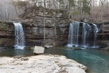
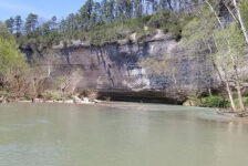
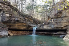
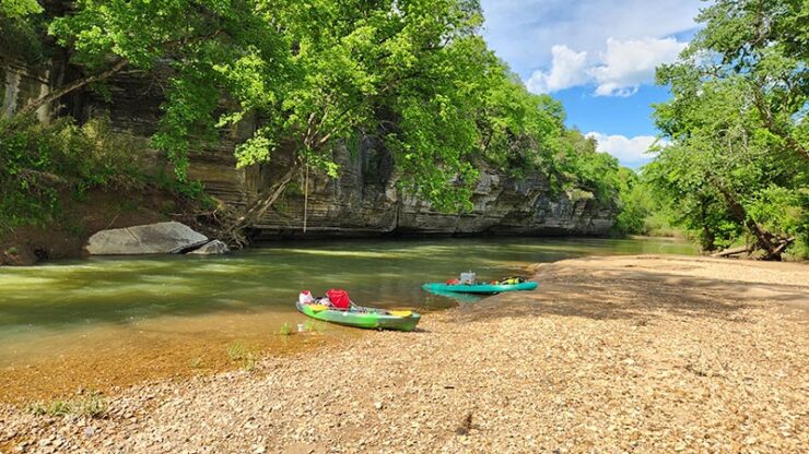
When floating War Eagle Creek, expect to see a diverse range of scenery. At times there will be bluffs that rise out of the creek, towering above you. Many of these hang out over the water with room for you to paddle underneath them. (Don’t miss the part at 6:05 in the video down below.) Other bluffs peak out at you from within the dense forest. You’ll see amazing rock formations along with shorter bluffs, some with water falling over them into the creek (see 12:18). At other times the forest disappears and the landscape flattens out into mud banks and pasture lands. Parts of it are not as scenic as you might hope. But just when you think this float is turning ugly, it rounds a bend into another beautiful bluffline. And the muddy banks transition back into rocky ones with fun shoals and clear water.
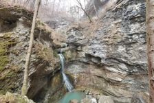
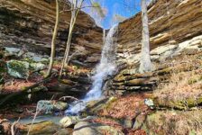
As you meander downstream, keep an eye out for hidden waterfalls cascading down into the creek, adding extra charm to the journey. And speaking of waterfalls, there is a really cool one that is not visible from the creek. But it’s a short hike up a small feeder creek that only adds a few minutes to your trip. The coordinates for it are listed in the Quick Glance section above (Waterfall #1). And you can get a peek at this waterfall at the 10:30 mark in the video below.
Plan Your Trip
The ideal time for floating War Eagle Creek is during spring runoff, typically from March to mid-June. Water levels can become low later in the summer. Be sure to check the river level on the RiverApp, at American Whitewater, or with outfitters beforehand to ensure adequate water flow. The ideal level for this float is 2.0-3.5 ft on the Hwy 45 gauge. Just over 4 feet is considered flood stage. If you consider self-shuttling this float, remember that the take-out is on private property. So check with OAR War Eagle about how to access it. You might be required to shuttle with OAR to gain access. I recommend doing that anyway as it’s a 20-minute drive each way – well worth the shuttle fee. But either way, you’ll want a vehicle with good ground clearance for the take-out.
Cell service here is spotty and often non-existent, so handle your phone business before arriving. If you want to spend the night or weekend, there are a few options for that. OAR has primitive campsites on their property. And the Withrow Springs State Park campground is 4-minute drive from the put-in at OAR. Also, this is a river that you can overnight float and camp on the riverbank. Just be sure not to get too far off the river onto private property. If camping isn’t your thing, a Google search shows cabins and vacation rental properties in the area. For anyone that likes a good post-float dinner, there are several dining options in nearby Huntsville.
Again, this Hwy 23 to Hwy 45 stretch is 13.5 miles. So allow yourself around 6-8 hours on the river, depending on how much you want to stop and hang out. Be sure to bring food and drinks for the river and remember – NO GLASS! If you are a new paddler, please read our Paddling page and be sure to check out the Paddling Tips and Gear List there. Remember your PFD and trash bag, and please do your part to leave no trace. Be safe out there and enjoy the float. You’ll want to take a camera for this one!


