In between float season and waterfall hiking season lies a season of dubious anticipation for many outdoor enthusiasts. When there’s not enough water to go floating, and waterfall hikes are non-existent. I call it the dry season. It’s one of the times of the year I often opt for mountain biking, even though I’m itching for a good hike. But there are some great non-waterfall day hikes out there to be had, like the one at Stem Rock Natural Area.
Stem Rock is a cluster of rock formations, crevices, and small caves in Searcy County, AR, near the community of Oxley. If you enjoy hikes with cool rock formations, like Alum Cove or Kings Bluff, then you should enjoy this one. Although it’s not as big or impressive as those two, the short easy hike makes it definitely worth a visit. This is a good hike to do in the Fall before the wet season arrives. When you want to go for a day hike but the waterfalls aren’t flowing yet. Or when you want to get out for an easy hike to see some Fall Foliage.
Quick Glance
Distance: Approximately 1.5 miles out and back
Difficulty: Easy
Parking Coordinates: 35.828587, -92.451726
(Copy/Paste Coordinates into GPS or Google Maps search bar)
Directions
From the intersection of Hwy 65 and Hwy 66 at the town of Leslie, head east on Hwy 66 for 7 miles. At the community of Oxley, turn right onto Oxley Rd. 0.3 miles later, veer to the right to stay on Oxley Rd. Continue for another 0.9 miles until you see a dirt parking area on the right. There is a small green sign near the parking area for “Stem Rock Natural Area”.
What to Expect
The Hike
Everything about hiking at Stem Rock Natural Area is easy. The parking area is easy to access, being right off a paved road that is only around 8 miles from Hwy 65 at Leslie. The trail is really easy to follow. You don’t need a map, or GPS. No planning or preparation necessary. Just get on the trail and follow it all the way to Stem Rock and back. It is 1.5 miles round-trip on an out and back trail. It is easy hiking for all skill levels on an flat ATV trail with little-to-no elevation change. ATVs are not allowed on the trail, but mountain bikes are. There are some other short bluffs and boulders to explore along the way for anyone that wants to bushwhack off the trail.
Stem Rock
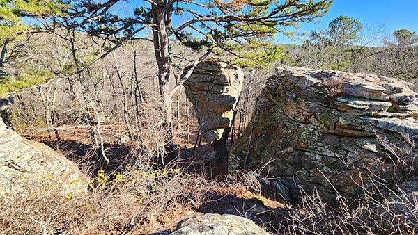
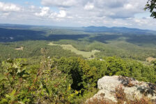
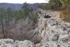
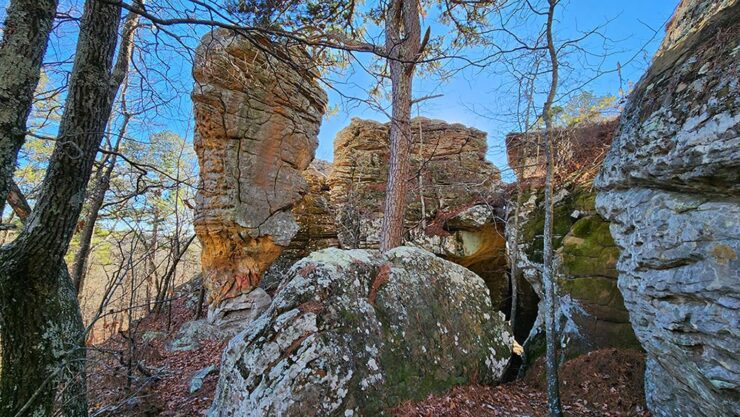
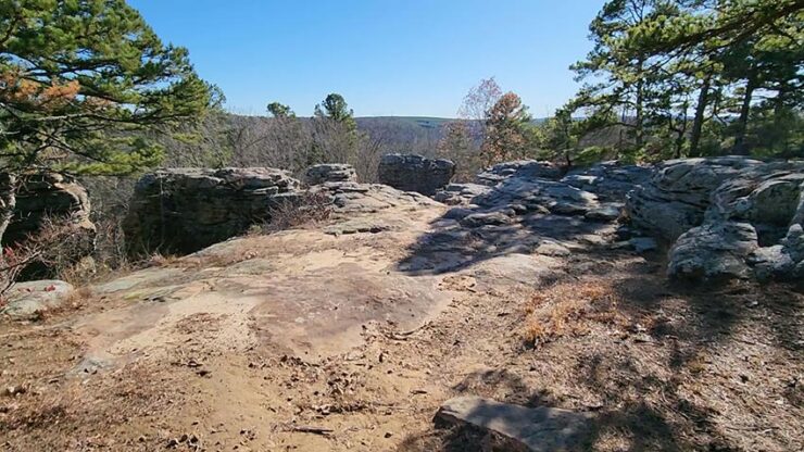
The Stem Rock area is a unique bluff outcropping adorned with a grouping of pedestal rocks and huge rock formations. It is very reminiscent of both Pedestal Rocks and Buzzards Roost in that you can walk on top of it, around the bottom, or through the middle of it. And from the top, you’ll have a nice view of the surrounding hills and valleys.
There are three levels to the rock formations. At first glance it might seem tricky to reach the different levels. But if you look around a bit, you’ll quickly find the way. Starting from the top and looking out to the valley, go around to the far right side of the bluffs to get to the second level. To get down to the third level (the very bottom), go to the opposite side of the bluffs to the far left. You’ll find a faint trail leading past a huge boulder, past a small cave, and on to the bottom. From there you can walk around the base of the pedestal rocks and formations. Or you can take the “tunnel” that runs between those and the main bluff. All of this is featured in the video below.
Plan Your Trip
When hiking at Stem Rock Natural Area, I recommend that you give yourself at least an hour to hike and explore the rocks. Since this is a quick and easy hike, I wouldn’t consider it a destination trip. It’s a place you stop to visit while you’re in the area or passing through. Or maybe you pair this one up with another hike in the area to make a full day of it. Maybe something like Bluffton Preserve , a short drive down Hwy 65 from here. I did this hike in early December after the leaves were down. So I don’t know what hiking here is like in Spring or Summer. But I’m guessing late Fall through Winter is probably best for visibility over the valley, and around the Stem Rock cluster.
You can expect to have decent cell service in this area if you need it. And this trail is pet-friendly, so bring your four-legged hiking buddy. You might want to pack a hammock too. It’s a good spot for it. There are no restrooms here. So do your business before you arrive, or be OK with going in the woods. If you bring in food, be prepared to pack out any trash might have and leave no trace. Restrooms, gas, and restaurants are not far away, and can all be found in nearby Leslie, and along Hwy 65. If you find yourself looking for a day hike in the dry season, add Stem Rock Natural Area to your hiking list. It is a nice, very low-effort option.


