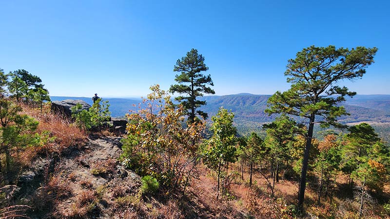
Some hikes are worth a re-visit. And a second viewing of that iconic monolith perched near the top of Hess Knob – known as the Arkansas Sphinx – is one such hike. There are two hiking routes you can take to the Sphinx. On my first trip there (read here), I opted for the shorter – but much steeper – route from parking area #1. While preparing for that hike, I read an article from the hiking blog of the late Rick Henry with info on a second route. Mr. Henry described the second route to the Arkansas Sphinx as longer, but less steep and strenuous than route #1. This route also hits the peak of Hess Knob with a magnificent vista view of the Sphinx and it’s scenic backdrop. So in my first Arkansas Sphinx article and video, I promised to come back to try the second route to the Arkansas Sphinx.
To kick off 2024 Fall hiking season, my good buddy David and I set out for Hagarville to take on this alternate route. Usually when I write about a hike, I take a fairly positive approach to it. I highlight the things I liked the most, but I keep things real with honest assessments of the things I don’t like. That being said, I don’t have a lot of positive things to say about the second route to the Arkansas Sphinx. In my opinion, there’s just no reason to choose this route over the hike from parking area #1. If that’s all you need to know, you can stop right here. If you want to know WHY, or insist on doing route #2 anyway, then read on.
Quick Glance
Distance: Approximately 2.4 miles out and back
Difficulty: Moderate to Difficult
Parking Area #2 Coordinates: 35.65158, -93.29700
Trailhead: 35.65107, -93.29597
Arkansas Sphinx: 35.640581, -93.288939
Parking Area #1: 35.639211, -93.291492
Hagarville Grocery: 35.516263, -93.330430
GPS Track: Click Here
(Copy/Paste Coordinates into GPS or Google Maps search bar)
Directions
Whatever part of the state you are in, make your way to Hwy 23 between Sand Gap and Hagarville. Coming from the south, at the intersection of Hwy 164 and Hwy 123 in Hagarville, head north on Hwy 123. After 10.6 miles, turn left on Forest Service Rd 1003. Park in the triangle there. Coming from Sand Gap, head east on Hwy 123 from the Hwy 7 intersection. You’ll cross the single lane iron bridge over Big Piney Creek, and pass by Haw Creek Campground. At 16.1 miles from Sand Gap, turn right on Forest Service Rd 1003. Park in the triangle there. From the parking area, walk south down Hwy 123 for about 30-40 yards and cross the highway. Look for the yellow metal gate up in the woods. That’s the trailhead for route #2. See the video further below for a visual on this. Again, I recommend skipping this and driving on to parking area #1.
What to Expect
Two Routes
If you are still reading, then you probably want to know why I don’t recommend hiking this route. Well it’s just this simple…it’s because there is a much better route! There just isn’t a good reason to take the second route to the Arkansas Sphinx. One might argue that the second route is less physically demanding since route #1 is so extremely steep. But I disagree with that. Route #1 definitely IS steeper. In fact, it’s very steep. But it’s very short at only 0.17 miles each way. And it’s not like the second route is flat and easy. It’s not at all. It may not be as steep, but it is a considerable climb. In fact, it has twice as much elevation gain (638 feet) as route #1. It’s just spread out over a longer distance. A whole mile longer, to be exact. The marginally easier grade doesn’t make up for the extra distance.
Route Two Hike
The second route to the Arkansas Sphinx is 1.17 miles each way (2.34 miles round-trip). It is mostly uphill along a very overgrown ATV trail. That’s the second reason I don’t recommend this route. Parts of this route are essentially a bushwhack. It’s so bad that we lost the trail a few times and just had to stay close to our GPS track. There is an open field a little over halfway through the hike. On the far end of the field is where the trail is hard to find. We could barely see a faint trace of an ATV trail beneath the cover of forest vegetation. It was close to the GPS track I had saved, so we followed it. The trail was so overgrown that it was pretty much nonexistent. Eventually the trail became a little more visible, but was blocked in several places by fallen trees. Going over and around these trees through all the overgrowth was not fun.
At one point the overgrown ATV trail veered away from the GPS track we were following. But those two eventually converged again and we knew we were on the right track. This was definitely the worst part of the hike. In addition to wading through the weeds, traversing the trees, and trying to stay on course, it was also a good bit uphill. Before we even reached the vista bluffs that we had set out for, I had already decided we weren’t going back this way. We would be taking route #1 back. Fortunately, I already knew what to expect with route #1. I knew that even though it was a longer distance back to the truck, it was mostly along a smooth road and would actually be faster. And the trail for route #1 – although steeper – is a much cleaner trail.

Panoramic Views
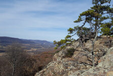
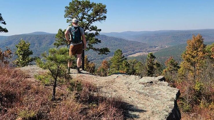
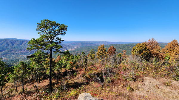
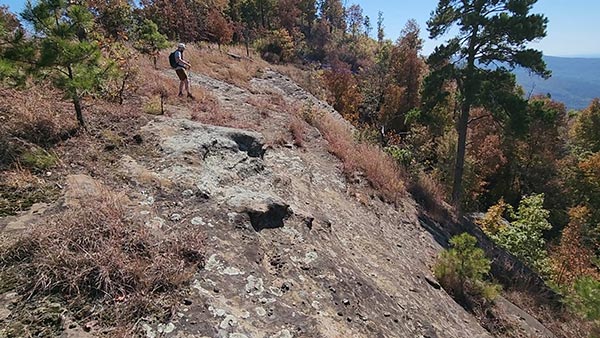
There is one redeeming quality to hiking the second route to the Arkansas Sphinx. When the trail leads you out of the woods, it takes you right up onto the bluffs with the vista view that we set out to see. Upon rounding the top of this hill, you’re rewarded for a tough hike in a dramatic fashion. With one step up onto the bluffs, you are hit right in the face with a breathtaking view of the surrounding hills and valleys. I captured this view in the video below. Moving a few more yards along the ridge, the Sphinx comes into view just down the hill. Standing on the bare rock face at the top of Hess Knob looking down at the Sphinx is quite an amazing sight.
This brings me to the last reason why I don’t recommend taking the second route to the Arkansas Sphinx. As amazing as these views are, this spot can be reached by taking route #1 and continuing on past the Sphinx and up the hill to this part. So from the top, we continued along the bluff line. After a little looking around, we found the trail heading down the hill. It’s a little steep in parts, but a fairly short trek down to the Sphinx.
The most rewarding part of the hike to the Arkansas Sphinx is the breathtaking view when you get there. The unique rock formation, combined with the stunning views, makes for a perfect photo opportunity. On a clear day, hikers can see for miles in three directions. The rolling hills and valleys of the Ozark Mountains can all be seen from the Sphinx’s perch. It instantly makes my list for one of the best hiking spots in Arkansas to see Fall colors. One of the coolest features of the Arkansas Sphinx is the “window” in the pedestal of the rock formation. It’s a hole that has been eroded all the way through the rock. The background scenery viewed through this window makes for some interesting photos.
Plan Your Trip
If you are still reading this far, then perhaps I have not yet talked you out of hiking the second route to the Arkansas Sphinx. I’ve mentioned how overgrown and difficult to navigate this trail is. I should mention that our hike was in mid-October. So maybe by the middle of Winter it’s not so bad. I still don’t think it would be worth it though. But if you just insist on doing it, I recommend waiting until at least December when the ground vegetation has died and thinned out a bit. Give yourself at least a couple of hours to do the hike and enjoy some time at the Sphinx. If you’re up for it after that, there are plenty more great hikes nearby along Hwy 123. Short hikes like Pam’s Grotto and Pack Rat Falls , or non-waterfall hikes like Buzzards Roost would be good. And there are still TONS of waterfall hikes on the west side of Hwy 123, that I have not written about yet. But you can find these on the Waterfalls in Arkansas Map. You’ll definitely want sturdy footwear for this one and some bug spray. And I highly recommend a trekking pole if you opt for route #1 on the trip back down. Dogs are welcome on this trail, but it might be a tough one for them.
Cell service is very spotty in this area. While driving, I couldn’t get a signal anywhere within 10 miles of the parking area. But I got a pretty good signal while sitting up above the Sphinx. The closest restrooms are the pit toilets at Haw Creek Campground, or at Hagarville Grocery. Food and drinks can also be found at Hagarville Grocery (see coordinates above). Their sandwiches are epic and the banana milkshake is a great post-hike treat. Be prepared to pack out any trash you might have on your hike and leave no trace. The Arkansas Sphinx is a reminder of the power and beauty of nature. Its geological uniqueness and gorgeous views make it a must-visit destination for anyone exploring the Ozark Mountains.


