
Hiking
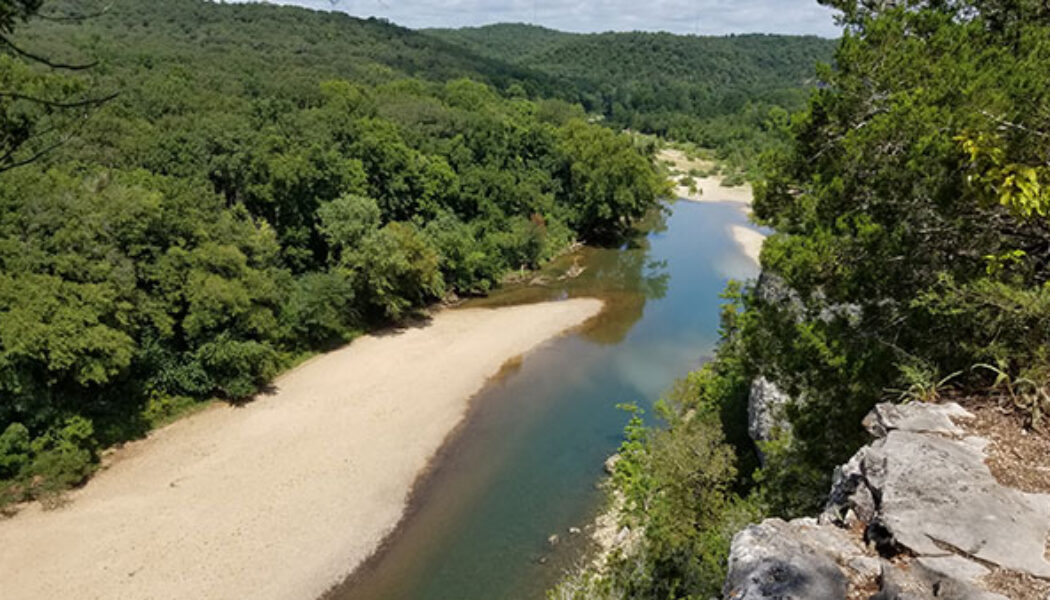

Hiking the Riverview Trail at Tyler Bend
It seems like every Arkansas Summer has a stretch of drought sometime between July and September. When the float rivers dry up and waterfall hikes become… well, just hikes. This summer (2021) has been especially dry and hot, making it difficult to get out and do these things. So what can you do when you just gotta get out there? How about a vista hike? Well that’s exactly what I did one Sunday in August. I hiked the Riverview Trail at Tyler Bend Recreation Area on the Buffalo River. There are a lot of high bluffs along the Buffalo River with trails leading to some great views. I like to hit those trails this time of year. Last Summer I did the most popular, Centerpoint/Goat Trail to Big Bluff near Compton. So this time I chose something closer to the Lower Buffalo. There a...

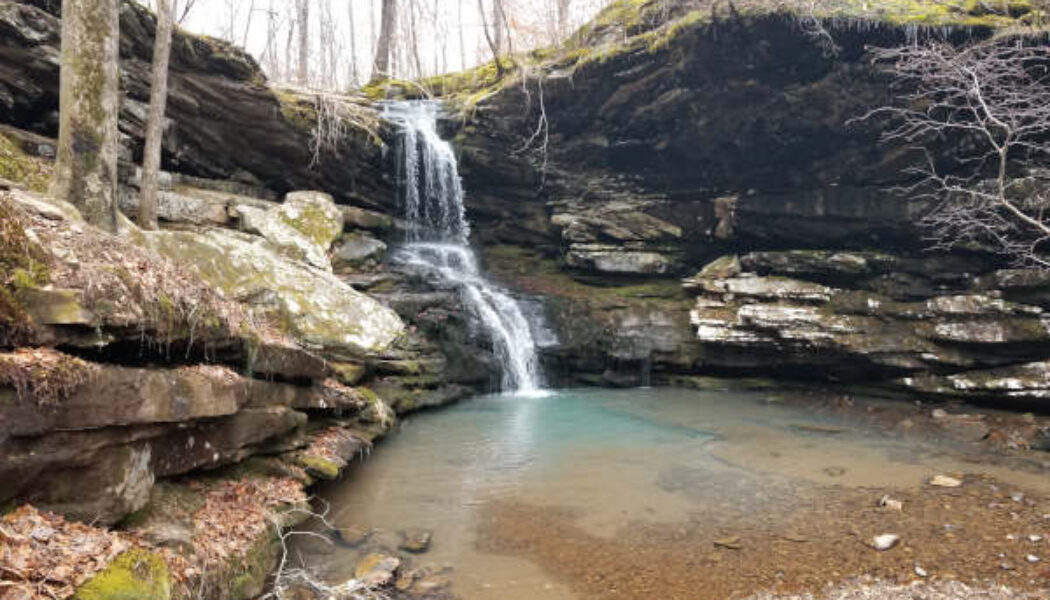
Hike to Steele Falls in the Sylamore Wilderness
A couple of weeks ago I wrote about a recent visit to Mountain View, AR and all the fun things to do around there. Our first stop that day was at Loco Ropes for some ziplining and ropes adventures. You can check out our visit to Loco Ropes here. The second half of our day would take us into the Sylamore Wilderness for a hike to Steele Falls. It’s actually the Sylamore District of the Ozark-St. Francis National Forest. But right or wrong, I just call it the Sylamore Wilderness. Before we would get to Steele Falls though, we had a few other stops to make. First was lunch at Wing Shack in Mountain View (great burgers!). Then we made a quick stop at Blanchard Springs to check out Mirror Lake Falls. From there, we made our way to the area of Fifty-Six and a stop at the beautiful Gunner Po...


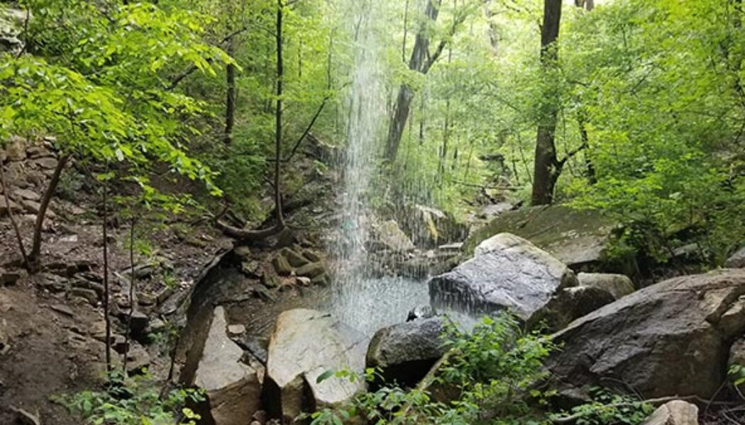
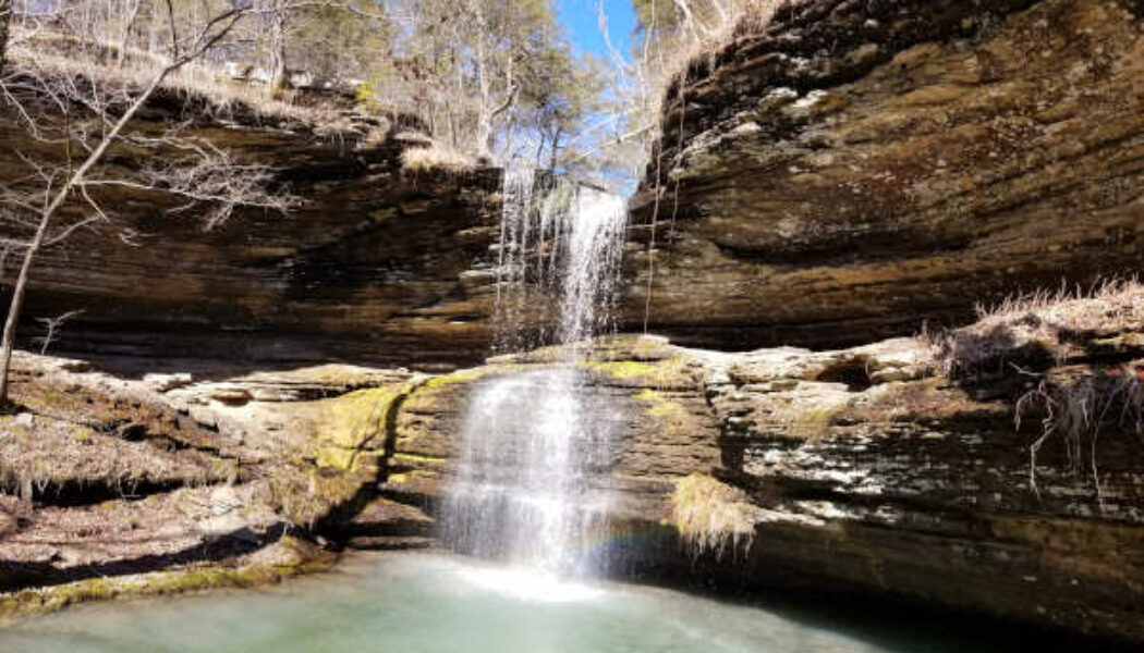
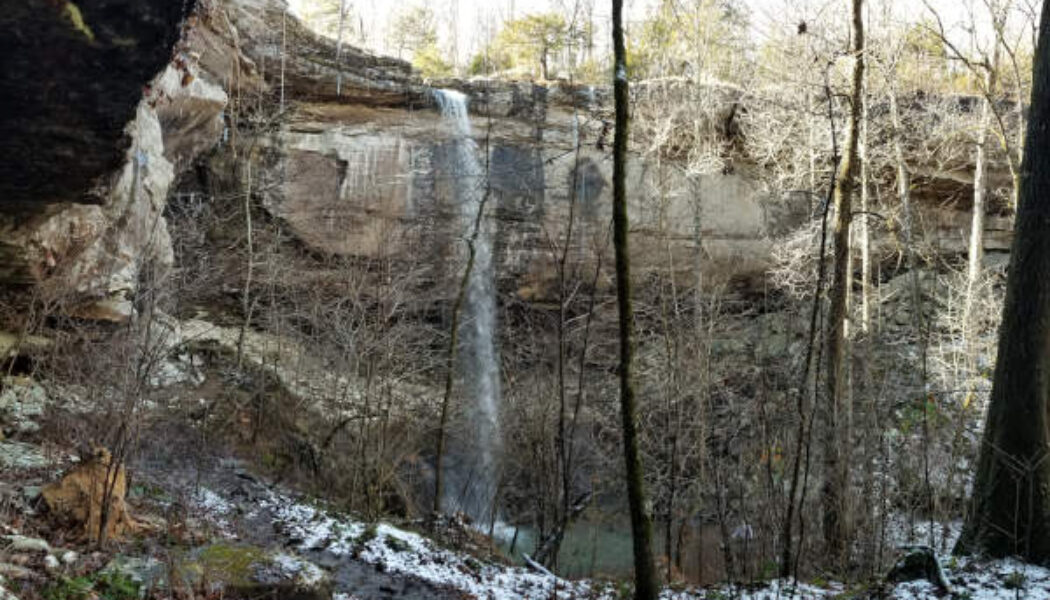
Hike to Mineral Springs Falls
Here we are in June and it’s still raining like it’s April. Floating the rivers is a little unpredictable right now. But one thing you can rely on is that the waterfall hiking is excellent pretty much every weekend. Earlier this spring I ventured into the hills northwest of Batson to visit Bingham Hollow Falls. Along the way, I stoppled to make the short hike to Mineral Springs Falls. I was actually on my way to a weekend camping and floating trip on the Mulberry River. That float ended up cancelled due to some unexpected cold and windy weather. So the waterfall hike to Mineral Springs Falls and later to Bingham Hollow wound up as the highlight of the weekend. Bingham Hollow was as great as I thought it would be. But Mineral Springs Falls was much more than I expected, and a ni...
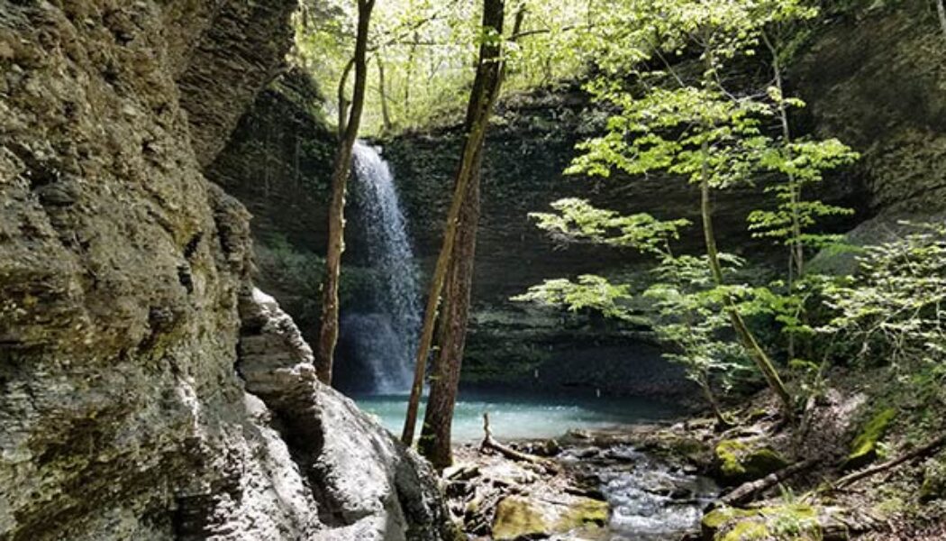

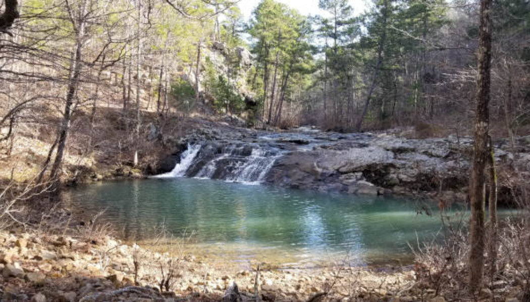
Splashdown Falls and Intersection Falls
I have written several articles now about waterfalls that I have missed while hiking to others close by. My research is getting better, so hopefully I won’t keep missing them. But I recently visited two more waterfalls you can easily combine with other waterfall hikes in the Falling Water Creek area. Splashdown Falls and Intersection Falls are two that are located off Falling Water Rd near several popular waterfalls. If you ever hike to Terry Keefe Falls, you should definitely add Splashdown Falls to the same hike. There are a lot waterfalls in this area such as Six Finger Falls and Fuzzy Butt Falls, Horsetail Falls, Terry Keefe Falls, and others. If you ever stop to see ANY of the waterfalls along Falling Water Rd, Intersection Falls is another quick and easy stop you can add. I had...
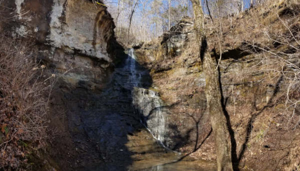

Horsetail Falls off Falling Water Creek
If you hunt enough waterfalls in Arkansas, you will eventually miss one that’s close to an area you’ve already hiked. I like to cover as much as I can in each hiking trip and article. So when I miss a cool feature on a hike, it’s pretty common for me to go back and do it again. One area that I’ve recently revisited for this exact reason is Horsetail Falls off Falling Water Creek. I did an article last year on Six Finger Falls and Fuzzy Butt Falls. On that hike, I accessed Fuzzy Butt Falls by crossing Falling Water Creek at Six Fingers. I knew the trail went back upstream to the bridge crossing Falling Water Creek. But what I didn’t know was that the trail takes you right by Horsetail Falls! I had heard of Horsetail Falls before but had never looked it up. So I...

Hike to Schoolhouse Falls near Lost Corner
I love finding new areas to hike that I’m completely unfamiliar with. They offer brand new sights, new mountains, streams, waterfalls, and trails. For me it’s the same excitement as taking a vacation to a new but popular place. You don’t know exactly what to expect, but you know you’re going to enjoy it. Even though I’ve explored quite a bit of Arkansas, this still continues to happen (which is a good thing!). The latest example is an area of the Big Piney Forest I’ve been exploring lately, just east of Hector. And my first visit to this area included a quick hike to Schoolhouse Falls. Yes, I realize a lot of people know about this area and hike it regularly. But for some reason, I’ve skipped right over it for years on my way to areas northwest of ...

Forked Mountain Falls in the Flatside Wilderness
In the northeast corner of the Ouachita Mountain region lies the Flatside Wilderness area. It is an area that’s relatively less explored and often overlooked. I think this may be because exploring this area requires a LOT of dirt road driving, which may turn some folks away. Personally, I like driving those dirt roads. I think another reason is that people mostly hear about the beautiful scenery and waterfalls in the Ozarks, because it’s the most popular area. Hey, I get it – the Ozarks are still my favorite too. But there is also great scenery – including waterfalls – in the Ouachitas. One of those is Forked Mountain Falls in the Flatside Wilderness area. Forked Mountain can be seen from many different places while driving through the Flatside Wilderness area...
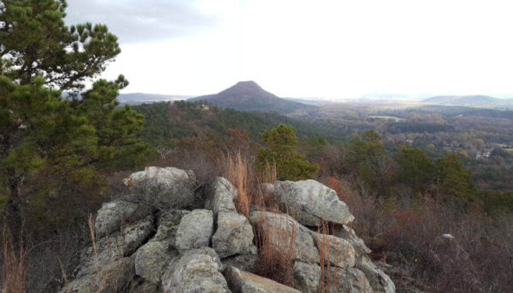

Hiking or Biking at Rattlesnake Ridge
Living in Central Arkansas, I’ve watched the sun go down many times from the top of Pinnacle Mountain. From my spot on the north peak, I’ve looked to the west and wondered “what is that other mountain over there?” And “it sure would be cool if we could hike to the top of it and look back this way.” Well, that mountain “over there” overlooking Lake Maumelle is Rattlesnake Ridge. And in 2018 it was opened to the public for hiking by the Nature Conservancy and Arkansas Dept of Natural Heritage. Finally, a much-needed new place to hike close to home! I love Pinnacle, but after you’ve been to the top 150 times (not kidding), it kinda loses its luster. In 2019, mountain bike trails were added so we can now go hiking OR biking at Rattlesnake R...

Hike to Magnolia Falls in the Ozarks
When it comes to hiking, I learned long ago to plan your hike, research it, and know what you’re getting into. I’ve learned this lesson several times. But every now and then I seem to forget it, and will go off exploring without a plan. Or I’ll plan a hike and change my mind on the way so I can see something else. Such was the case the first time I made the hike to Magnolia Falls between Deer and Fallsville. I had planned two other waterfall hikes near Ponca that day in early October. But after seeing that the area creeks would be low on water, I opted for Magnolia Falls. I had Magnolia Falls on my list for a while and even read a little bit about it. But I was still completely unprepared that day. I had not downloaded a map or read enough about how to access the other wa...

Sweden Creek Falls Hike in the Ozarks
For my first hike of the year I continued on my quest to hike all the major waterfalls in the Upper Buffalo River area. I decided to start the year off with the Sweden Creek Falls hike since it had been on my list for a while. And the conditions were perfect for a waterfall hike that day. The Kingston area had gotten some rain for several days before, and even some snow. On the day of my hike, the sun was out in full to warm things up to the mid-40’s. This meant there should be plenty of water in the falls from the snow-melt and previous rain. Full sun and water in the falls? I couldn’t ask for better conditions, especially for this hike. Driving up Hwy 21 from Clarksville to Boxley, I was pleased to see there was still a light dusting of snow on the ground. I haven’t see...
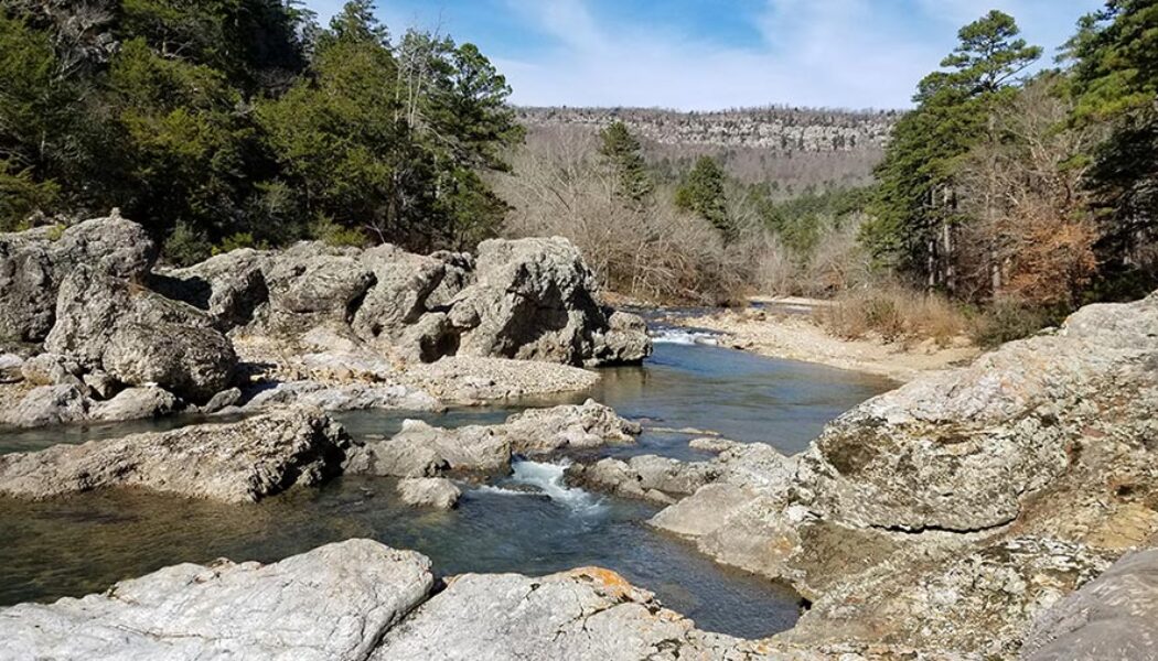

Hike to Winding Stairs on Eagle Rock Loop
I continue to be blown away by the natural beauty in our state. Just when I think I’ve seen the prettiest hike in Arkansas, I eventually go on another one that changes my mind. The hike to Winding Stairs on the Eagle Rock Loop Trail in the Ouachitas is the latest one. I’ll admit that I have not given enough attention to the Ouachita Mountain region so far. Sometimes I get in the habit of heading straight to the Ozarks for hiking waterfalls and paddling rivers. But there are areas of the Ouachitas that are just as great and in my opinion, very underrated. This area around the Eagle Rock Loop is right up there with some of the best spots in the Ozarks. Many people have gotten confused and lost trying to follow this trail. Unless you download a map, it can be easy to get off the t...
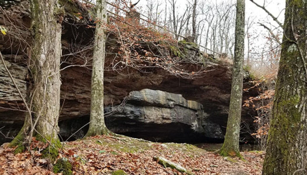

Alum Cove Natural Bridge
Many of the hikes I have written about so far are located in the areas between Russellville and Jasper, or Clarksville and Ponca. Nestled right in the middle of all those hills, creeks, and waterfalls lies Alum Cove Natural Bridge Recreation Area. In all my trips through this area, I’ve passed really close to Alum Cove probably a hundred times. And until recently, I had never stopped to visit – always in a rush to get somewhere else. But this past November, I made it a point to specifically stop in to check out Alum Cove. I was not disappointed. I had actually set out to do a different hike that day a little further north. But the road to that trailhead was flooded so I had to call an audible. I’d been saving the Alum Cove area trail as a backup plan for just such an occa...
