
Waterfalls

Hike to Grapevine Shelter and Blue Hole Cascades
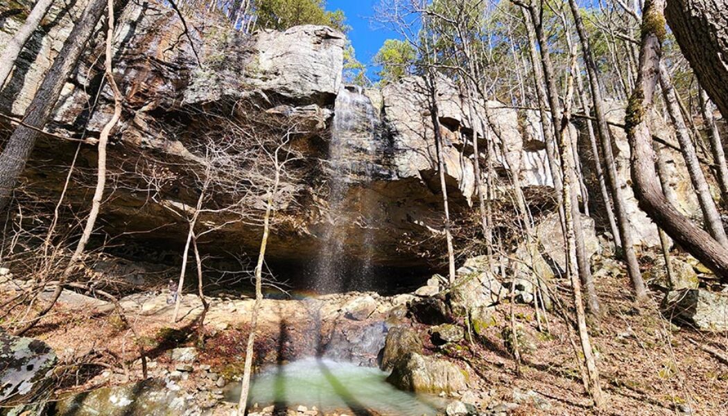
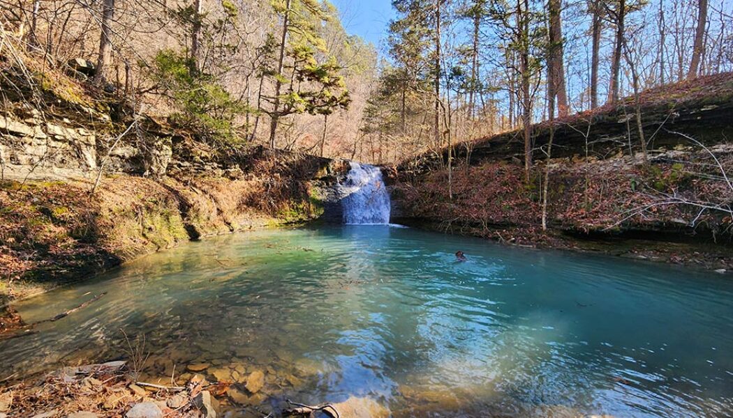
While Grapevine Shelter might not be as widely recognized as some of Arkansas’ more famous natural landmarks, it is a captivating destination for adventurous hikers and waterfall lovers. Located in the Lost Corner area of the Southern Ozarks, this one is a little bit of a hidden gem. Like many other waterfalls in the Lost Corner area, Grapevine Shelter is not found in Tim Ernst’s waterfall book (second edition). But there are several falls close by that Tim included, such as Blue Hole Cascades and Green Grotto Falls. If you make the drive to see those, you might as well see Grapevine Shelter while you’re there. But only if you’re up for a challenge. Because the hike to Grapevine Shelter is not for everyone. Being mostly a bushwhack through the woods, this ...

Hike to Stave Mill Falls and Little Oak Falls
Years ago, I had the opportunity to go trail riding at Mack’s Pines on Hwy 7, north of Dover. And let me tell you, we had an absolute blast doing it. That was years before I had learned the lay of the land when it comes to waterfall hikes. So little did I know that day, that the waterfall we stopped to admire on our ride was actually Stave Mill Falls. And because we entered the trail riding area a good bit south of Mack’s Pines, I didn’t realize how close we were to the Moccasin Gap Recreation Area. Nor did I have any idea that it was only a short hike to Stave Mill Falls and Little Oak Falls. Fast forward several years and many dozen trips past Moccasin Gap on Hwy 7. This hike made my to-do list, but kept getting passed over for other hikes I wanted to check off my Tim E...

Hike to Devils Canyon Falls
On the rare occasion that I get much further west than the town of Ozark, it’s usually because I’m spending the night somewhere in Northwest Arkansas. It’s a little far for a day trip from Central Arkansas (my home), especially during the short Winter days when I do most of my hiking. So any time I travel to Northwest Arkansas, I try to check one of the waterfall hikes west of Ozark off my list. One of those hikes that had been on my list for a long time was the hike to Devils Canyon Falls. When I finally had an opportunity to peel off I-40 for a few hours to do it, this hike instantly made my favorites list. A short list that includes hikes like Thunder Canyon, Richland Creek, Winding Stairs, and Tea Kettle Falls, among others. The hike to Devils Canyon Falls is a somewh...

Hike to Hemmed in Hollow from the Compton Trailhead
In 2020, I made my first visit to Hemmed-in Hollow Falls. Admittedly, I took the short, easy route by making the quick hike from the Buffalo River while on a float trip. I knew about the popular hike to Hemmed in Hollow from the Compton Trailhead, and had heard it was pretty difficult. So after seeing the impressive sight of the falls crashing down into the hollow, I figured I could check this one off my list. (Seeing the falls is the whole point, right?). But after years of hiking other waterfalls, I felt like I needed this challenging hike on the blog. So I decided to return to Hemmed-in Hollow to do the hike from the top. Hemmed in Hollow Falls, located on the Buffalo National River, is 209 feet tall. That makes it the tallest waterfall in Arkansas. In fact, it’s the tallest water...

Floating War Eagle Creek – Hwy 23 to Hwy 45
The Ozarks, a vast and scenic mountain range stretching across Missouri, Arkansas, and Oklahoma, is a paddler’s paradise. With an abundance of options ranging from gentle floats to adrenaline-pumping whitewater, the Ozarks cater to all paddling skill levels. In the Arkansas Ozarks, iconic rivers such as the Buffalo, Kings, and Mulberry garner most of the attention, and rightfully so. But beyond these popular rivers lie some lesser known gems like War Eagle Creek. Floating War Eagle Creek is a must-do for anyone seeking a scenic and relaxing experience in nature, away from the crowds. My first glimpses of War Eagle Creek came while I was driving to Marble for a float trip down the nearby Kings River. I knew right then I had to come back to float this one too. This gentle waterway is o...

Hike to Kings River Falls
The Kings River is well-known as a fun and scenic destination for floating and fishing. But it also has plenty to offer in the way of hiking. From its headwaters near the community of Boston, it carves its way north through the Ozark Mountains. Far before this meandering stream reaches the major paddling sections, it tumbles over a massive rock shelf, to create the picturesque Kings River Falls. But this isn’t just any run-of-the-mill waterfall in a stream. The rocky shores around the waterfall help form a deep pool, perfect for a cool refreshing dip on a hot day. The hike to Kings River Falls is indeed more than a standard waterfall hike – it’s a trip to an Ozark swimming hole and natural oasis. Quick Glance Distance: Approximately 1.5 miles out and back Difficulty: Very...

Hike to Hobo Falls on the OHT
The Ozark Mountains, renowned for their rolling hills, deep valleys, and hidden waterfalls, offer a haven for outdoor enthusiasts. Winding through this scenic landscape is the Ozark Highlands Trail (OHT), a designated National Recreation Trail, and a gem of Ozarks. Starting at Lake Fort Smith, this long distance trail winds through the heart of the Ozark National Forest for over 200 miles. This scenic route is known for its diverse terrain, from gentle valleys and meandering streams to challenging climbs and breathtaking vistas. And while it may be a thru-hiker’s dream, the OHT is divided into sections that offer numerous day hiking options. One of those options is the hike to Hobo Falls on the OHT. I’ve had the hike to Hobo Falls on my to-do list for several years. And long be...

Hike to Ladderbucket Falls and John Mountain Falls
Tucked away in the rolling hills and verdant valleys of the southern Ozarks, lies a tiny mountaintop community aptly named Lost Corner. As it’s name implies, it is an area that many people don’t know much about, if they even know it exists at all. You will not find any stores, shops, restaurants, or many signs of civilization at Lost Corner. But what you will find is a remote wilderness area rich with streams, bluffs, steep ravines, and wildlife. It’s an area I visit several times a year for it’s seemingly endless options for waterfall hikes. My most recent trip would include the hike to Ladderbucket Falls and John Mountain Falls. For this hike, my good buddy David and I would team up once again with Gez Rogers and Super Leeds of Waterfalls in Arkansas. Gez is the c...
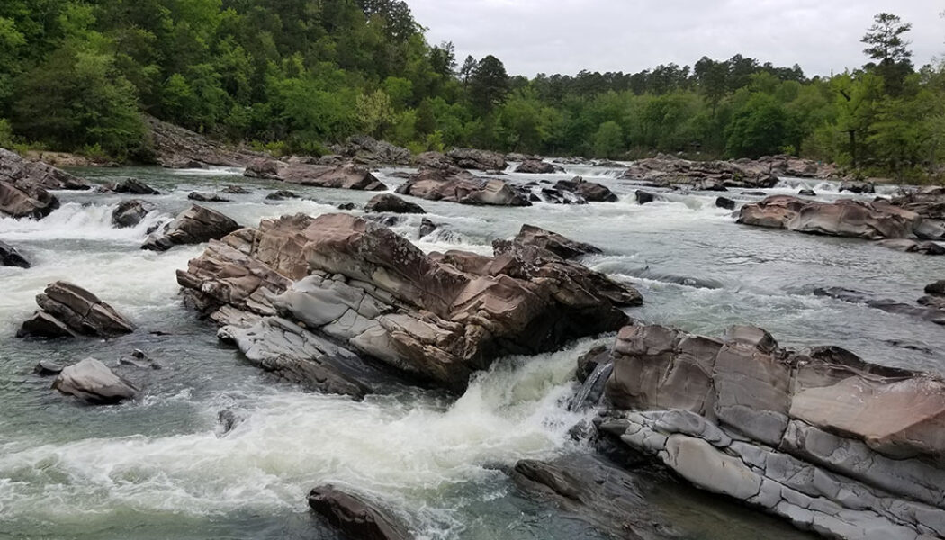

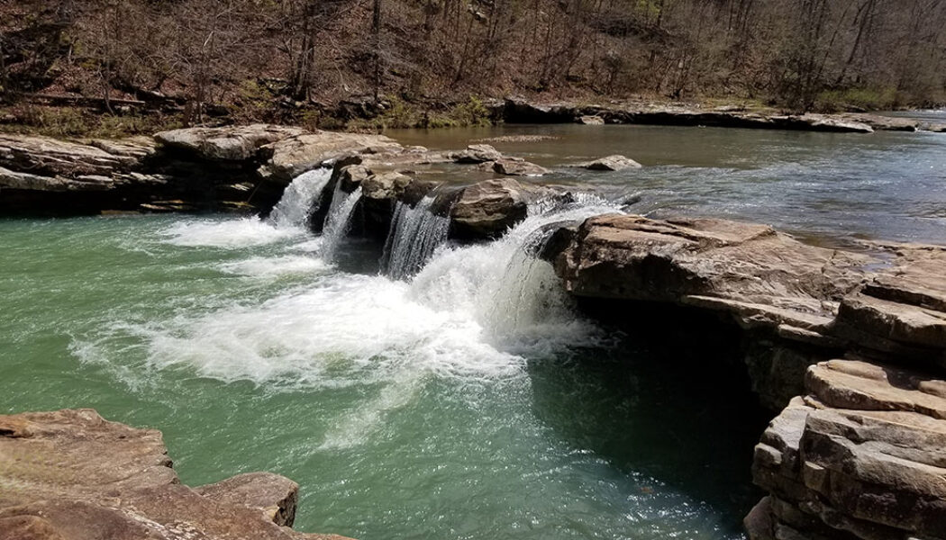
Hiking Cossatot Falls
Because we have so many fantastic State Parks in Arkansas, I think some of them don’t quite get the attention they deserve. We are truly fortunate here to have such amazing State Parks like Petit Jean , Devil’s Den, Mt Magazine, Mt. Nebo, Hobbs, and others. While those parks tend to draw the most visitors, others, like Cossatot State Park, sometimes get lost in the shuffle. And if you’ve never been hiking Cossatot Falls at Cossatot River State Park, you’re missing out on one of the most impressive natural sights in the state. When most people think of the word “Cossatot”, they think of the Cossatot River and it’s Class IV whitewater sections. Most people – including me – are not equipped or skilled enough to paddle these sections, so th...
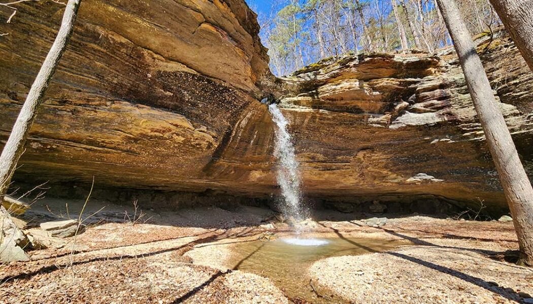

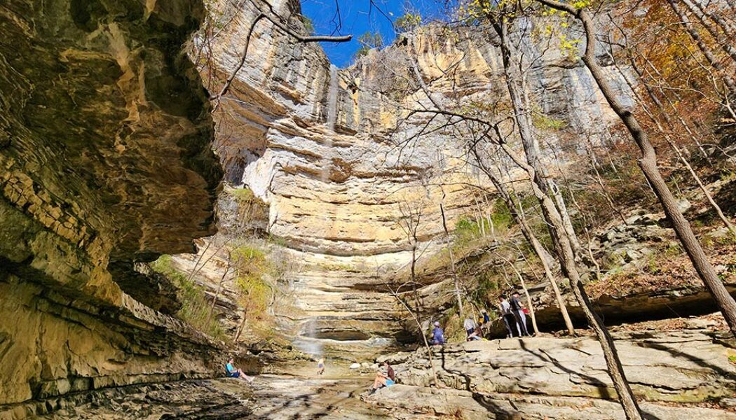
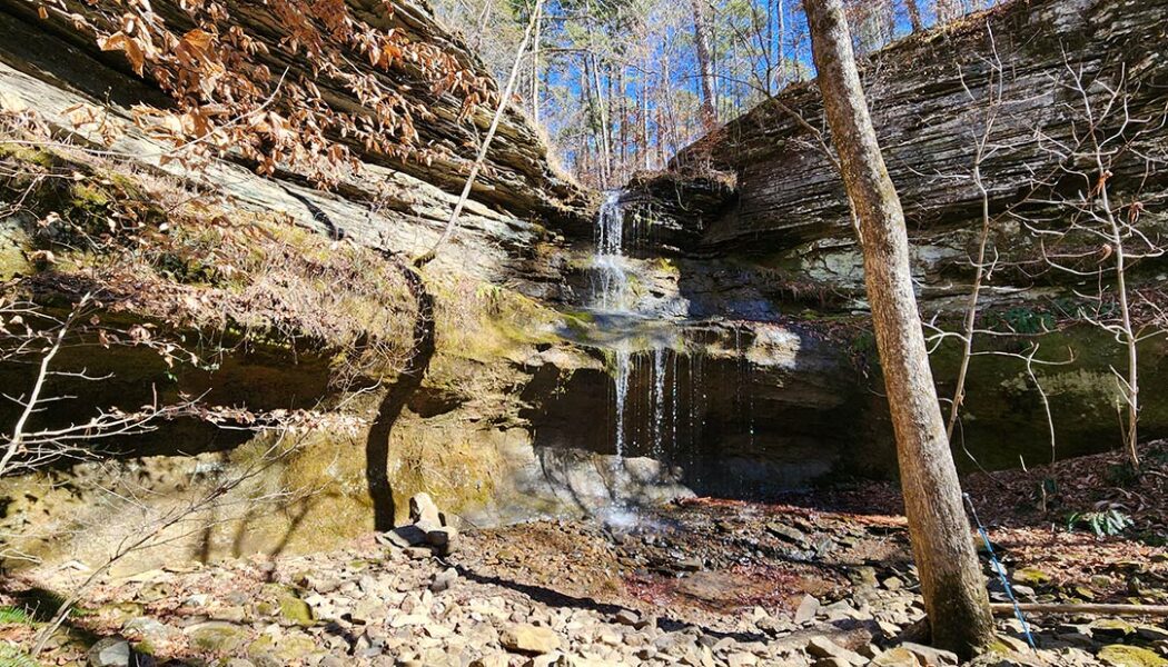
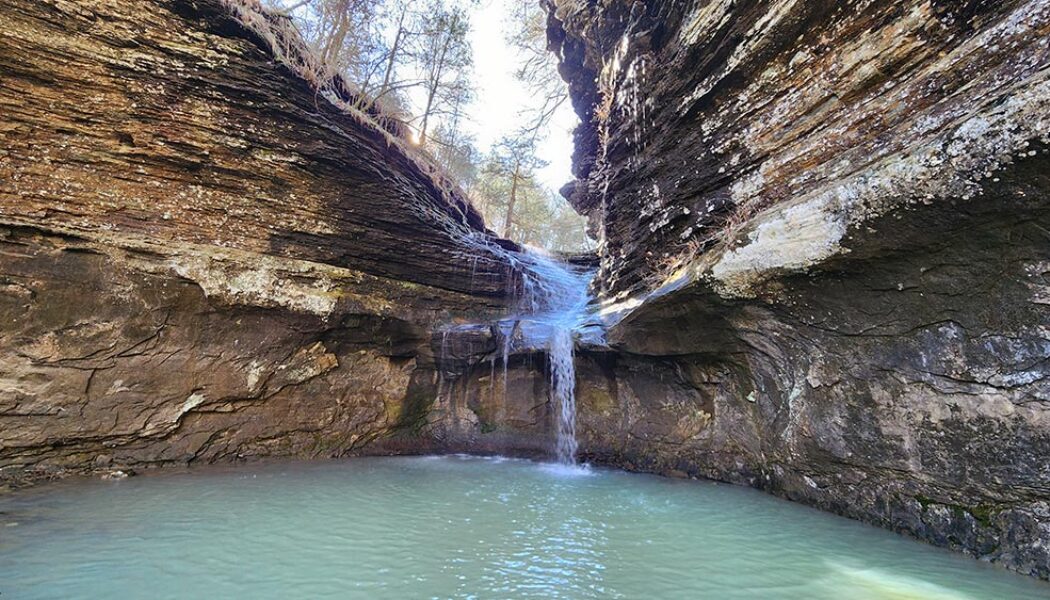
Tea Kettle Falls Hike (with Reynolds Hollow Falls)
Tea Kettle Falls is one of the more well-known and unique waterfalls in Arkansas. The base of the waterfall is a massive grotto style bluff that is quite an impressive sight on it’s own. The creek flowing over the top of the bluff has carved a hole in the rock at the top of it. Much like Glory Hole Falls, the water drops through this hole before ever making it to the edge of the bluff. But where the hole at Glory Hole falls drops straight down through the bluff, Tea Kettle is different. Instead of the hole coming out the bottom, it re-routes horizontally, shooting the water out the side of the bluff. This rock formation resembles the spout of a kettle, which is how Tea Kettle Falls gets its name. I’ve wanted to do the Tea Kettle Falls hike for quite a while, and finally got the...
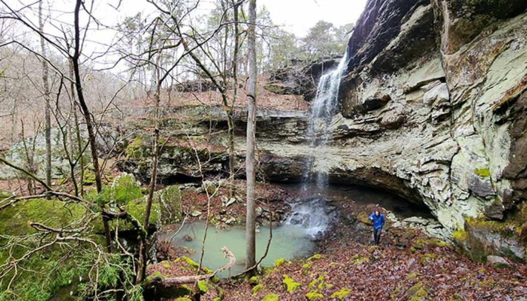

Hike to Iris Falls Near Lost Corner
The hike to Iris Falls is one that should be on every Arkansas waterfall hunters list. It is one of the many waterfalls you will find in the Lost Corner area, northwest of Morrilton. In fact, it is only about a quarter of a mile down the road from the parking area to Lizard Log Falls. If you have the Tim Ernst waterfall book, he describes this as a 7-mile hike. But that is if you want to see all of the waterfalls along Brock Creek Trail 23. If you want to see each one individually, there certainly are ways to do that. I have previously written articles on Schoolhouse Falls and Lizard Log Falls along Brock Creek Trail 23. I still have Voices Falls and Whiskey Chute Falls left to do in this group. As for the hike to Iris Falls, here is the approach I believe most peo...
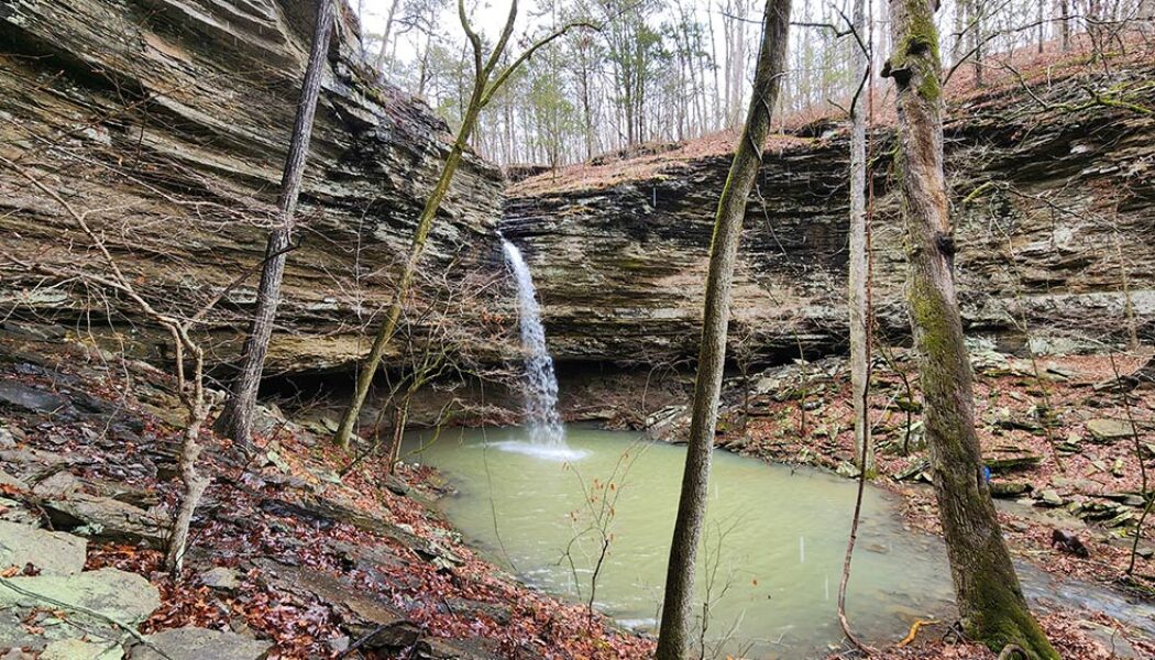

Hiking to Lizard Log Falls Near Lost Corner
The Brock Creek Trail Area and other hollows near Lost Corner are a waterfall hunter’s paradise. This area is well-documented by waterfall pioneers like Tim Ernst and the late Rick Henry, among others. A look at the Waterfalls in Arkansas map will show you just how chock full of waterfalls this place is. Some of these waterfalls – like Schoolhouse Falls – can be accessed via easy hiking trails. Others, like Brushy Grotto Falls and Green Grotto Falls involve some trail and some bushwhack hiking. Many of them have multiple ways you can reach the falls. Hiking to Lizard Log Falls is one of those. Lizard Log Falls is a hike that I attempted to do two years before this writing. I got a little confused that day because the GPS track I had saved did not jive ...
