
#bluffs
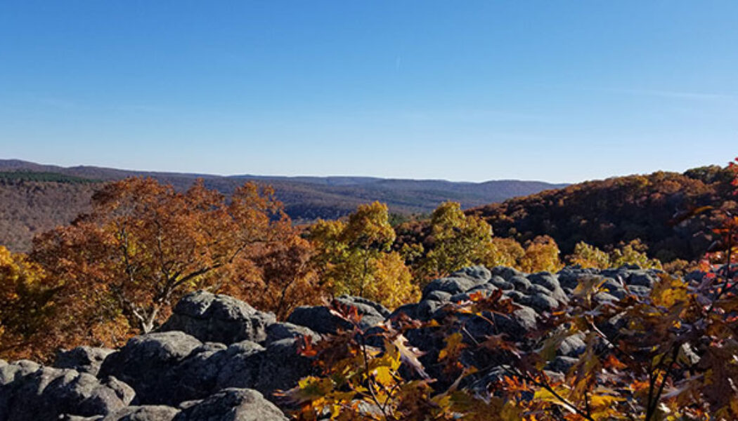

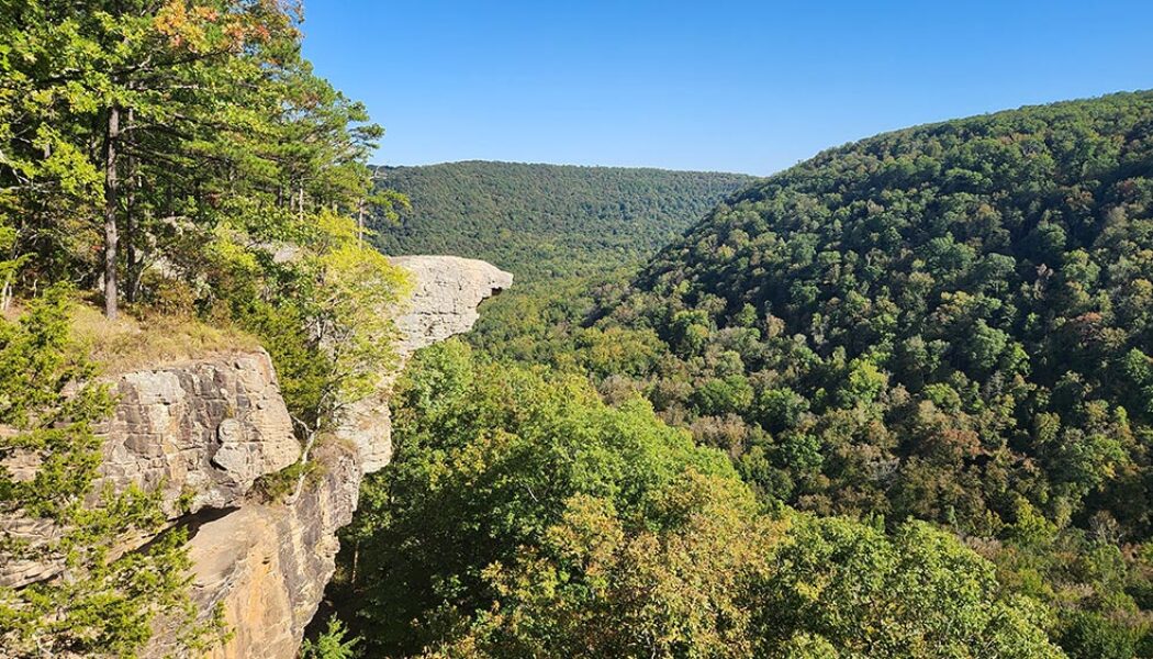
Hike to Buzzards Roost
I find something to enjoy about every hike that I do. But some hikes are better than others. And then there are the ones that really stand out from the rest. Those are usually the ones where I spend the whole time thinking “how am I just now visiting this place?!”. The hike to Buzzards Roost is the latest one that really blew me away. Maybe it’s because I geek out a little bit over crazy rock formations (see video below), and this hike is full of them. This geological wonderland has two natural bridges and a huge rock outcropping/vista full of caves and tunnels. I would compare it to the Bear Cave Trail area at Petit Jean State Park, but more impressive. It also didn’t hurt that we caught this area on the last weekend of peak leaf season this fall. This hike has a c...
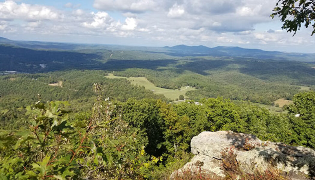

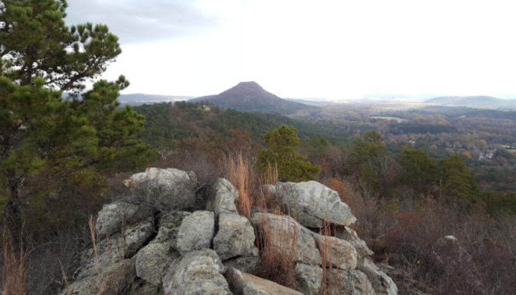
Round Top Mountain Hiking Trails
There are many hikes in Arkansas that are better at certain times than others. And when you can’t do those, you need a backup plan. I have a list of hikes that I have been saving for times when rivers and waterfalls are dry. These are my “Plan B” hikes. Not because they are not good hikes, but because they can be done at any time. Hikes like Centerpoint/Goat Trail to Big Bluff or the Mt. Nebo Rim Trail for example. The latest Plan B hike I’ve checked off my list was a visit to Round Top Mountain hiking trails. I have passed by Round Top Mountain dozens of times on my way to Jasper or the Upper Buffalo River area. This Fall I finally had a good chance to stop in and hike it. I had been out waterfall hunting up Hwy 7 right after a rain. And after striking out on...
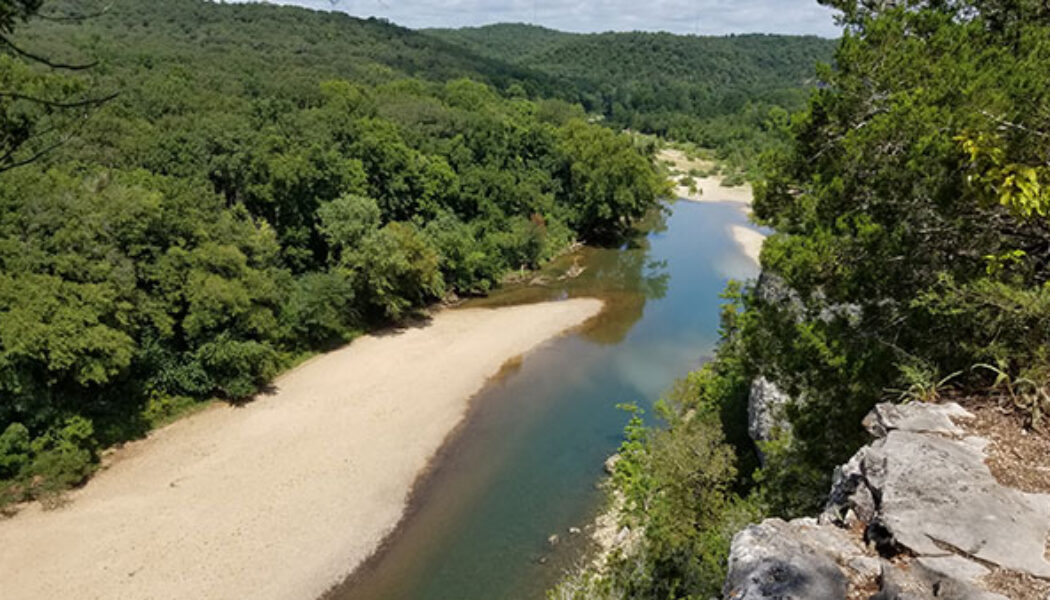

Hiking the Riverview Trail at Tyler Bend
It seems like every Arkansas Summer has a stretch of drought sometime between July and September. When the float rivers dry up and waterfall hikes become… well, just hikes. This summer (2021) has been especially dry and hot, making it difficult to get out and do these things. So what can you do when you just gotta get out there? How about a vista hike? Well that’s exactly what I did one Sunday in August. I hiked the Riverview Trail at Tyler Bend Recreation Area on the Buffalo River. There are a lot of high bluffs along the Buffalo River with trails leading to some great views. I like to hit those trails this time of year. Last Summer I did the most popular, Centerpoint/Goat Trail to Big Bluff near Compton. So this time I chose something closer to the Lower Buffalo. There a...
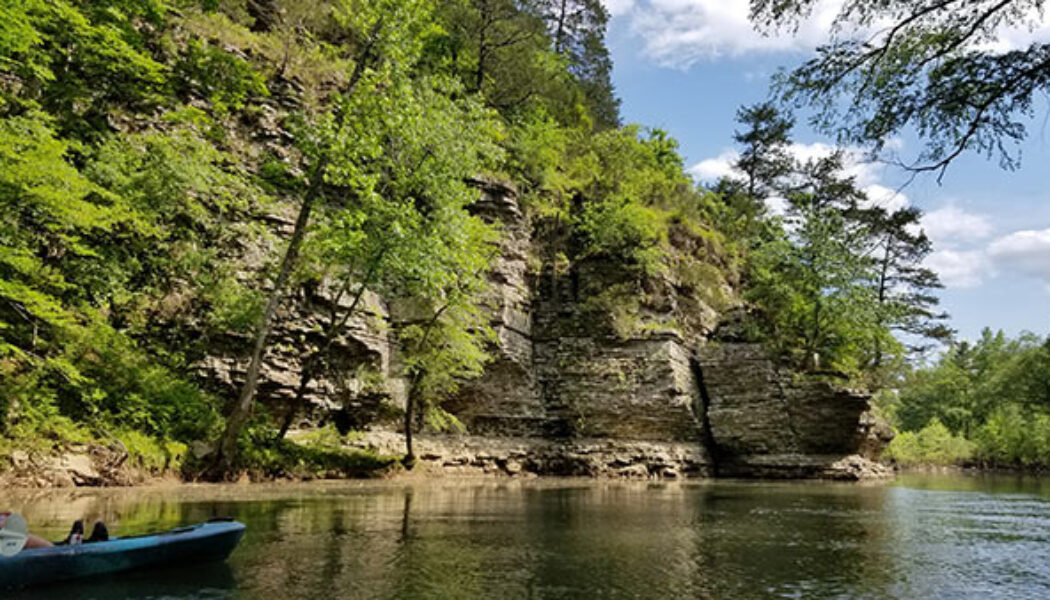

Floating the Cove Creek run on Cadron Creek
The 2021 float season has been a good one so far. Planning has been a challenge at times but I’ve managed to paddle a lot of new water this year. This Spring, I made my first floats down Kyle’s Landing to Ozark on the Buffalo, and Norman to Caddo Gap on the Caddo River. And in May I finally got to float the Cove Creek run on Cadron Creek. (This is Hwy 65 to Hwy 285). This one had been on my list for a while since floating the section upriver from it many years ago. I’ve always heard this is a nice float, but the scenery and the river completely exceeded my expectations that day. Floating the Cove Creek run on Cadron Creek is really convenient for folks in Central Arkansas and the Ozark foothills. It’s only a half hour north of Conway and easy to self-shuttle. I̵...
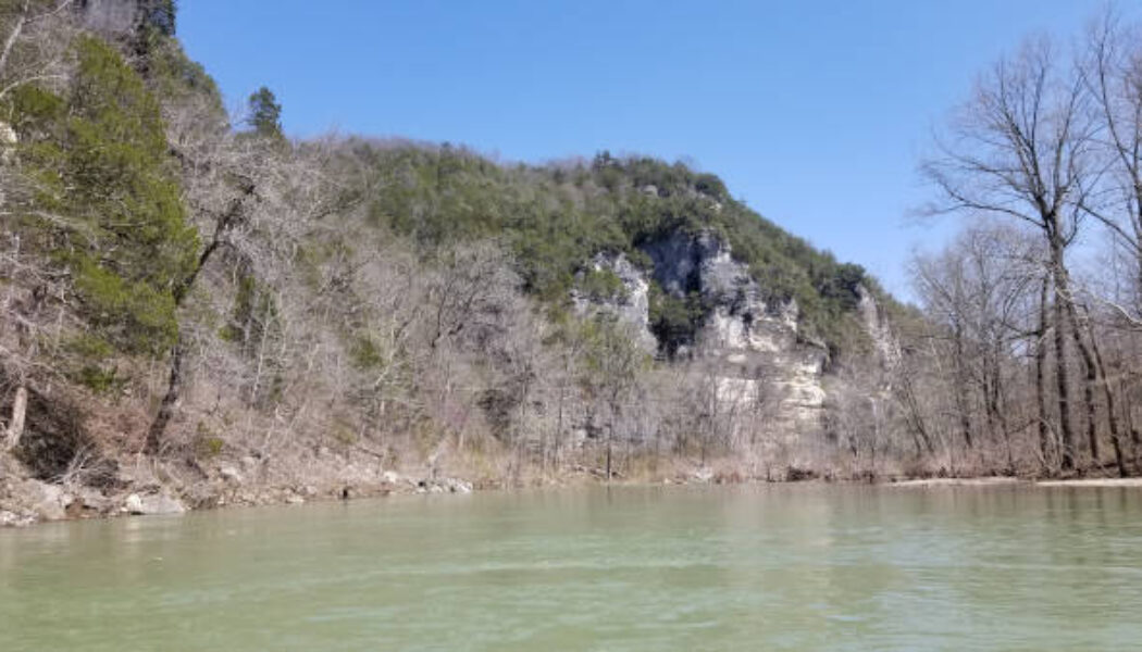

Floating Kyle’s Landing to Ozark on the Buffalo River
Spring is here and it’s time to float the upper portion of your favorite rivers. This year, my first float trip was Kyle’s Landing to Ozark on the Buffalo River. I usually make it a point to float Ponca to Kyle’s Landing every year. But I’m on a mission to float all the sections of the Buffalo I haven’t done yet, along with some new rivers. So floating this section on the Upper Buffalo was a top priority. It will likely be too low to float by mid-June, so you’ve got to get it while you can! We had a perfect Saturday for floating the last weekend of March. The area had gotten some good rain that week and the river was really high that Friday. But the Upper Buffalo drains off quickly, and by Saturday the water level was just right. Combine that with a sunn...

Hiking or Biking at Rattlesnake Ridge
Living in Central Arkansas, I’ve watched the sun go down many times from the top of Pinnacle Mountain. From my spot on the north peak, I’ve looked to the west and wondered “what is that other mountain over there?” And “it sure would be cool if we could hike to the top of it and look back this way.” Well, that mountain “over there” overlooking Lake Maumelle is Rattlesnake Ridge. And in 2018 it was opened to the public for hiking by the Nature Conservancy and Arkansas Dept of Natural Heritage. Finally, a much-needed new place to hike close to home! I love Pinnacle, but after you’ve been to the top 150 times (not kidding), it kinda loses its luster. In 2019, mountain bike trails were added so we can now go hiking OR biking at Rattlesnake R...
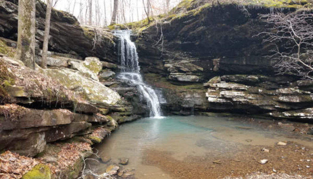

Hike to Magnolia Falls in the Ozarks
When it comes to hiking, I learned long ago to plan your hike, research it, and know what you’re getting into. I’ve learned this lesson several times. But every now and then I seem to forget it, and will go off exploring without a plan. Or I’ll plan a hike and change my mind on the way so I can see something else. Such was the case the first time I made the hike to Magnolia Falls between Deer and Fallsville. I had planned two other waterfall hikes near Ponca that day in early October. But after seeing that the area creeks would be low on water, I opted for Magnolia Falls. I had Magnolia Falls on my list for a while and even read a little bit about it. But I was still completely unprepared that day. I had not downloaded a map or read enough about how to access the other wa...
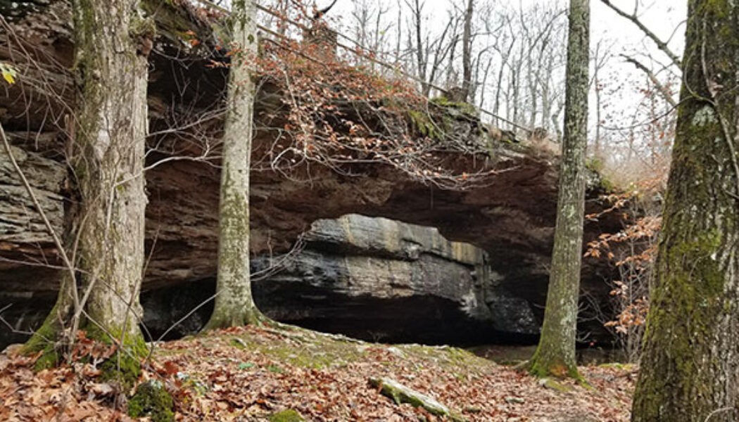

Alum Cove Natural Bridge
Many of the hikes I have written about so far are located in the areas between Russellville and Jasper, or Clarksville and Ponca. Nestled right in the middle of all those hills, creeks, and waterfalls lies Alum Cove Natural Bridge Recreation Area. In all my trips through this area, I’ve passed really close to Alum Cove probably a hundred times. And until recently, I had never stopped to visit – always in a rush to get somewhere else. But this past November, I made it a point to specifically stop in to check out Alum Cove. I was not disappointed. I had actually set out to do a different hike that day a little further north. But the road to that trailhead was flooded so I had to call an audible. I’d been saving the Alum Cove area trail as a backup plan for just such an occa...

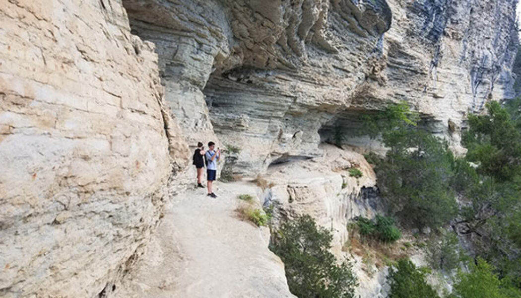
Hike to Whitaker Point(Hawksbill Crag)
If you do a lot of hiking in Arkansas and haven’t made the hike to Whitaker Point, you have to add this one to your to-do list. It’s one of the more popular hikes in the Ozarks. Even if you don’t know what Whitaker Point is, you’ve probably seen a picture of it somewhere. Also known as Hawksbill Crag, it is one of the most photographed scenic spots in Arkansas. Lots of marriage proposals happen here and people actually pay photographers to capture the moment from far off. So what is it? Hawksbill Crag is a large rock outcropping sticking out from the top of a really high bluff. The bluff overlooks Whitaker creek in the valley below. On the AllTrails app, it is listed as “Whitaker Point Trail (Hawksbill Crag)”. On Google maps, you’ll find both ̶...

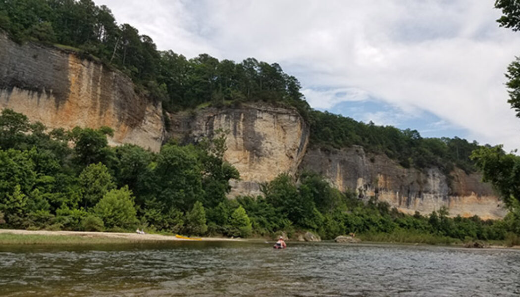
Hiking the Big Bluff Goat Trail on the Buffalo River
I have written a few articles about certain popular hikes or floats that have always eluded me for whatever reason. Hiking the Big Bluff Goat Trail is one of those that has been on my list for years, but just never happened. But this summer, I finally got to mark this hike off my list. And it was everything I expected it to be. In a time where waterfall hikes are all the rage, this a great hike to do when those falls are all dried up. What a great hike this one is. It’s not too long, not too short, slightly challenging, and definitely one of the most rewarding. If you have not made this hike yet, I highly recommend adding it to your list. If you use the AllTrails app, this hike is called Centerpoint to Goat Trail. I think you can get all the way to Hemmed-In Hollow from this trail, b...
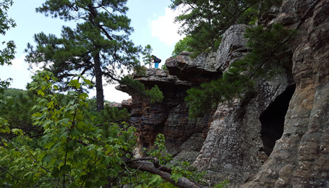

Hike to Pedestal Rocks
Well, here we are in the middle of Summer – the dog days. Most of the rivers are really low for floating. Most of the waterfalls are just a trickle, if not dry. And man, is it HOT! If you don’t have a pool, or a boat for enjoying the lake, don’t worry. There are still some fun things to do outdoors. Even in the low rivers, there are still some swimming holes out there. So why not do a hike and swim? During another sweltering summer a few years ago, some friends and I did exactly that with a hike to Pedestal Rocks. You may be thinking “wait a minute…Pedestal Rocks doesn’t have a swimming hole. It doesn’t have any water at all!” You would be correct. It doesn’t. But just 13 minutes down the road is the ever-popular swimming hole at Fallin...

Woolum to Baker Ford Float on the Buffalo
I’m kind of a creature of habit. I have a lot of my favorite floats that I try to do every year. The down side to that is I’ve missed out on a lot of other great floats. You can only do so many per year! So I’m doing more new (to me)floats this year. And a few weeks ago I did the Woolum to Baker Ford float on the Buffalo in my quest to cover all sections of the river. I have floated sections all around this one, but just never got around to hitting Woolum. So my buddy Eric and I loaded our trucks and planned a self-shuttle float to cross this one off the list. This float can be hit and miss by mid-summer. It may be too low one day, but with a little rain it can be fine. Before going, check the river level at American Whitewater or on the RiverApp. I tend to check both. Bu...
