
#Ozarks
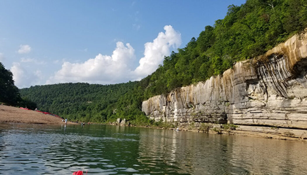

Maumee to Rush on the Buffalo River – An Overnight Float
One of my favorite ways to experience the rivers in Arkansas is with an overnight float trip. I’ve done several of these, and my most recent overnighter was South Maumee to Rush on the Buffalo River. All of the lands bordering the Buffalo River are public lands owned by the National Park Service. This makes the Buffalo one of the few rivers in Arkansas where you can camp almost anywhere along the entire river. Maumee to Rush is located on the lower Buffalo, making it floatable – usually – well into July. I love overnight floats because I don’t have to worry about the campgrounds filling up or trying to find a site. I don’t have to worry about getting off the river at a certain time to catch a shuttle. And when I do come off the river I don’t have to driv...

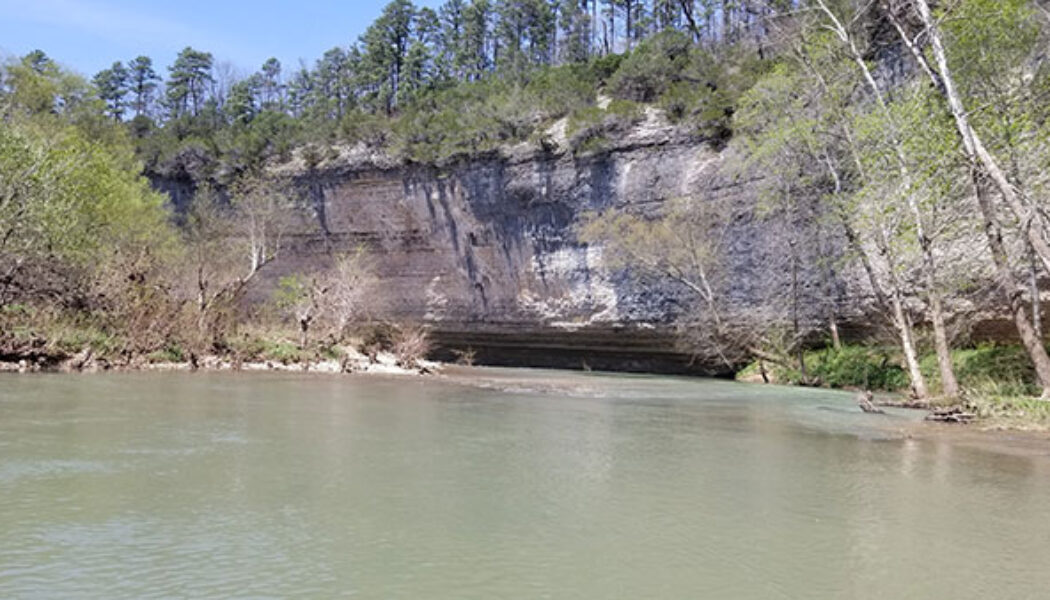
Floating North Sylamore Creek – Blanchard Springs to White River
One of my favorite things about doing a new hike, bike, or float is the surprise element. And the best surprise is when I finish it and have a new favorite. Floating North Sylamore Creek from Blanchard Springs to the White River was one of those occasions. I’m not saying it is my number one favorite, but it definitely lands securely in my top five. I knew it would be pretty good, but I had no idea of what this river really had in store for us. To say that I was pleasantly surprised would be a massive understatement. Floating North Sylamore Creek has been on my to-do list for quite some time. The problem is that it’s not an easy float to plan for. This creek drains really fast, so you have to hit it at just the right time to have a good float. Since I mostly have to float on the...

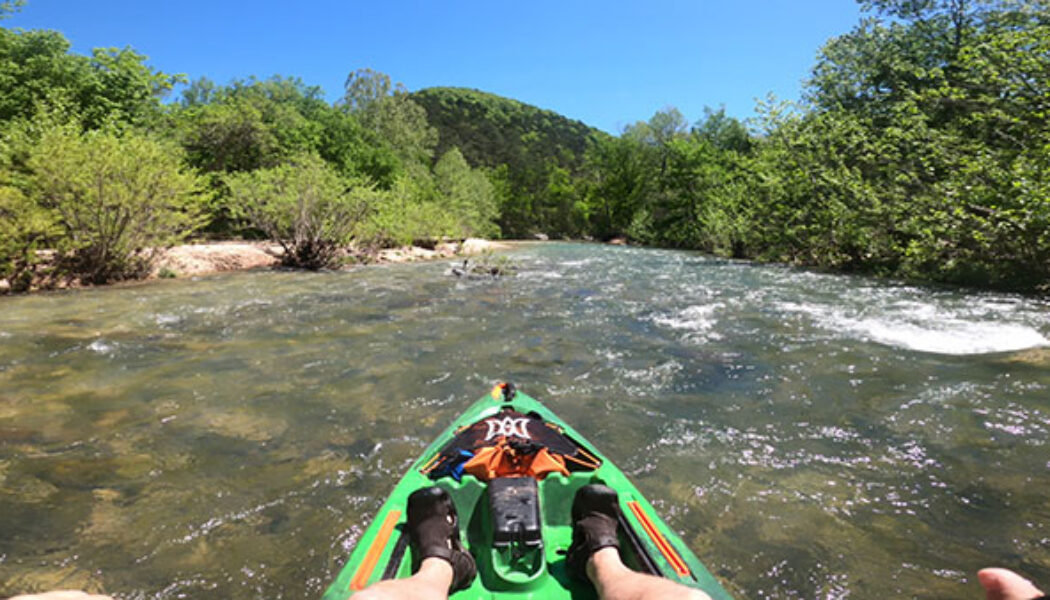
Marble to Marshall Ford on the Kings River
We are so fortunate here in Arkansas to have so many beautiful rivers to float, fish, and hike on. If your goal is to float them all, it can take a while to get to some of them. Especially when you have some favorite floats that are hard to stray from! The Kings River is one that’s been on my list for a while. But due to distance (and competing rivers), it has eluded my paddle for years. So this year, I made the Kings River my top priority. But my buddies and I weren’t satisfied with just any section of the river. We wanted the best water and most scenic. So my 2022 float season started with a float from Marble to Marshall Ford on the Kings River I recruited two of my best buddies, Eric and Neil to join me on this one. We were going to camp, but with rain in the forecast that S...

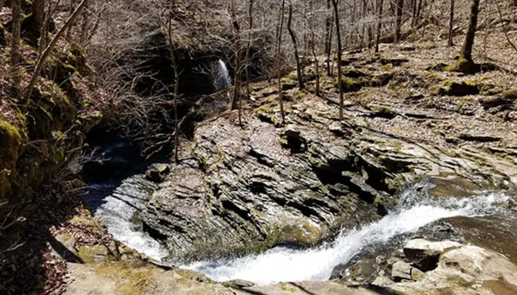
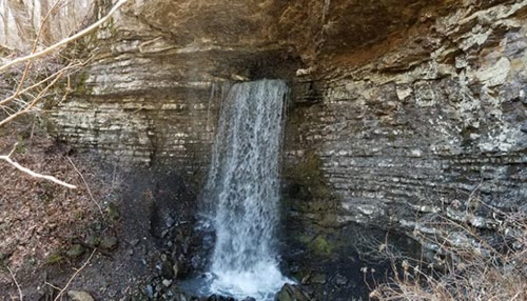
Bushwhack to Ladderbucket Falls
Hello again everyone! Travis here, back with another tale from the trails. While I rarely have the opportunity to hike during weekdays, I’d taken this past Wednesday off to celebrate my younger brother’s birthday. We share a deep fondness for the outdoors, so it’s only natural we’d celebrate with a hike. He selected a Bushwhack to Ladderbucket Falls from Tim Ernst’s “Arkansas Waterfalls” as our destination, a moderate 4.5-mile out-and-back trail nestled on the southeastern portion of Lost Corner. Lost Corner is the home of many excellent waterfalls, including Brushy Grotto Falls and Green Grotto Falls, both of which were featured by Scott recently. The torrential rains of Monday and Tuesday had left the region well saturated; we were confident it w...
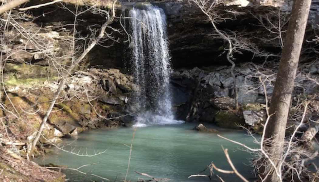

Bushwhack to Greasy Creek Falls
Hello everyone! My name is Travis, and I’m a new member of the AROwnBackyard team. I’ll be sharing tales of trails around Arkansas to help all of you discover your next outdoor adventure. This past week, I undertook a bushwhack to Greasy Creek Falls, as well as several of its waterfall friends in the nearby area! One of my dear friends, Gez Rogers of Waterfalls in Arkansas, has compiled an excellent map of waterfalls around Arkansas. For quick reference, you can always find this map on the AR Own Backyard hiking page. Although it already contains hundreds, some waterfalls haven’t managed to make it to the map just yet! After all, Arkansas has many excellent hollows, gaps, and canyons not fully documented. For me, these chunks of this wilderness make for an ideal weekend h...

Bear Creek Waterfall Hike
I try to cover a variety of hikes that range in difficulty for hikers of all abilities. Sometimes I do an easy hike, and other times a more difficult hike. It just depends on what I’m in the mood for. If I’ve been stressed or too busy to plan a difficult hike, I might go for an easy one. Something on a well-travelled or well-marked trail I don’t have to think about. Hikes like Lost Valley or Kings Bluff. On the other hand, sometimes I’m in the mood for a challenge. I have a long list of these kind of hikes to do. The latest one I’ve checked off the list is the Bear Creek Waterfall Hike. The Bear Creek waterfall hike has been on my list for years. When I first saw pictures of Sidewinder Falls and V-Slot falls, I knew I had to do this hike. I had the impression ...

Hike to Big Creek Cave Falls and Wolf Creek Cave Falls
One of my favorite things about hiking with friends is seeing their reaction to some of the amazing sights in our beautiful state. Often times I’ll hike alone – intentionally – for my own mental health and to disconnect from everything. But other times, I like to have a hiking partner. This is especially true for more remote or difficult hikes where I’m not completely sure what to expect. So for a recent hike to Big Creek Cave Falls, I invited my long-time friend Neil Webb. Not because this hike is difficult, but because it is kind of remote. I wasn’t completely sure what to expect, but it ended up being a much easier hike than I thought. Some of my hiking partners are used to seeing places like this. Others have done some of the basic popular hikes like Cedar...
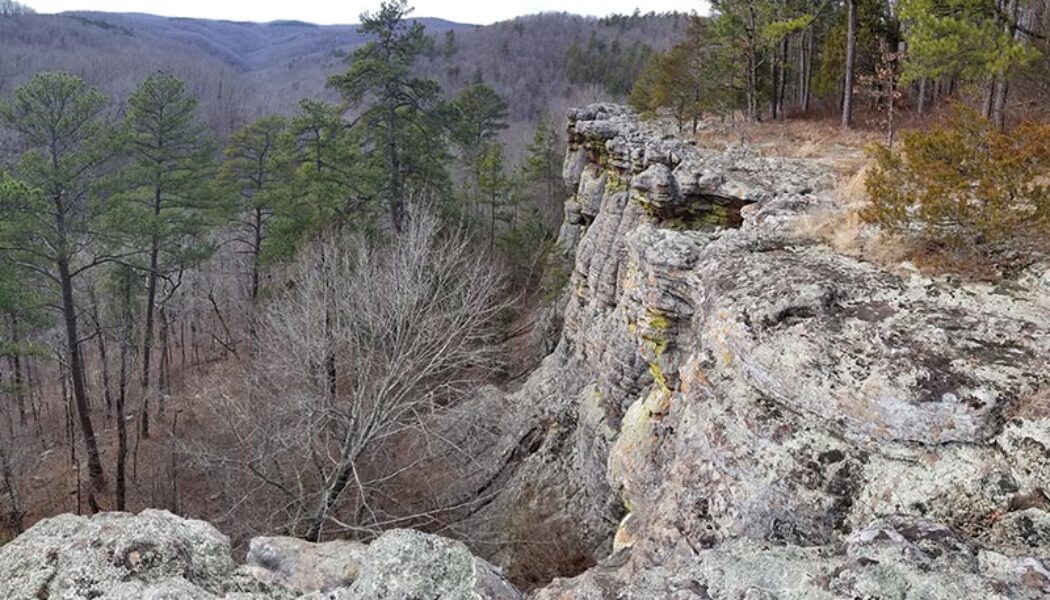

Hiking the Kings Bluff Loop
Sometimes you just need a do-over. The third article I ever wrote for my blog was for a hike to Kings Bluff Falls. I did that hike years before I ever knew I would have an outdoors blog. I didn’t research the hike or even really know what to expect. We just showed up and hiked to the falls and back, not even knowing what else was out there. That was the case for several of my early articles, but this one only had a few pictures and no video! There’s so much more to hiking the Kings Bluff Loop than I covered the first time. So I think this hike deserves a do-over. After that first visit, I made a return trip there and hiked the Pedestal Rocks Loop. Both hikes are really one big loop, but you can hike them separately. The rock formations at Pedestal Rocks are amazing. It wasnR...

Creekside Hike to Green Grotto Falls
Coming into 2021, I had a pretty long list of hikes to do in the southern Ozarks’ Lost Corner area. But one hike that was not on my list was the creekside hike to Green Grotto Falls. Nope, I was going to follow the main trail and miss some cool waterfalls upstream from Green Grotto. That is until I met up with my friend Gez Rogers, who knew a great creekside route to Green Grotto and several others. We did two hikes that day, and Green Grotto was our afternoon hike. In case you missed it, Part One of this hiking day was a creekside hike to Brushy Grotto Falls that morning. Gez really knows the Lost Corner area well. So I was stoked to team up with him and his pals Super Leeds and Travis Howk for this hike. As I mentioned in Part One, Gez Rogers is the creator of the Waterfalls in Ark...

Creekside Hike to Brushy Grotto Falls
Lost Corner is an area I first visited in early 2021 with a hike to Schoolhouse Falls. When researching that one I learned there are a TON of waterfalls in the wilderness around Lost Corner. It’s another one of those places where most of the hikes will show you multiple waterfalls on a single hike. This January, after a good rain, I made my third visit to Lost Corner for a full day of waterfall hikes. The first one of the day was a creekside hike to Brushy Grotto Falls. For this hike, I teamed up with Gez Rogers, the creator of the Waterfalls in Arkansas map. This is an awesome map that has recently surpassed over 125K views! It’s super helpful, so if you your’e not using it, you should be! Anyway, we had discussed teaming up on a hike for nearly a year. Lost Corner hikes...

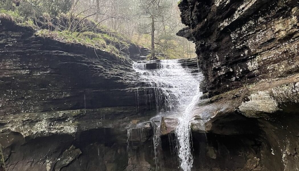
Compton’s Double Falls and Amber Falls
*In Memory of Rick Henry.* Rick, you may not have known most of your readers, but we feel like we knew you. Thank you for leading us to so many beautiful places. When it comes to waterfall hiking, it’s always great to get your money’s worth with multiple falls on a single hike. Most of the waterfall hikes in the Ozarks offer this opportunity, although some make it easier than others. My recent Christmas hike to Compton’s Double Falls and Amber Falls is a great example. Much like the Magnolia Falls hike, this one has several falls, each one just around the bend from the next. As long as there is water, you get to see five waterfalls on this hike. And you can continue down Whitaker Creek to see several more (Wild Burro, Beagle Point, and other smaller falls). This is a...


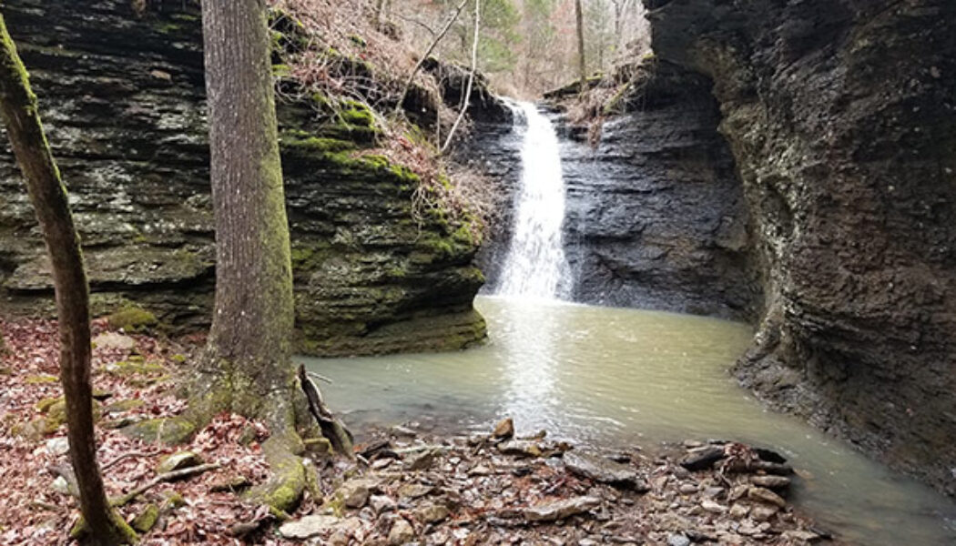
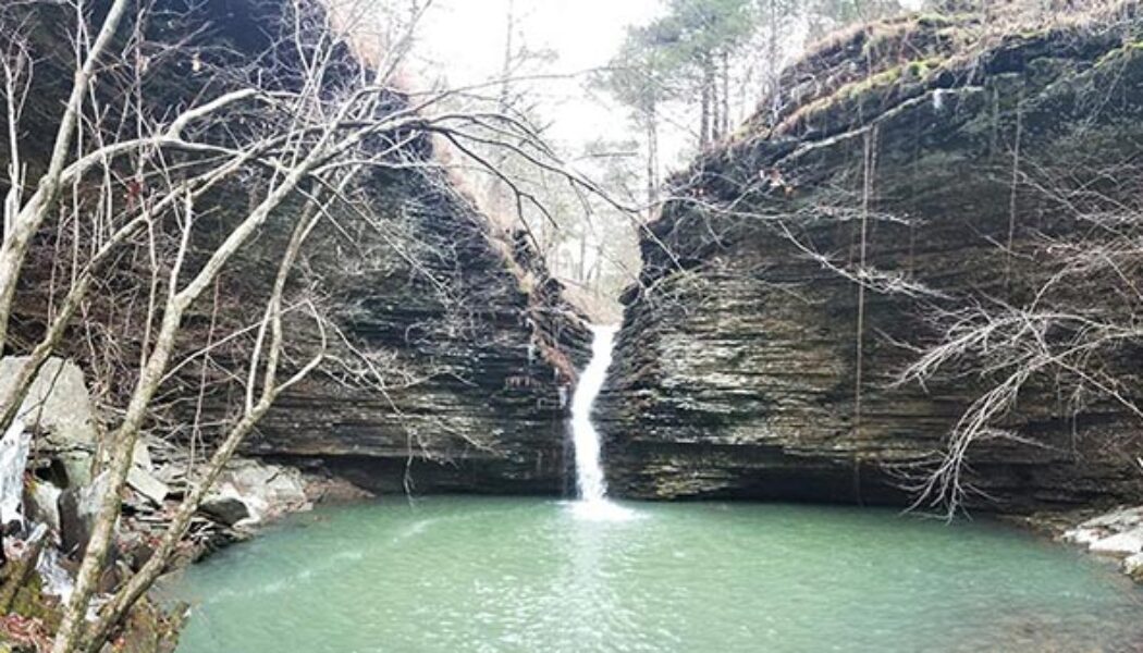
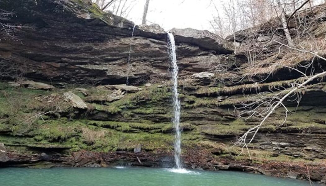
Hike to Thunder Canyon Falls
Waterfall season got a late start this year, but it is finally underway. I have been on a roll lately, checking hikes off my list that have been tugging at me for years. And once the steady rains hit the Natural State, I got to start checking off some more. At the top of my list this waterfall season was the Hike to Thunder Canyon Falls. I actually tried to do this one last Winter. But I had not done my homework and was unprepared for creek crossings, or even reaching the trailhead. Since then I’ve had trouble getting back there after the right amount of rain. That is until December, 2021. When the rains finally hit, I was ready for this one. I enjoy all of the waterfalls that I hike to. But there is something different about Thunder Canyon. To me, there’s a certain mystique ab...
