
#Ozarks

Hike to Schoolhouse Falls near Lost Corner
I love finding new areas to hike that I’m completely unfamiliar with. They offer brand new sights, new mountains, streams, waterfalls, and trails. For me it’s the same excitement as taking a vacation to a new but popular place. You don’t know exactly what to expect, but you know you’re going to enjoy it. Even though I’ve explored quite a bit of Arkansas, this still continues to happen (which is a good thing!). The latest example is an area of the Big Piney Forest I’ve been exploring lately, just east of Hector. And my first visit to this area included a quick hike to Schoolhouse Falls. Yes, I realize a lot of people know about this area and hike it regularly. But for some reason, I’ve skipped right over it for years on my way to areas northwest of ...

Hike to Magnolia Falls in the Ozarks
When it comes to hiking, I learned long ago to plan your hike, research it, and know what you’re getting into. I’ve learned this lesson several times. But every now and then I seem to forget it, and will go off exploring without a plan. Or I’ll plan a hike and change my mind on the way so I can see something else. Such was the case the first time I made the hike to Magnolia Falls between Deer and Fallsville. I had planned two other waterfall hikes near Ponca that day in early October. But after seeing that the area creeks would be low on water, I opted for Magnolia Falls. I had Magnolia Falls on my list for a while and even read a little bit about it. But I was still completely unprepared that day. I had not downloaded a map or read enough about how to access the other wa...

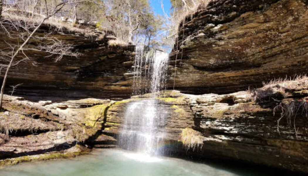
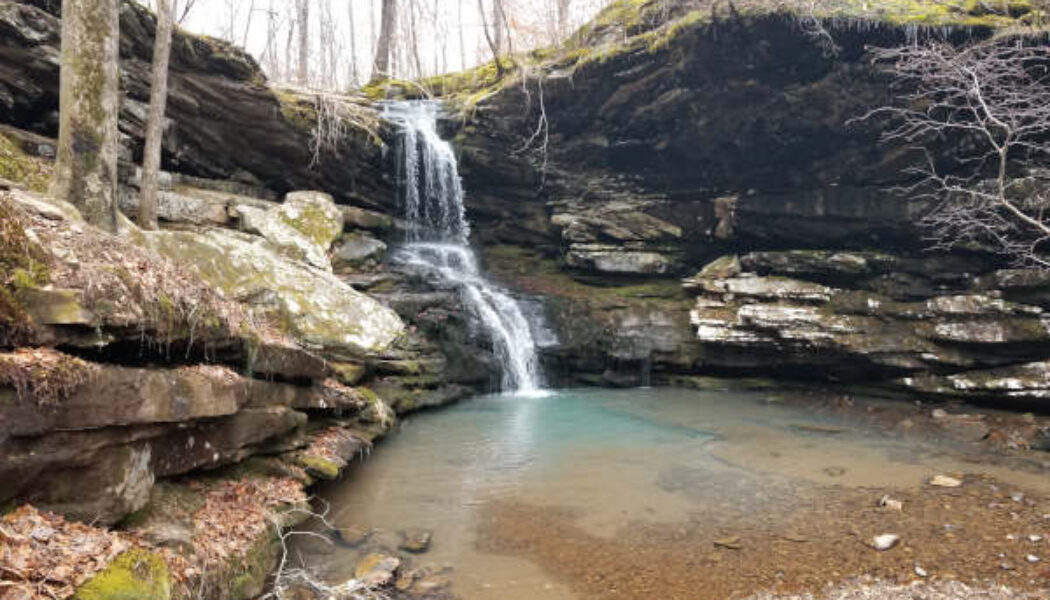
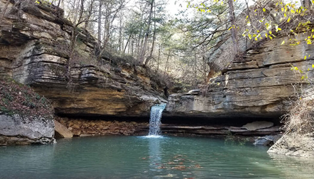
Sweden Creek Falls Hike in the Ozarks
For my first hike of the year I continued on my quest to hike all the major waterfalls in the Upper Buffalo River area. I decided to start the year off with the Sweden Creek Falls hike since it had been on my list for a while. And the conditions were perfect for a waterfall hike that day. The Kingston area had gotten some rain for several days before, and even some snow. On the day of my hike, the sun was out in full to warm things up to the mid-40’s. This meant there should be plenty of water in the falls from the snow-melt and previous rain. Full sun and water in the falls? I couldn’t ask for better conditions, especially for this hike. Driving up Hwy 21 from Clarksville to Boxley, I was pleased to see there was still a light dusting of snow on the ground. I haven’t see...
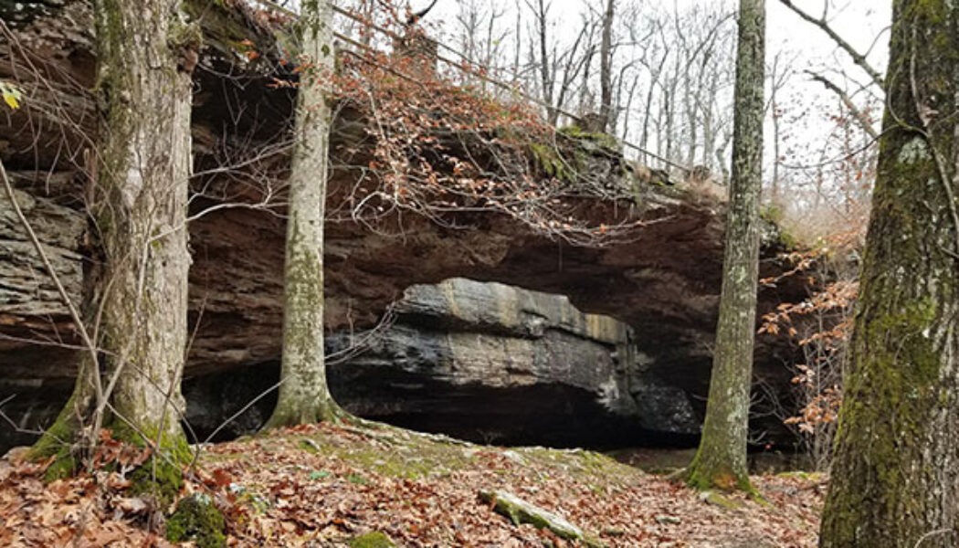

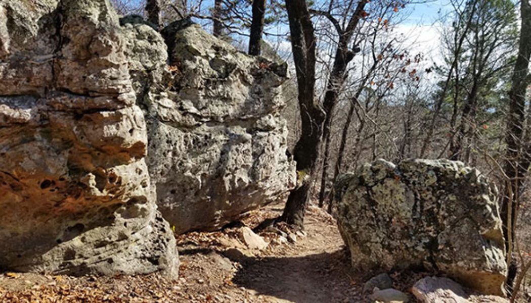
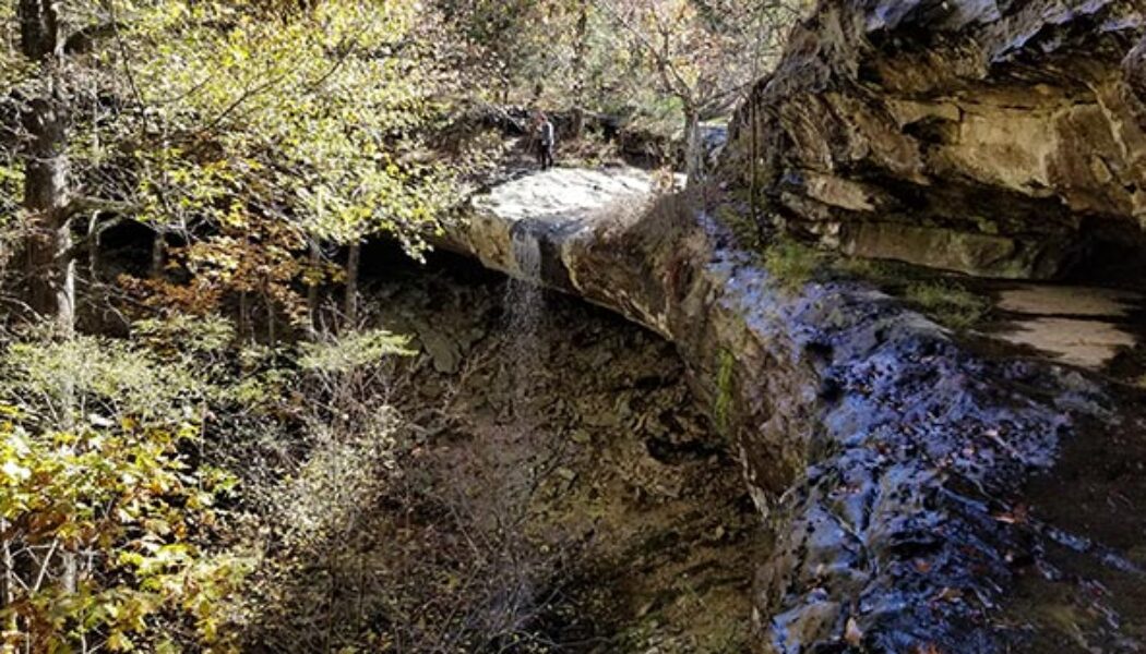
Alum Cove Natural Bridge
Many of the hikes I have written about so far are located in the areas between Russellville and Jasper, or Clarksville and Ponca. Nestled right in the middle of all those hills, creeks, and waterfalls lies Alum Cove Natural Bridge Recreation Area. In all my trips through this area, I’ve passed really close to Alum Cove probably a hundred times. And until recently, I had never stopped to visit – always in a rush to get somewhere else. But this past November, I made it a point to specifically stop in to check out Alum Cove. I was not disappointed. I had actually set out to do a different hike that day a little further north. But the road to that trailhead was flooded so I had to call an audible. I’d been saving the Alum Cove area trail as a backup plan for just such an occa...

Mountain Bike Trails at Mt. Nebo State Park
There has been a surge of new mountain bike trails constructed all over the state in the past few years. New trails are being finished faster than I can keep up with them. Not only is the quantity of trails in Arkansas increasing, but so is the quality. For years, I was used to riding on trails that basically amounted to hiking trails you could ride bikes on. But these new trails are professionally constructed specifically for mountain biking. The mountain bike trails at Mt. Nebo State Park are a great example. They are part of the Arkansas State Parks Monument trails collection, which you can read more about here. Much like the new trails around Bentonville, Hot Springs, and Pinnacle Mountain, these new trails make mountain biking more fun. That’s because they are designed for bikin...

Paige Falls and Broadwater Hallow Falls
I have written a few articles lately about hiking around the Upper Buffalo River. That’s because there are so many great places there to hike. And most of them are not that far from each other, so it’s easy to do several in a day. All the trails have something different to offer. Some of them have waterfalls, others have majestic views, and some have caves and weird rock formations. They range from easy to difficult, short to long. And some of them are barely a hike at all. Paige Falls and Broadwater Hallow Falls is one of those. Much like Six Finger Falls and Fuzzy Butt Falls, it’s really hard to call this one a hike because the falls are so close to the road. The hike may be really short, but that doesn’t make the waterfalls here less impressive. In fact, this is ...

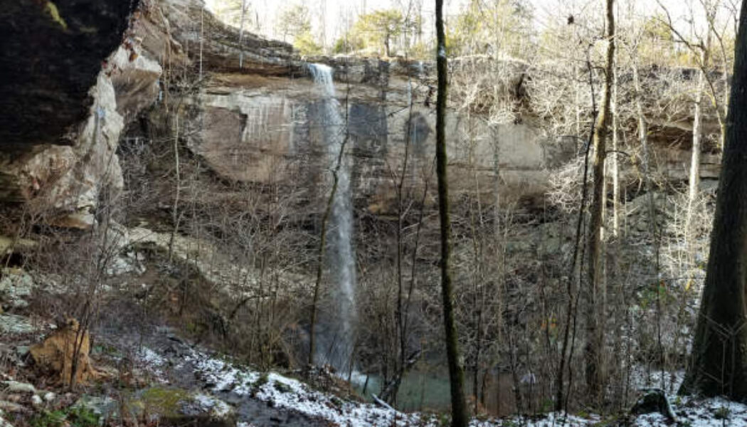
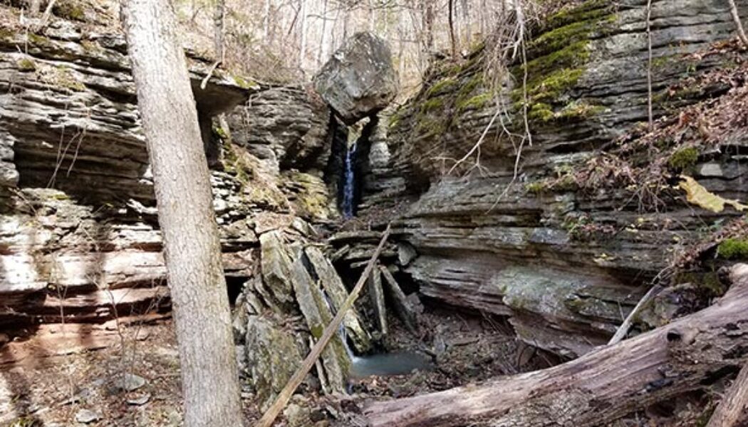
Hike to Hideout Hollow
As much as I hate for summer to end, there is a silver lining to Fall and cooler weather getting here. It’s my favorite time of the year to go hiking, for so many reasons. Overgrown trails become more clean. Ticks, chiggers and snakes go away. I can hike all day without sweating my ass off. The fall colors make the drive and the hike even more scenic. And late Fall means more rain, which means the waterfalls are running! This Fall I picked the perfect day to make the hike to Hideout Hollow. Hideout Hollow is a huge grotto/gorge (a hollow) encased in steep bluff walls with a 40 foot waterfall in the middle. Beneath the cliffs you can find the remains of an old “hideout” structure used by outlaws years ago. Hence the name “Hideout Hollow”. Stories vary on who th...

Hike to Balanced Rock Falls
The Buffalo River is well-known as probably the most popular floating and paddling river in Arkansas. But the lands around it are home to some of the best hiking spots in the state. In particular the Upper Buffalo area near Ponca, Boxley Valley and Compton is where you’ll find a lot of the most popular trails. There is a lesser-known hike in this area that is worth a look and that is the hike to Balanced Rock Falls. You won’t find the trailhead for this one on Google maps like the other ones. Nor is it listed on the Buffalo River NPS hiking page or the Hiking Project App. But you can find it on the AllTrails app I found this hike when I saw pictures of Balanced Rock Falls posted on some of the Facebook hiking pages that I follow. I like interesting rock formations as much as I ...
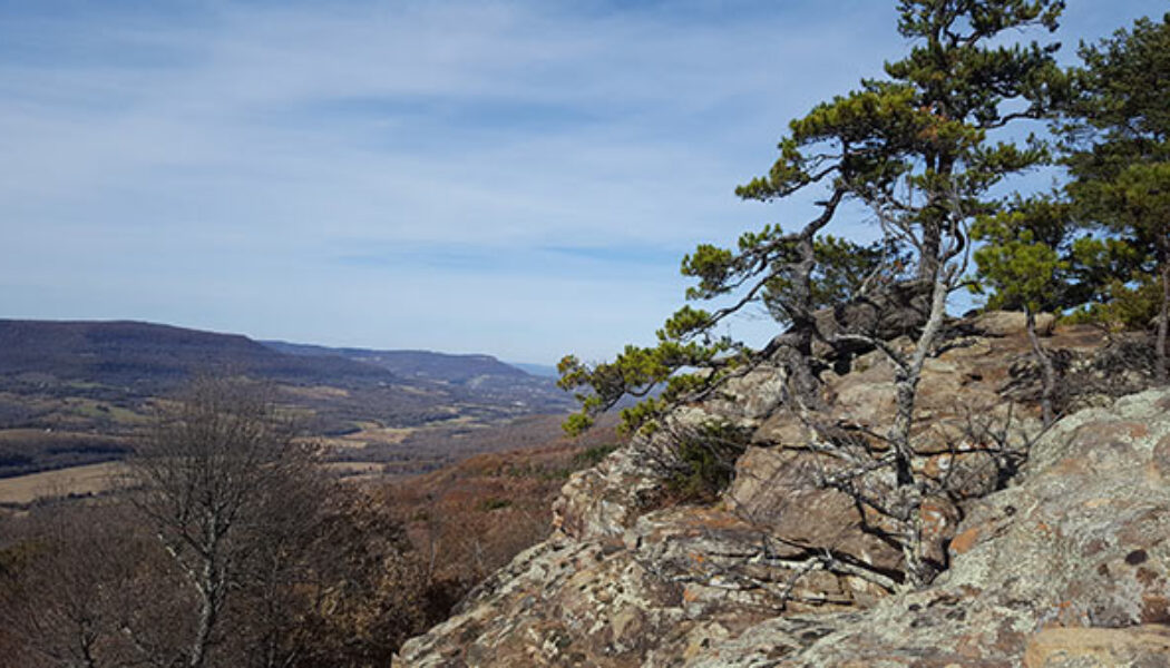

Climbing and Hiking at Sam’s Throne
Summer is over, and before long the Ozarks will be covered up with the colors of Fall. And one of my favorite spots to see all the Fall colors is Sam’s Throne. This is a hike along the top of a bluff line to a point overlooking a valley, and the views here are gorgeous! Hiking at Sam’s Throne can be a very short hike, or a longer hike depending on what you want to see. Either way, it’s a great place to hang out for a while and enjoy the views. Sam’s Throne is also a popular rock climbing destination. I’m not a climber myself, so I won’t write any about that and risk putting bad info out there. But it’s worth mentioning to anyone interested in climbing…and I do like watching the climbers scale the walls. Between that, the views, and the drive ...
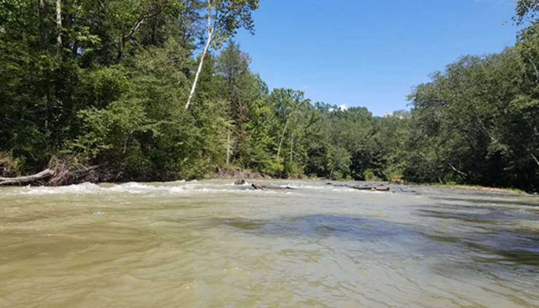

Wolf Pen to Byrd’s on the Mulberry River
Folks, we have had some really good (and rare) late-summer floating opportunities this year. I have written several times about taking advantage of the prime floating conditions of Spring and early Summer. One of the spots this really applies to is the run from Wolf Pen to Byrd’s on the Mulberry River. I missed my chance early in the summer. But thanks to all the rain from the hurricanes, I got a rare late-summer chance to float this section of river on Labor Day weekend. I have stated in a previous article that High Bank to Byrd’s was one of my favorite floats in the state. Well, I’m adding 4 miles to that run and saying Wolf Pen to Byrd’s is now one of my favorites! Not only did we catch it when it was runnable – it was actually high. If you’re lucky e...

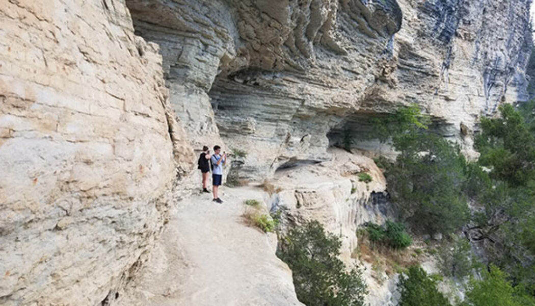
Hike to Whitaker Point(Hawksbill Crag)
If you do a lot of hiking in Arkansas and haven’t made the hike to Whitaker Point, you have to add this one to your to-do list. It’s one of the more popular hikes in the Ozarks. Even if you don’t know what Whitaker Point is, you’ve probably seen a picture of it somewhere. Also known as Hawksbill Crag, it is one of the most photographed scenic spots in Arkansas. Lots of marriage proposals happen here and people actually pay photographers to capture the moment from far off. So what is it? Hawksbill Crag is a large rock outcropping sticking out from the top of a really high bluff. The bluff overlooks Whitaker creek in the valley below. On the AllTrails app, it is listed as “Whitaker Point Trail (Hawksbill Crag)”. On Google maps, you’ll find both ̶...

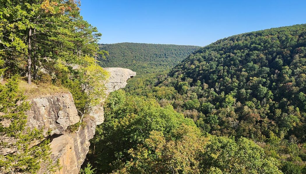
Hiking the Big Bluff Goat Trail on the Buffalo River
I have written a few articles about certain popular hikes or floats that have always eluded me for whatever reason. Hiking the Big Bluff Goat Trail is one of those that has been on my list for years, but just never happened. But this summer, I finally got to mark this hike off my list. And it was everything I expected it to be. In a time where waterfall hikes are all the rage, this a great hike to do when those falls are all dried up. What a great hike this one is. It’s not too long, not too short, slightly challenging, and definitely one of the most rewarding. If you have not made this hike yet, I highly recommend adding it to your list. If you use the AllTrails app, this hike is called Centerpoint to Goat Trail. I think you can get all the way to Hemmed-In Hollow from this trail, b...
