
#shorthike

The Arkansas Sphinx: A Natural Wonder in the Ozarks
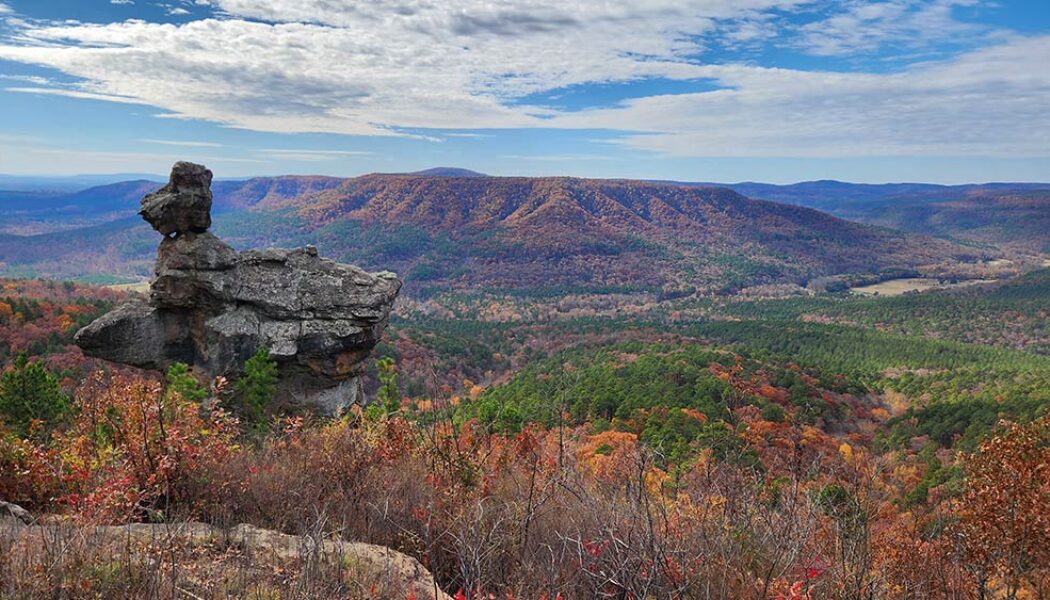
Nestled in the heart of the Ozark Mountains, lies a natural wonder known locally as the Arkansas Sphinx. This sandstone monolith rises 20 feet above its perch near the top of Hess Knob. Its profile bears a resemblance to the iconic sphinx of ancient Egypt. Measuring approximately 20-30 feet tall and just as wide, the Arkansas Sphinx is believed to have been formed over millions of years through erosion. Wind, water, and ice carved away at the softer rock layers, leaving behind the Sphinx-like profile in the sandstone that we see today. Standing tall and proud, the Arkansas Sphinx offers stunning panoramic views of the surrounding countryside. This popular destination for hikers, photographers, and nature enthusiasts stands as a testament to the power of nature’s artistry. This natura...
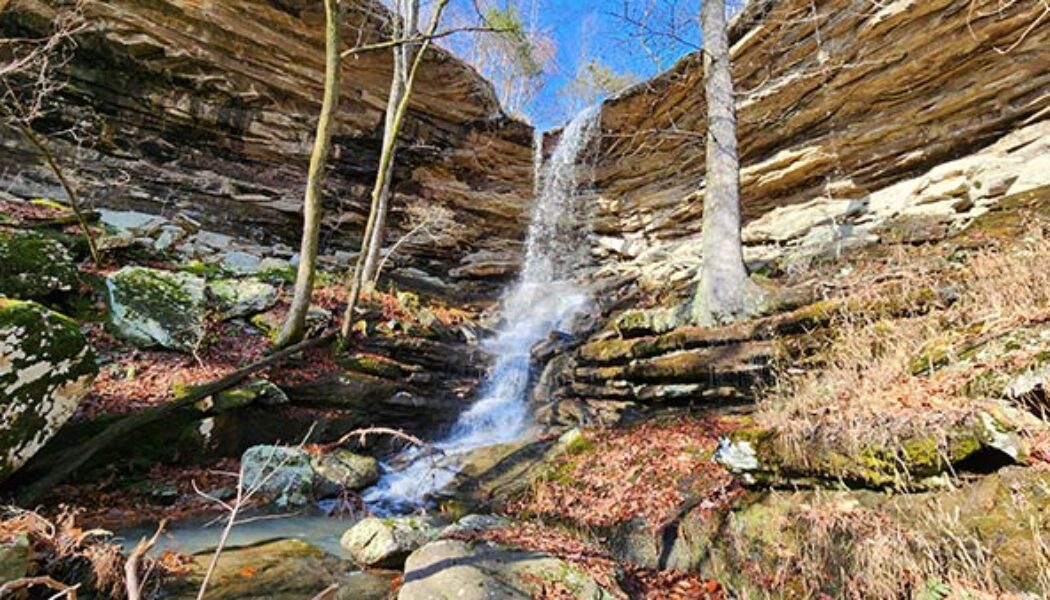

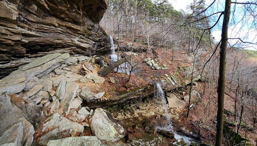
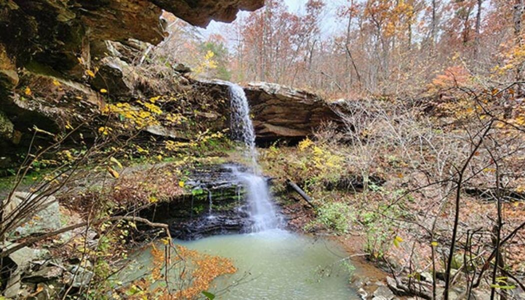
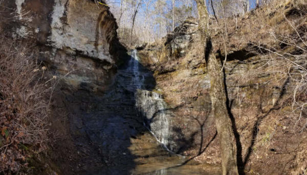
Easy Bushwhack Hike to Lonesome Hollow Falls
In my last article I described how AR Hwy 7 is the road to so many treasures in the Ozarks. In case you missed it, you can catch up on that one here. Yes, Scenic Hwy 7 between Dover and Harrison, and the many roads that intersect it, lead to a myriad of great hikes. There are long hikes, short hikes, difficult hikes, easy ones, and everything in between. As you travel along this highway, you’ll likely pass right by many of these adventures and not even realize it. That was certainly true for me. So in the Fall of 2022, I caught up with a few of these by hiking to Fern Falls and Hudson Shelter Falls. And finally, I made the easy bushwhack hike to Lonesome Hollow Falls Along the same road as Lonesome Hollow Falls lies a bushwhack hike along Cub Creek with multiple waterfalls. And to th...

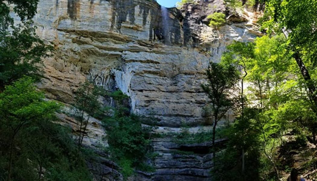
Hike to Hudson Shelter Falls
It was a random Sunday drive up Hwy 7 into the Ozarks years ago where I unexpectedly found my future playground. Little did I know at the time that a visit to Haw Creek Falls would lead to this rabbit hole of adventures that I’ll likely never find the end of. Haw Creek would lead to Pack Rat Falls and Pam’s Grotto. And then across Hwy 7, I would find Kings Bluff and Pedestal Rocks, which would lead me to Falling Water Creek. And from that point, I was hooked. Oh I had done some mountain biking, some paddling, and your basic State Park hikes. But nothing like the Ozark gems I would find all up and down Hwy 7, and eventually all across the state. Since that day, I’ve travelled along this highway countless times, often not knowing what other gems I was passing right by. One ...

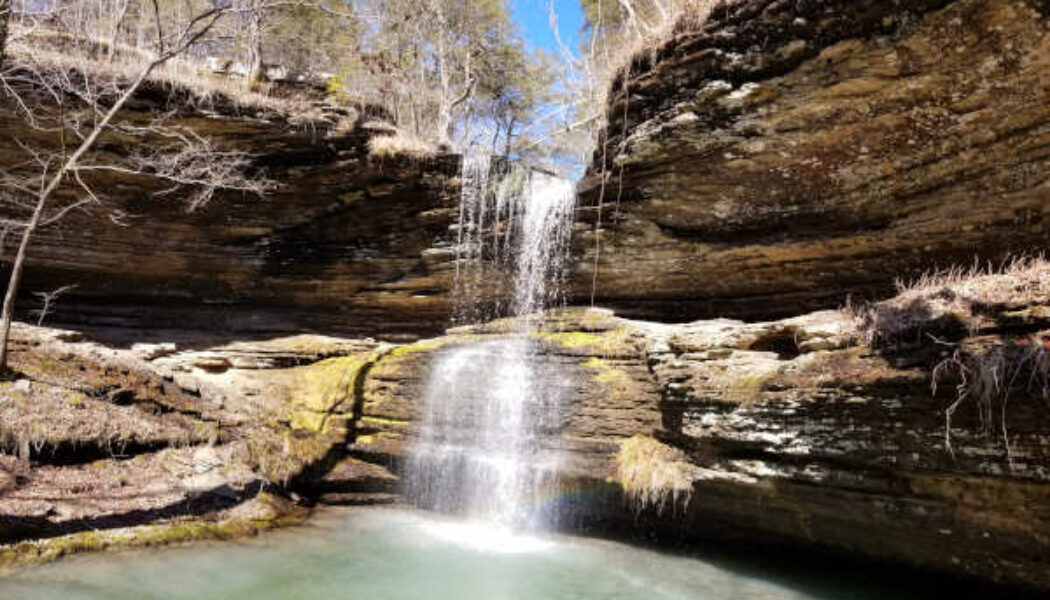
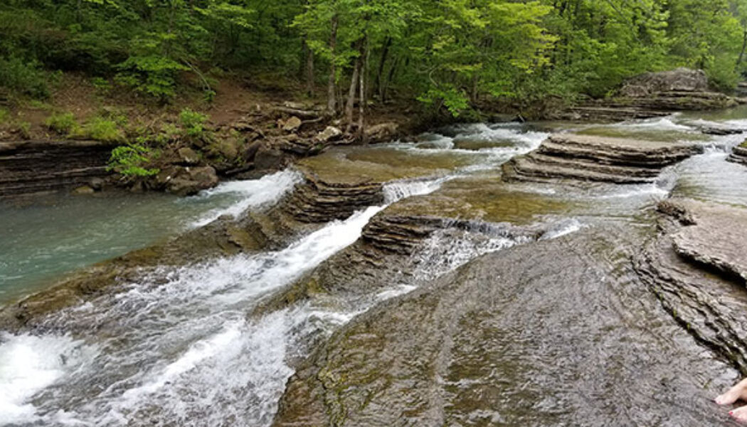
Hike to Fern Falls
The beginning of waterfall season can be a little hit-and-miss sometimes. I guess the dry ground in the Fall soaks up all the rainfall before it can drain off. There have been several Autumn hikes I’ve done right after a rain, only to reach a waterfall that’s dry or barely running. (Like the first time I hiked to Magnolia Falls). Because of this, I tend to save the longer or more difficult hikes for late Winter/early Spring, when I know the falls will be running strong. Early in the season, I’ll “test the waters” with some shorter hikes. So if I strike out, oh well – at least it was a short hike! This year, I started waterfall season off with a hike to Fern Falls in the Ozarks. Fern Falls is a pretty well-known waterfall that gets a decent amount of visi...
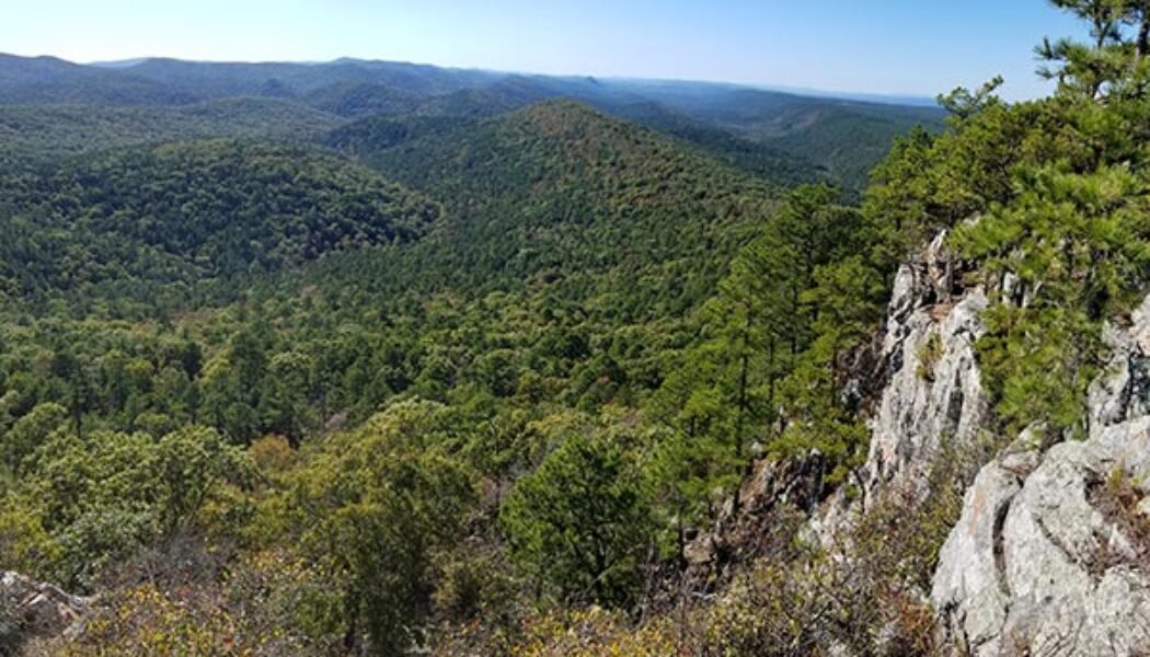

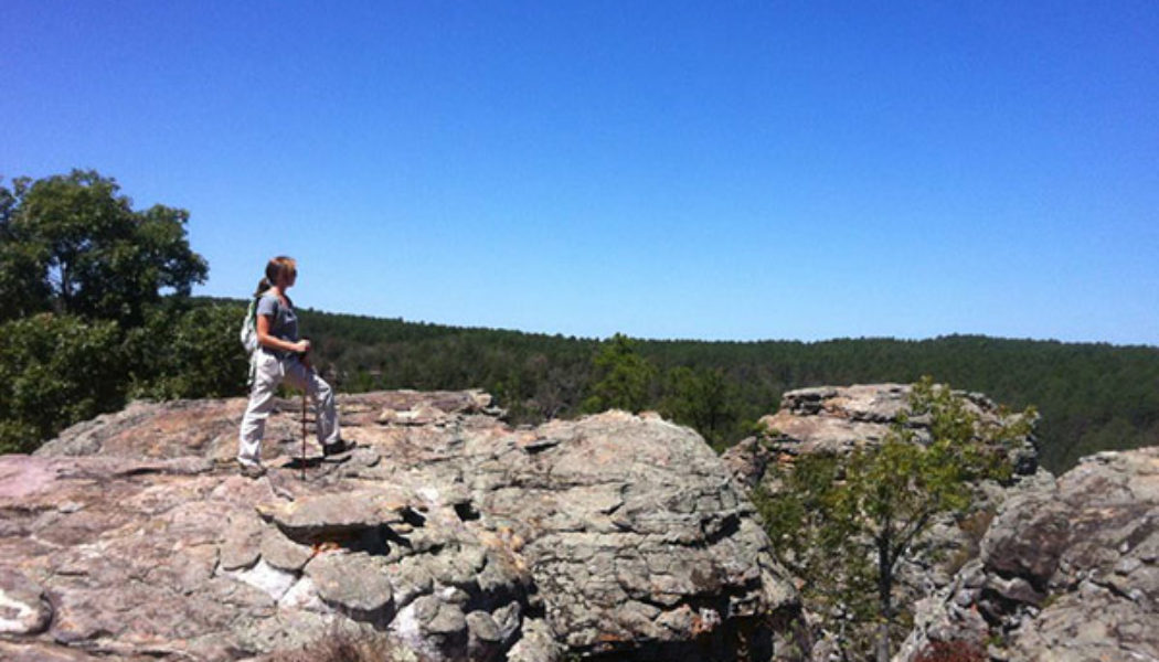
Flatside Pinnacle (and Brown Creek Cascade)
When it comes to good places to see Fall colors in Arkansas, I have a short list of locations that immediately come to mind. First, it is really hard to beat Sam’s Throne this time of year – both the drive and the short hike. Next, for hiking to see Fall colors, I really like Buzzards Roost a lot. Those two locations are up in the Ozarks near Mt. Judea and Sand Gap. For people near Central Arkansas that want something closer, one of my best recommendations is a drive to Flatside Pinnacle. And if there has been any recent rain, maybe add a stop at Brown Creek Cascade. The Flatside Pinnacle Vista is located in the Flatside Wilderness area in the easternmost part of the Ouachita Mountains. This vast wilderness area consists of 10,000 acres to the west of Lake Maumelle, and east of...

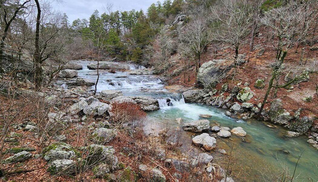
Horsetail Falls off Falling Water Creek
If you hunt enough waterfalls in Arkansas, you will eventually miss one that’s close to an area you’ve already hiked. I like to cover as much as I can in each hiking trip and article. So when I miss a cool feature on a hike, it’s pretty common for me to go back and do it again. One area that I’ve recently revisited for this exact reason is Horsetail Falls off Falling Water Creek. I did an article last year on Six Finger Falls and Fuzzy Butt Falls. On that hike, I accessed Fuzzy Butt Falls by crossing Falling Water Creek at Six Fingers. I knew the trail went back upstream to the bridge crossing Falling Water Creek. But what I didn’t know was that the trail takes you right by Horsetail Falls! I had heard of Horsetail Falls before but had never looked it up. So I...

Hike to Schoolhouse Falls near Lost Corner
I love finding new areas to hike that I’m completely unfamiliar with. They offer brand new sights, new mountains, streams, waterfalls, and trails. For me it’s the same excitement as taking a vacation to a new but popular place. You don’t know exactly what to expect, but you know you’re going to enjoy it. Even though I’ve explored quite a bit of Arkansas, this still continues to happen (which is a good thing!). The latest example is an area of the Big Piney Forest I’ve been exploring lately, just east of Hector. And my first visit to this area included a quick hike to Schoolhouse Falls. Yes, I realize a lot of people know about this area and hike it regularly. But for some reason, I’ve skipped right over it for years on my way to areas northwest of ...

Forked Mountain Falls in the Flatside Wilderness
In the northeast corner of the Ouachita Mountain region lies the Flatside Wilderness area. It is an area that’s relatively less explored and often overlooked. I think this may be because exploring this area requires a LOT of dirt road driving, which may turn some folks away. Personally, I like driving those dirt roads. I think another reason is that people mostly hear about the beautiful scenery and waterfalls in the Ozarks, because it’s the most popular area. Hey, I get it – the Ozarks are still my favorite too. But there is also great scenery – including waterfalls – in the Ouachitas. One of those is Forked Mountain Falls in the Flatside Wilderness area. Forked Mountain can be seen from many different places while driving through the Flatside Wilderness area...

Hemmed in Hollow Falls Via the Buffalo River
Did you know that the highest waterfall between the Appalachians and the Rocky Mountains is located right here in Arkansas? Yep, that’s right. Hemmed in Hollow, located on the Buffalo National River, is 209 feet tall. That makes it the highest waterfall in Mid-America, according the National Park Service. From the regular trail head it’s a pretty tough hike. It starts in the hills above the top of the falls and ends at the bottom of the falls. So the steep uphill hike out of there is the difficult part. But for anyone that’s physically unable to do this hike, I have good news. You can access Hemmed in Hollow Falls via the Buffalo River and it’s a very short, easy hike. OK, so if you thought I was going to tell you about some special elevator, zip line or something, ...

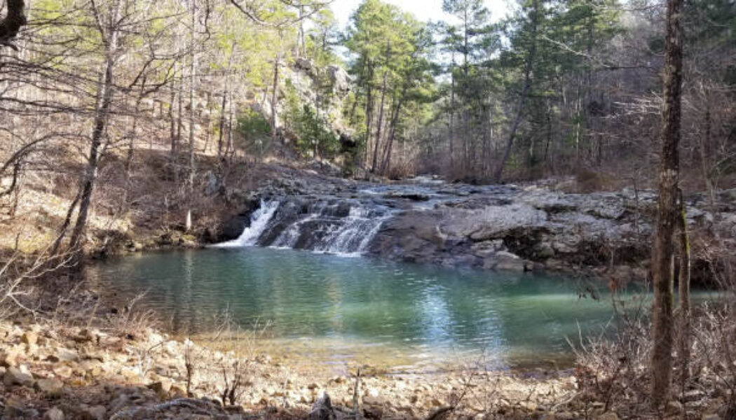
Six Finger Falls and Fuzzy Butt Falls
Falling Water Road near Ben Hur is home to many popular Ozark waterfalls. Some of them require a short, easy hike to see. Some of them are longer, tougher hikes. Others, such as the ever-popular Falling Water Falls, can be seen from the road. Six Finger Falls and Fuzzy Butt Falls are two others that are very accessible and easy to get to. Six Finger Falls, just like Falling Water Falls, is one that you can see from the road. You literally park next to it, walk 50 feet down a rocky trail, and you are there. Fuzzy Butt Falls on the other hand, cannot be seen from the road. But it is so close that I hardly even consider it a hike. If you are not a big hiker but still want to see some awesome waterfalls, these two are for you. They are so close together that if you are going to make the drive ...

Little Missouri Falls in the Ouachitas
Original article from March 14, 2020 edited/rewritten on November 27,2024. One of my favorite things about hiking is often the drive to get the trailhead. There is often a lot of scenery and cool things to see on those dirt roads out there. Sometimes I enjoy a day of driving backroads through the wilderness with very little hiking at all. On some of those cold, wet Winter days, or days I don’t feel up for a tough hike, it’s a good way to still get out and enjoy nature. One of my favorite spots to do this is near the Albert Pike area with a stop at Little Missouri Falls in the Ouachitas. With miles and miles of backroads in this area, visiting Little Missouri Falls is just the tip of the iceberg. There are so many areas to hike and things to see. But for anyone that’s neve...

Petit Jean State Park – Bear Cave Trail
Welcome to Part Six of the Petit Jean State Park hiking series, Bear Cave Trail. Petit Jean is Arkansas’ first state park. It’s also one of my go-to spots when I want a spur-of-the-moment, close to home day hike. It’s great because there are so many options there. Whether you want waterfalls, vista views, caves, or cool rock formations, Petit Jean has it all. And if caves and cool rock formations are your thing, then Bear Cave Trail is a spot you must check out. It’s not really much of a hike. But it’s such a cool and interesting part of the park that I just couldn’t leave out of this series. Directions Petit Jean State Park is a few miles southwest of Morrilton right off Hwy 154. Or approx 6 miles north of Adona off Hwy 10 to Hwy 324/155 if you’re...
- 1
- 2
