
#waterfall

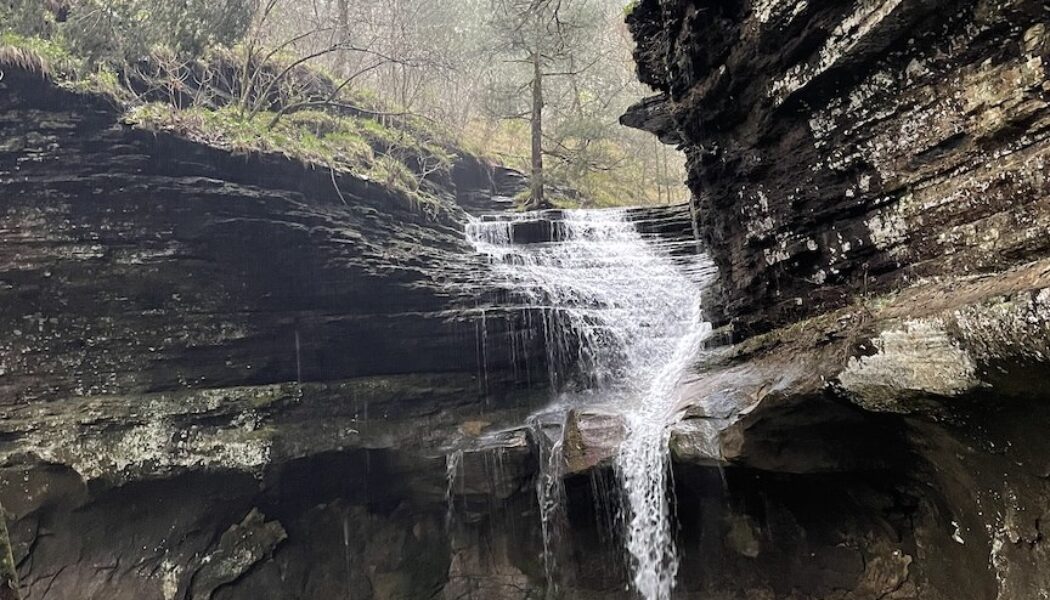
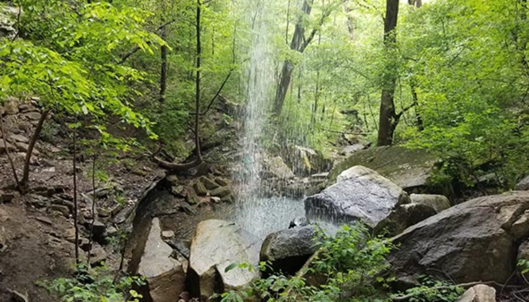
Hike to Stave Mill Falls and Little Oak Falls
Years ago, I had the opportunity to go trail riding at Mack’s Pines on Hwy 7, north of Dover. And let me tell you, we had an absolute blast doing it. That was years before I had learned the lay of the land when it comes to waterfall hikes. So little did I know that day, that the waterfall we stopped to admire on our ride was actually Stave Mill Falls. And because we entered the trail riding area a good bit south of Mack’s Pines, I didn’t realize how close we were to the Moccasin Gap Recreation Area. Nor did I have any idea that it was only a short hike to Stave Mill Falls and Little Oak Falls. Fast forward several years and many dozen trips past Moccasin Gap on Hwy 7. This hike made my to-do list, but kept getting passed over for other hikes I wanted to check off my Tim E...

Hike to Hobo Falls on the OHT
The Ozark Mountains, renowned for their rolling hills, deep valleys, and hidden waterfalls, offer a haven for outdoor enthusiasts. Winding through this scenic landscape is the Ozark Highlands Trail (OHT), a designated National Recreation Trail, and a gem of Ozarks. Starting at Lake Fort Smith, this long distance trail winds through the heart of the Ozark National Forest for over 200 miles. This scenic route is known for its diverse terrain, from gentle valleys and meandering streams to challenging climbs and breathtaking vistas. And while it may be a thru-hiker’s dream, the OHT is divided into sections that offer numerous day hiking options. One of those options is the hike to Hobo Falls on the OHT. I’ve had the hike to Hobo Falls on my to-do list for several years. And long be...

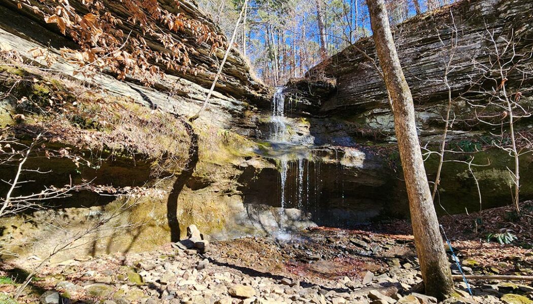
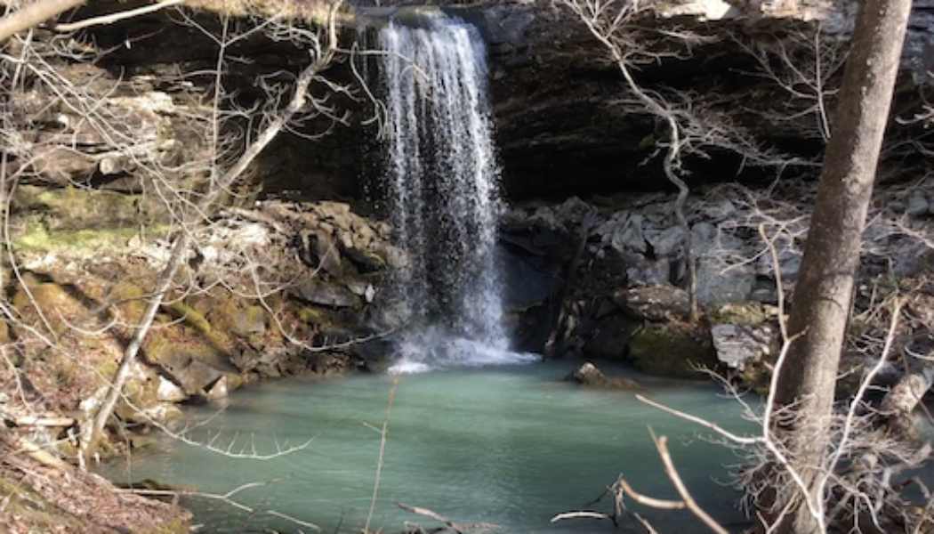
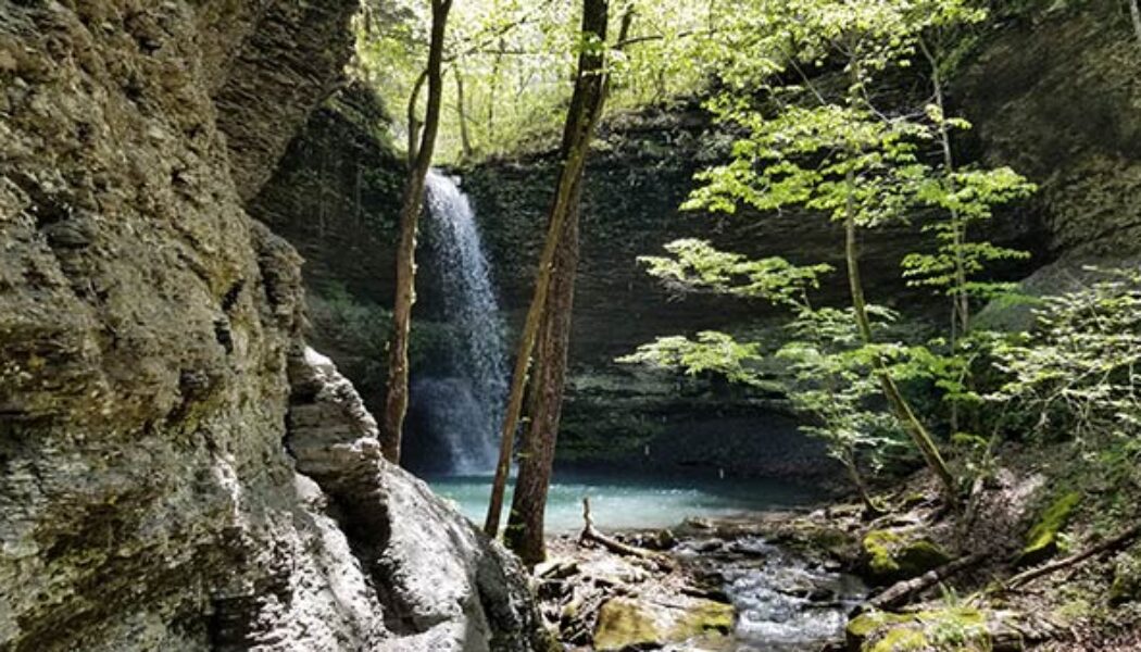
Hike to Ladderbucket Falls and John Mountain Falls
Tucked away in the rolling hills and verdant valleys of the southern Ozarks, lies a tiny mountaintop community aptly named Lost Corner. As it’s name implies, it is an area that many people don’t know much about, if they even know it exists at all. You will not find any stores, shops, restaurants, or many signs of civilization at Lost Corner. But what you will find is a remote wilderness area rich with streams, bluffs, steep ravines, and wildlife. It’s an area I visit several times a year for it’s seemingly endless options for waterfall hikes. My most recent trip would include the hike to Ladderbucket Falls and John Mountain Falls. For this hike, my good buddy David and I would team up once again with Gez Rogers and Super Leeds of Waterfalls in Arkansas. Gez is the c...
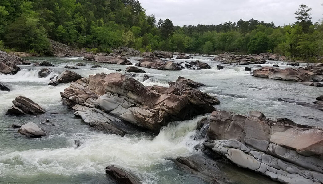

Hiking Cossatot Falls
Because we have so many fantastic State Parks in Arkansas, I think some of them don’t quite get the attention they deserve. We are truly fortunate here to have such amazing State Parks like Petit Jean , Devil’s Den, Mt Magazine, Mt. Nebo, Hobbs, and others. While those parks tend to draw the most visitors, others, like Cossatot State Park, sometimes get lost in the shuffle. And if you’ve never been hiking Cossatot Falls at Cossatot River State Park, you’re missing out on one of the most impressive natural sights in the state. When most people think of the word “Cossatot”, they think of the Cossatot River and it’s Class IV whitewater sections. Most people – including me – are not equipped or skilled enough to paddle these sections, so th...

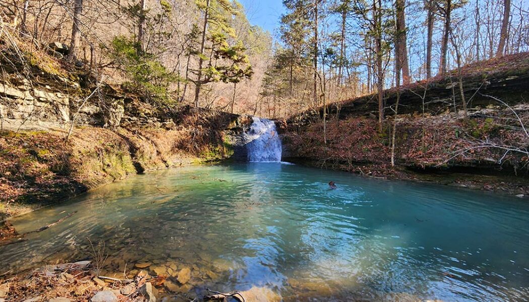
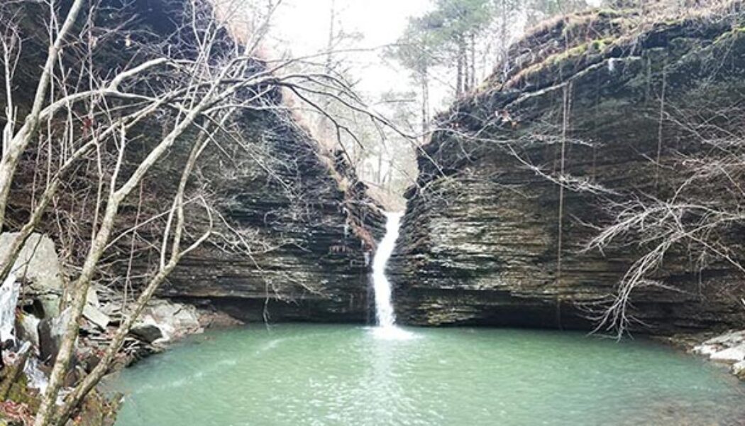
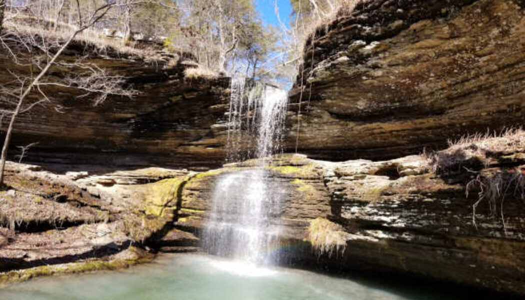
Bushwhack to Ladderbucket Falls
Hello again everyone! Travis here, back with another tale from the trails. While I rarely have the opportunity to hike during weekdays, I’d taken this past Wednesday off to celebrate my younger brother’s birthday. We share a deep fondness for the outdoors, so it’s only natural we’d celebrate with a hike. He selected a Bushwhack to Ladderbucket Falls from Tim Ernst’s “Arkansas Waterfalls” as our destination, a moderate 4.5-mile out-and-back trail nestled on the southeastern portion of Lost Corner. Lost Corner is the home of many excellent waterfalls, including Brushy Grotto Falls and Green Grotto Falls, both of which were featured by Scott recently. The torrential rains of Monday and Tuesday had left the region well saturated; we were confident it w...

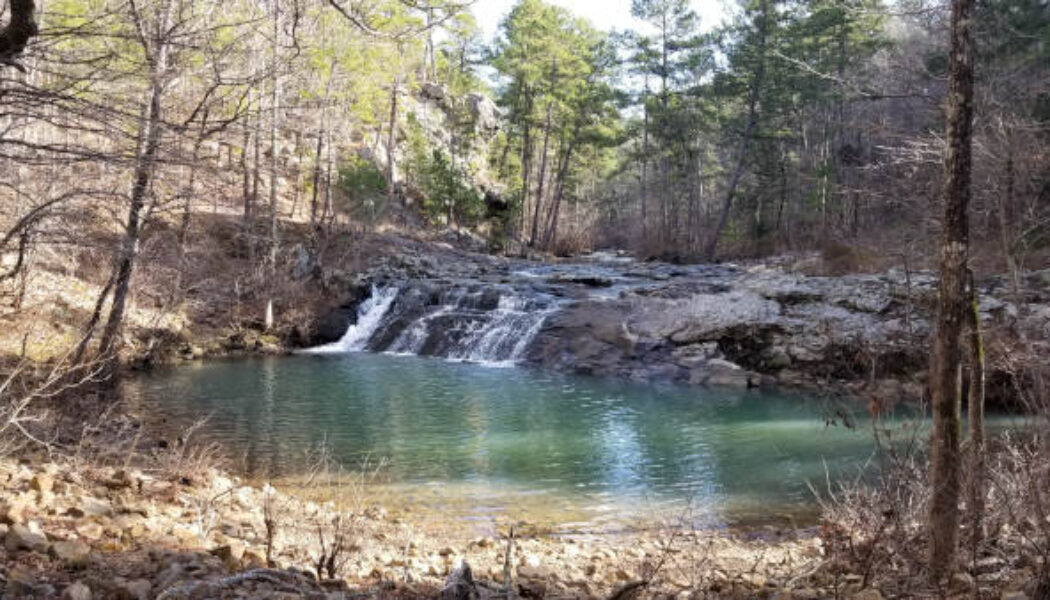
Bushwhack to Greasy Creek Falls
Hello everyone! My name is Travis, and I’m a new member of the AROwnBackyard team. I’ll be sharing tales of trails around Arkansas to help all of you discover your next outdoor adventure. This past week, I undertook a bushwhack to Greasy Creek Falls, as well as several of its waterfall friends in the nearby area! One of my dear friends, Gez Rogers of Waterfalls in Arkansas, has compiled an excellent map of waterfalls around Arkansas. For quick reference, you can always find this map on the AR Own Backyard hiking page. Although it already contains hundreds, some waterfalls haven’t managed to make it to the map just yet! After all, Arkansas has many excellent hollows, gaps, and canyons not fully documented. For me, these chunks of this wilderness make for an ideal weekend h...

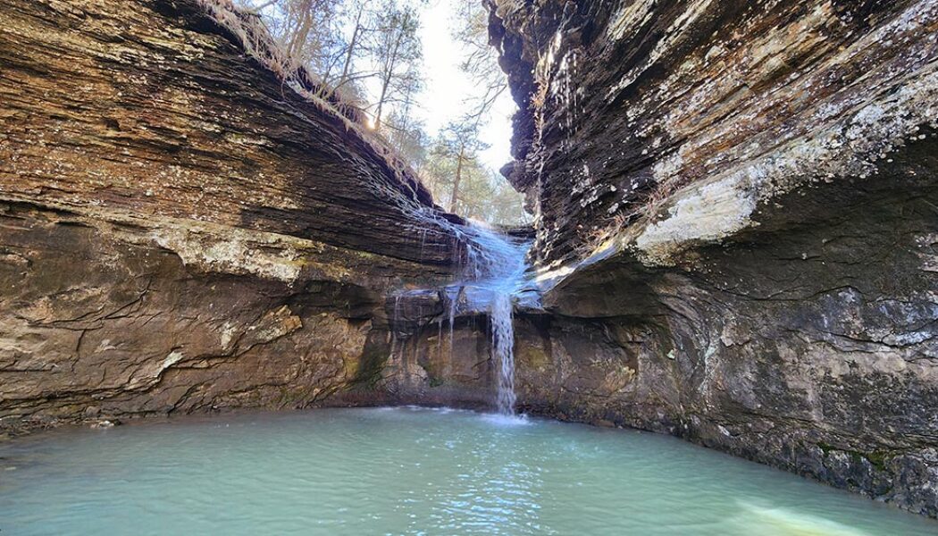
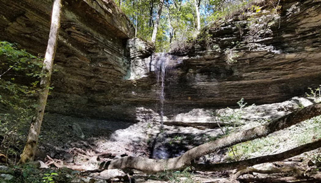
Creekside Hike to Brushy Grotto Falls
Lost Corner is an area I first visited in early 2021 with a hike to Schoolhouse Falls. When researching that one I learned there are a TON of waterfalls in the wilderness around Lost Corner. It’s another one of those places where most of the hikes will show you multiple waterfalls on a single hike. This January, after a good rain, I made my third visit to Lost Corner for a full day of waterfall hikes. The first one of the day was a creekside hike to Brushy Grotto Falls. For this hike, I teamed up with Gez Rogers, the creator of the Waterfalls in Arkansas map. This is an awesome map that has recently surpassed over 125K views! It’s super helpful, so if you you’re not using it, you should be! Anyway, we had discussed teaming up on a hike for nearly a year. Lost Corner hikes...

A Fall Hike to Rough Falls in Rough Hollow
A recent camping trip this Fall unexpectedly led us to a new group of waterfalls I had not visited before. I say unexpectedly because our original camping destination (Cove Lake) was full when we arrived. I had Cove Lake area hikes planned out and everything! Altering our plans on the fly, we opted to spend the weekend at Longpool Campground near Dover. I’ve stayed at this campground and hiked to Longpool Falls many times. But until this trip, I had never made the hike to Rough Falls just down the road at Rough Hollow. If you have ever been to Longpool Campground, you know there is no cell service there. Luckily, I had already spent a little time researching Rough Hollow on the Waterfalls in Arkansas map. There are quite a few waterfalls in this hollow that you can see in one hike. I...

Hike to Steele Falls in the Sylamore Wilderness
A couple of weeks ago I wrote about a recent visit to Mountain View, AR and all the fun things to do around there. Our first stop that day was at Loco Ropes for some ziplining and ropes adventures. You can check out our visit to Loco Ropes here. The second half of our day would take us into the Sylamore Wilderness for a hike to Steele Falls. It’s actually the Sylamore District of the Ozark-St. Francis National Forest. But right or wrong, I just call it the Sylamore Wilderness. Before we would get to Steele Falls though, we had a few other stops to make. First was lunch at Wing Shack in Mountain View (great burgers!). Then we made a quick stop at Blanchard Springs to check out Mirror Lake Falls. From there, we made our way to the area of Fifty-Six and a stop at the beautiful Gunner Po...

Splashdown Falls and Intersection Falls
I have written several articles now about waterfalls that I have missed while hiking to others close by. My research is getting better, so hopefully I won’t keep missing them. But I recently visited two more waterfalls you can easily combine with other waterfall hikes in the Falling Water Creek area. Splashdown Falls and Intersection Falls are two that are located off Falling Water Rd near several popular waterfalls. If you ever hike to Terry Keefe Falls, you should definitely add Splashdown Falls to the same hike. There are a lot waterfalls in this area such as Six Finger Falls and Fuzzy Butt Falls, Horsetail Falls, Terry Keefe Falls, and others. If you ever stop to see ANY of the waterfalls along Falling Water Rd, Intersection Falls is another quick and easy stop you can add. I had...

Hike to Schoolhouse Falls near Lost Corner
I love finding new areas to hike that I’m completely unfamiliar with. They offer brand new sights, new mountains, streams, waterfalls, and trails. For me it’s the same excitement as taking a vacation to a new but popular place. You don’t know exactly what to expect, but you know you’re going to enjoy it. Even though I’ve explored quite a bit of Arkansas, this still continues to happen (which is a good thing!). The latest example is an area of the Big Piney Forest I’ve been exploring lately, just east of Hector. And my first visit to this area included a quick hike to Schoolhouse Falls. Yes, I realize a lot of people know about this area and hike it regularly. But for some reason, I’ve skipped right over it for years on my way to areas northwest of ...

Forked Mountain Falls in the Flatside Wilderness
In the northeast corner of the Ouachita Mountain region lies the Flatside Wilderness area. It is an area that’s relatively less explored and often overlooked. I think this may be because exploring this area requires a LOT of dirt road driving, which may turn some folks away. Personally, I like driving those dirt roads. I think another reason is that people mostly hear about the beautiful scenery and waterfalls in the Ozarks, because it’s the most popular area. Hey, I get it – the Ozarks are still my favorite too. But there is also great scenery – including waterfalls – in the Ouachitas. One of those is Forked Mountain Falls in the Flatside Wilderness area. Forked Mountain can be seen from many different places while driving through the Flatside Wilderness area...
